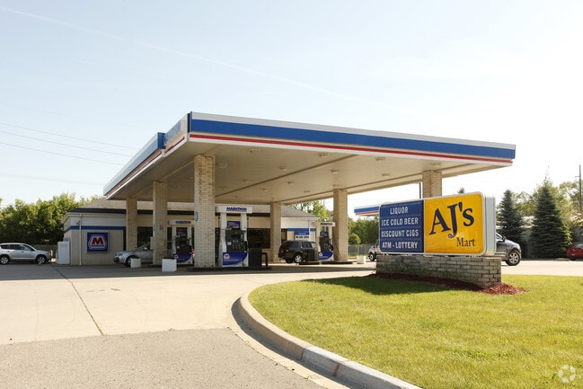
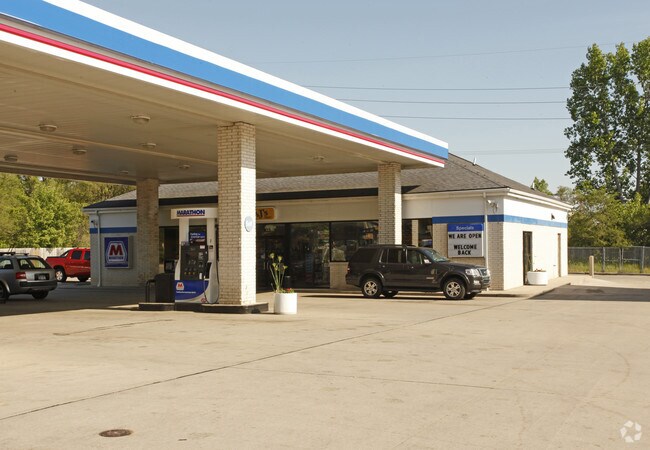
Property Record
433 E Highland Rd, Howell, MI 48843

Property Detail
433 E Highland Rd
06-25-200-009
SEC 25 T3N R4E COM E 1/4 COR, TH N 24.5 FT TO C/L M-59, TH N85*07'W 688.2 FT TO POB, TH N85*07'W 200 FT, TH N4*53'E 294.8 FT,
Commercialnec
Livingston
NSC
Michigan
B and X Area of moderate flood hazard, usually the area between the limits of the 100-year and 500-year floods.
1.37 AC
2025
Livingston County
2025
Detroit
724003
Detroit-Warren-Dearborn, MI
3,055 SF
NEARBY LISTINGS FOR SALE OR LEASE
DEMOGRAPHICS near 433 E Highland Rd
1 mile
3 mile
5 mile
2025 Total Population
6,132
28,888
43,724
2030 Population
6,184
29,239
44,340
Pop Growth 2025-2030
+ 0.85%
+ 1.22%
+ 1.41%
Average Age
42
41
42
2025 Total Households
2,650
11,637
17,310
HH Growth 2025-2030
+ 0.87%
+ 1.17%
+ 1.39%
Median Household Inc
$87,706
$90,529
$94,427
Avg Household Size
2.30
2.40
2.50
2025 Avg HH Vehicles
2.00
2.00
2.00
Median Home Value
$286,306
$307,296
$313,871
Median Year Built
1996
1993
1994
Nearby Places
Map Layers
Map Styles
 Street
 Aerial
Transit
 Traffic
 Biking
Places
Listings with unknown addresses are not visible on the map
- Restaurants
- Banks
- Shops
- Fitness
- Groceries
PUBLIC TRANSPORTATION
AIRPORT
Bishop International
Drive
Walk
Distance
Bishop International
51 min
34.4 mi
Capital Region International
Drive
Walk
Distance
Capital Region International
52 min
40.9 mi
Nearby Properties
Address
Land Use
TOTAL SIZE
Lot Size
Zoning
Address
Land Use
TOTAL SIZE
Lot Size
Zoning
767,161 SF
127.33 AC
I-1
Address
Land Use
TOTAL SIZE
Lot Size
Zoning
344,387 SF
27.72 AC
I-1
Address
Land Use
TOTAL SIZE
Lot Size
Zoning
75,407 SF
159.26 AC
R2
Address
Land Use
TOTAL SIZE
Lot Size
Zoning
89,443 SF
10.45 AC
R-M
Address
Land Use
TOTAL SIZE
Lot Size
Zoning
102,971 SF
11.95 AC
I-1
Address
Land Use
TOTAL SIZE
Lot Size
Zoning
171,564 SF
30.98 AC
O-1
Address
Land Use
TOTAL SIZE
Lot Size
Zoning
199,635 SF
19.85 AC
RPUD
Address
Land Use
TOTAL SIZE
Lot Size
Zoning
145,366 SF
13.60 AC
R-M
Address
Land Use
TOTAL SIZE
Lot Size
Zoning
95,252 SF
11.56 AC
R-M
Address
Land Use
TOTAL SIZE
Lot Size
Zoning
37.65 AC
MFR
Address
Land Use
TOTAL SIZE
Lot Size
Zoning
81,417 SF
13.10 AC
R-M
Address
Land Use
TOTAL SIZE
Lot Size
Zoning
15.74 AC
RM
Address
Land Use
TOTAL SIZE
Lot Size
Zoning
161,366 SF
18.67 AC
HDR
Address
Land Use
TOTAL SIZE
Lot Size
Zoning
165,868 SF
27.80 AC
HDR
Address
Land Use
TOTAL SIZE
Lot Size
Zoning
80,330 SF
10 AC
MFR
Address
Land Use
TOTAL SIZE
Lot Size
Zoning
87,349 SF
9.68 AC
C,RM,PUD
Address
Land Use
TOTAL SIZE
Lot Size
Zoning
152,606 SF
16 AC
R-M
Address
Land Use
TOTAL SIZE
Lot Size
Zoning
91,380 SF
11.55 AC
HDR
Address
Land Use
TOTAL SIZE
Lot Size
Zoning
35,546 SF
7.64 AC
R-M
Address
Land Use
TOTAL SIZE
Lot Size
Zoning
57,582 SF
5.32 AC
C,RM,PUD
Address
Land Use
TOTAL SIZE
Lot Size
Zoning
79,801 SF
10.60 AC
B-2
Address
Land Use
TOTAL SIZE
Lot Size
Zoning
43,959 SF
33.51 AC
IFZ
Address
Land Use
TOTAL SIZE
Lot Size
Zoning
154,040 SF
13.70 AC
I
Address
Land Use
TOTAL SIZE
Lot Size
Zoning
121,850 SF
11.85 AC
I-1
Address
Land Use
TOTAL SIZE
Lot Size
Zoning
121,265 SF
15.10 AC
RCD
Address
Land Use
TOTAL SIZE
Lot Size
Zoning
246 SF
32.70 AC
I-1
Address
Land Use
TOTAL SIZE
Lot Size
Zoning
116,885 SF
13.78 AC
RCD
Address
Land Use
TOTAL SIZE
Lot Size
Zoning
119,436 SF
12.20 AC
I-1
Address
Land Use
TOTAL SIZE
Lot Size
Zoning
37,892 SF
5.40 AC
R-M
Address
Land Use
TOTAL SIZE
Lot Size
Zoning
57,736 SF
4.84 AC
R-M
The World's #1 Commercial Real Estate Marketplace
Connect with us
© 2026 CoStar Group
The information above has been obtained from sources believed reliable. While we do not doubt its accuracy we have not verified it and make no guarantee, warranty or representation about it. It is your responsibility to independently confirm its accuracy and completeness. Any projections, opinions, assumptions, or estimates used are for example only and do not represent the current or future performance of the property. The value of this transaction to you depends on tax and other factors which should be evaluated by your tax, financial, and legal advisors. You and your advisors should conduct a careful, independent investigation of the property to determine to your satisfaction the suitability of the property for your needs.