Property Record
433 Park Ave, Paterson, NJ 07504
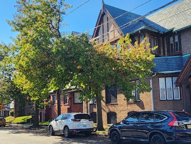
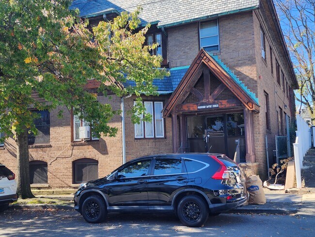
This Property Is For Sale
NEARBY LISTINGS FOR SALE OR LEASE
Property Detail
433 Park Ave
New York-Jersey City-White Plains, NY-NJ
FACILITY NAME: CHURCH
08-08601-0000-00008
Passaic
Religious
New Jersey
X
8
34031C0217G
0.23 AC
0
Passaic Urban Region
2025
Northern New Jersey
182501
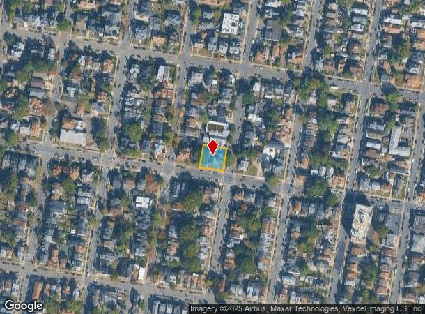
DEMOGRAPHICS near 433 Park Ave
1 Mile
3 Mile
5 Mile
2024 Total Population
60,041
285,797
580,907
2029 Population
57,747
275,048
564,458
Pop Growth 2024-2029
(3.82%)
(3.76%)
(2.83%)
Average Age
37
38
39
2024 Total Households
19,117
94,373
196,468
HH Growth 2024-2029
(3.94%)
(3.87%)
(2.90%)
Median Household Inc
$50,741
$66,244
$75,464
Avg Household Size
3.00
2.90
2.80
2024 Avg HH Vehicles
1.00
1.00
2.00
Median Home Value
$319,674
$391,000
$450,116
Median Year Built
1951
1952
1954
Nearby Places
Map Layers
Map Styles
 Street
 Aerial
- Restaurants
- Banks
- Shops
- Fitness
- Groceries
PUBLIC TRANSPORTATION
COMMUTER RAIL
Paterson (Main/Port Jervis Line - NJ Transit Commuter Rail (NJ Transit))
DRIVE
WALK
Distance
Paterson (Main/Port Jervis Line - NJ Transit Commuter Rail (NJ Transit))
2 min
1.2 mi
Broadway (Bergen County/Port Jervis Line - NJ Transit Commuter Rail (NJ Transit))
DRIVE
WALK
Distance
Broadway (Bergen County/Port Jervis Line - NJ Transit Commuter Rail (NJ Transit))
5 min
2.3 mi
AIRPORT
Newark Liberty International
DRIVE
WALK
Distance
Newark Liberty International
25 min
20.1 mi
LaGuardia
DRIVE
WALK
Distance
LaGuardia
36 min
24.0 mi
Westchester County
DRIVE
WALK
Distance
Westchester County
56 min
39.8 mi
Freight Ports
Port Newark Container Terminal
DRIVE
WALK
Distance
Port Newark Container Terminal
28 min
19.3 mi
Nearby Properties
Address
Land Use
TOTAL SIZE
Lot Size
Zoning
Address
Land Use
TOTAL SIZE
Lot Size
Zoning
8.75 AC
Address
Land Use
TOTAL SIZE
Lot Size
Zoning
12,506 SF
130 AC
B-2
Address
Land Use
TOTAL SIZE
Lot Size
Zoning
8.66 AC
CH1
Address
Land Use
TOTAL SIZE
Lot Size
Zoning
79,310 SF
2 AC
B-2
Address
Land Use
TOTAL SIZE
Lot Size
Zoning
26,816 SF
25.50 AC
POP
Address
Land Use
TOTAL SIZE
Lot Size
Zoning
9.96 AC
MU
Address
Land Use
TOTAL SIZE
Lot Size
Zoning
Address
Land Use
TOTAL SIZE
Lot Size
Zoning
152,050 SF
1.96 AC
B-1
Address
Land Use
TOTAL SIZE
Lot Size
Zoning
57,680 SF
20.01 AC
CR
Address
Land Use
TOTAL SIZE
Lot Size
Zoning
7.83 AC
Address
Land Use
TOTAL SIZE
Lot Size
Zoning
1.80 AC
Address
Land Use
TOTAL SIZE
Lot Size
Zoning
0.69 AC
I-1
Address
Land Use
TOTAL SIZE
Lot Size
Zoning
824,024 SF
39.71 AC
I1
Address
Land Use
TOTAL SIZE
Lot Size
Zoning
1,512 SF
90 AC
Address
Land Use
TOTAL SIZE
Lot Size
Zoning
90.48 AC
Address
Land Use
TOTAL SIZE
Lot Size
Zoning
Address
Land Use
TOTAL SIZE
Lot Size
Zoning
648 SF
108.80 AC
Address
Land Use
TOTAL SIZE
Lot Size
Zoning
5.88 AC
Address
Land Use
TOTAL SIZE
Lot Size
Zoning
14,152 SF
23.87 AC
Address
Land Use
TOTAL SIZE
Lot Size
Zoning
27.25 AC
Address
Land Use
TOTAL SIZE
Lot Size
Zoning
0.01 AC
Address
Land Use
TOTAL SIZE
Lot Size
Zoning
16.05 AC
Address
Land Use
TOTAL SIZE
Lot Size
Zoning
764,364 SF
16.60 AC
I-2
Address
Land Use
TOTAL SIZE
Lot Size
Zoning
11.87 AC
Address
Land Use
TOTAL SIZE
Lot Size
Zoning
0.12 AC
Address
Land Use
TOTAL SIZE
Lot Size
Zoning
Address
Land Use
TOTAL SIZE
Lot Size
Zoning
5.87 AC
B2
Address
Land Use
TOTAL SIZE
Lot Size
Zoning
29.11 AC
Address
Land Use
TOTAL SIZE
Lot Size
Zoning
192,252 SF
5 AC
Address
Land Use
TOTAL SIZE
Lot Size
Zoning
183,072 SF
5.50 AC
The World's #1 Commercial Real Estate Marketplace
Connect with us
© 2025 CoStar Group
The information above has been obtained from sources believed reliable. While we do not doubt its accuracy we have not verified it and make no guarantee, warranty or representation about it. It is your responsibility to independently confirm its accuracy and completeness. Any projections, opinions, assumptions, or estimates used are for example only and do not represent the current or future performance of the property. The value of this transaction to you depends on tax and other factors which should be evaluated by your tax, financial, and legal advisors. You and your advisors should conduct a careful, independent investigation of the property to determine to your satisfaction the suitability of the property for your needs.