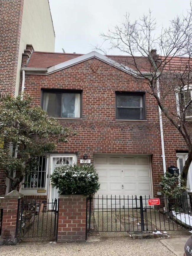
Property Record
4331 44Th St, Sunnyside, NY 11104
NEARBY LISTINGS FOR SALE OR LEASE
Property Detail
4331 44Th St
New York-Jersey City-White Plains, NY-NJ
Queens
00161-0013
New York
Duplex
0.05 AC
X
Sunnyside
3604970206F
Long Island (New York)
1,800 SF
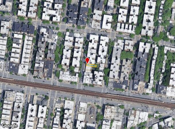
DEMOGRAPHICS near 4331 44Th St
1 Mile
3 Mile
5 Mile
2024 Total Population
101,365
1,075,165
2,967,520
2029 Population
96,993
1,009,872
2,772,365
Pop Growth 2024-2029
(4.31%)
(6.07%)
(6.58%)
Average Age
40
40
40
2024 Total Households
41,903
459,647
1,273,350
HH Growth 2024-2029
(4.42%)
(6.27%)
(6.85%)
Median Household Inc
$76,086
$89,664
$82,670
Avg Household Size
2.30
2.30
2.20
2024 Avg HH Vehicles
.00
.00
.00
Median Home Value
$593,092
$822,616
$861,070
Median Year Built
1949
1955
1953
Nearby Places
Map Layers
Map Styles
 Street
 Aerial
- Restaurants
- Banks
- Shops
- Fitness
- Groceries
PUBLIC TRANSPORTATION
TRANSIT/SUBWAY
46 Street-Bliss Street (7 - New York MTA Subway (The Subway))
DRIVE
WALK
Distance
46 Street-Bliss Street (7 - New York MTA Subway (The Subway))
3 min
4 min
0.2 mi
40 Street-Lowery Street (7 - New York MTA Subway (The Subway))
DRIVE
WALK
Distance
40 Street-Lowery Street (7 - New York MTA Subway (The Subway))
2 min
5 min
0.2 mi
52 Street (7 - New York MTA Subway (The Subway))
DRIVE
WALK
Distance
52 Street (7 - New York MTA Subway (The Subway))
4 min
10 min
0.5 mi
33 Street (7 Line) (7 - New York MTA Subway (The Subway))
DRIVE
WALK
Distance
33 Street (7 Line) (7 - New York MTA Subway (The Subway))
3 min
12 min
0.6 mi
Woodside-61 Street (7 - New York MTA Subway (The Subway))
DRIVE
WALK
Distance
Woodside-61 Street (7 - New York MTA Subway (The Subway))
7 min
19 min
1.0 mi
COMMUTER RAIL
Woodside Station (Babylon Branch - Long Island Rail Road, Far Rockaway Branch - Long Island Rail Road, Hempstead Branch - Long Island Rail Road, Long Beach Branch - Long Island Rail Road, Montauk Branch - Long Island Rail Road, Port Jefferson Branch - Long Island Rail Road, Port Washington Branch - Long Island Rail Road, Ronkonkoma Branch - Long Island Rail Road)
DRIVE
WALK
Distance
Woodside Station (Babylon Branch - Long Island Rail Road, Far Rockaway Branch - Long Island Rail Road, Hempstead Branch - Long Island Rail Road, Long Beach Branch - Long Island Rail Road, Montauk Branch - Long Island Rail Road, Port Jefferson Branch - Long Island Rail Road, Port Washington Branch - Long Island Rail Road, Ronkonkoma Branch - Long Island Rail Road)
7 min
20 min
1.0 mi
Hunterspoint Avenue Station (Hempstead Branch - Long Island Rail Road, Oyster Bay Branch - Long Island Rail Road)
DRIVE
WALK
Distance
Hunterspoint Avenue Station (Hempstead Branch - Long Island Rail Road, Oyster Bay Branch - Long Island Rail Road)
7 min
1.5 mi
AIRPORT
LaGuardia
DRIVE
WALK
Distance
LaGuardia
12 min
4.9 mi
John F Kennedy International
DRIVE
WALK
Distance
John F Kennedy International
23 min
13.9 mi
Newark Liberty International
DRIVE
WALK
Distance
Newark Liberty International
36 min
19.2 mi
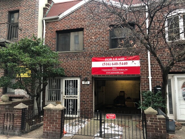
SALE & LEASE HISTORY
LISTING DATE
SALE/LEASE

Nov 22, 2019
For Sale
May 17, 2019
For Sale
Nearby Properties
Address
Land Use
TOTAL SIZE
Lot Size
Zoning
Address
Land Use
TOTAL SIZE
Lot Size
Zoning
1,586,876 SF
1.87 AC
C5-3
Address
Land Use
TOTAL SIZE
Lot Size
Zoning
2,400,000 SF
15.14 AC
C5-2
Address
Land Use
TOTAL SIZE
Lot Size
Zoning
2,124,441 SF
17.29 AC
R8
Address
Land Use
TOTAL SIZE
Lot Size
Zoning
1,160,500 SF
1.62 AC
C6-6
Address
Land Use
TOTAL SIZE
Lot Size
Zoning
2,230,742 SF
6.33 AC
R9
Address
Land Use
TOTAL SIZE
Lot Size
Zoning
822,014 SF
1.38 AC
C52.5
Address
Land Use
TOTAL SIZE
Lot Size
Zoning
916,553 SF
1.39 AC
C5-3
Address
Land Use
TOTAL SIZE
Lot Size
Zoning
539,643 SF
C5-2
Address
Land Use
TOTAL SIZE
Lot Size
Zoning
1,033,031 SF
1.87 AC
C52.5
Address
Land Use
TOTAL SIZE
Lot Size
Zoning
1,064,223 SF
0.88 AC
C52.5
Address
Land Use
TOTAL SIZE
Lot Size
Zoning
1,242,587 SF
1.49 AC
C6-6
Address
Land Use
TOTAL SIZE
Lot Size
Zoning
984,485 SF
1.03 AC
C6-6
Address
Land Use
TOTAL SIZE
Lot Size
Zoning
624,883 SF
0.75 AC
C6-6
Address
Land Use
TOTAL SIZE
Lot Size
Zoning
1,039,281 SF
0.92 AC
C5-3
Address
Land Use
TOTAL SIZE
Lot Size
Zoning
1,200,000 SF
10.24 AC
R9
Address
Land Use
TOTAL SIZE
Lot Size
Zoning
1,065,915 SF
2.13 AC
M16R10
Address
Land Use
TOTAL SIZE
Lot Size
Zoning
645,483 SF
0.78 AC
C5-3
Address
Land Use
TOTAL SIZE
Lot Size
Zoning
1,035,307 SF
0.86 AC
C5-3
Address
Land Use
TOTAL SIZE
Lot Size
Zoning
599,102 SF
0.81 AC
C5-3
Address
Land Use
TOTAL SIZE
Lot Size
Zoning
757,439 SF
0.91 AC
C1-9
Address
Land Use
TOTAL SIZE
Lot Size
Zoning
733,747 SF
0.98 AC
R10
Address
Land Use
TOTAL SIZE
Lot Size
Zoning
649,576 SF
0.64 AC
C5-3
Address
Land Use
TOTAL SIZE
Lot Size
Zoning
1,502,532 SF
6.35 AC
R7B
Address
Land Use
TOTAL SIZE
Lot Size
Zoning
714,224 SF
0.70 AC
R8
Address
Land Use
TOTAL SIZE
Lot Size
Zoning
840,000 SF
1.04 AC
C4-6
Address
Land Use
TOTAL SIZE
Lot Size
Zoning
493,090 SF
1.87 AC
C52.5
Address
Land Use
TOTAL SIZE
Lot Size
Zoning
536,992 SF
0.64 AC
C5-3
Address
Land Use
TOTAL SIZE
Lot Size
Zoning
1,503,235 SF
5.28 AC
C2-7
Address
Land Use
TOTAL SIZE
Lot Size
Zoning
805,287 SF
1 AC
R10
Address
Land Use
TOTAL SIZE
Lot Size
Zoning
772,163 SF
5.24 AC
C4-5X
The World's #1 Commercial Real Estate Marketplace
Connect with us
© 2025 CoStar Group
The information above has been obtained from sources believed reliable. While we do not doubt its accuracy we have not verified it and make no guarantee, warranty or representation about it. It is your responsibility to independently confirm its accuracy and completeness. Any projections, opinions, assumptions, or estimates used are for example only and do not represent the current or future performance of the property. The value of this transaction to you depends on tax and other factors which should be evaluated by your tax, financial, and legal advisors. You and your advisors should conduct a careful, independent investigation of the property to determine to your satisfaction the suitability of the property for your needs.