Property Record
4333 Kaiser Rd, Stockton, CA 95215

Property Detail
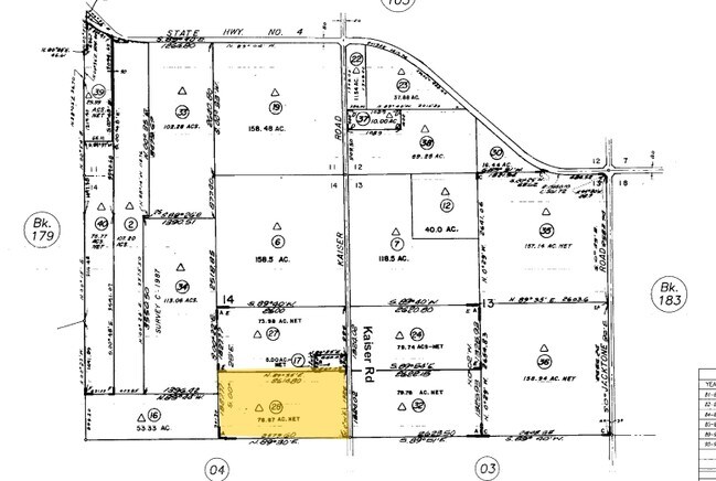
4333 Kaiser Rd
181-020-28
MAP 27 PG 179
Orchard
SAN JOAQUIN
AG40
California
B and X Area of moderate flood hazard, usually the area between the limits of the 100-year and 500-year floods.
78.67 AC
2025
Stockton
2025
Stockton/Modesto
003601
Stockton-Lodi, CA
NEARBY LISTINGS FOR SALE OR LEASE
-
-
View all Stockton listings for sale on LoopNet.com
DEMOGRAPHICS near 4333 Kaiser Rd
1 mile
3 mile
5 mile
2025 Total Population
75
3,145
48,250
2030 Population
77
3,148
49,940
Pop Growth 2025-2030
+ 2.67%
+ 0.10%
+ 3.50%
Average Age
34
43
36
2025 Total Households
21
580
12,356
HH Growth 2025-2030
+ 4.76%
+ 1.21%
+ 3.77%
Median Household Inc
$64,500
$77,257
$63,038
Avg Household Size
3.50
3.30
3.60
2025 Avg HH Vehicles
2.00
2.00
2.00
Median Home Value
$399,999
$594,697
$365,365
Median Year Built
1961
1968
1973
Nearby Places
Map Layers
Map Styles
 Street
 Aerial
Layers
 Traffic
 Biking
Places
Listings with unknown addresses are not visible on the map
- Restaurants
- Banks
- Shops
- Fitness
- Groceries
PUBLIC TRANSPORTATION
COMMUTER RAIL
Stockton- Robert J Cabral Station (ACE Train - Altamont Corridor Express)
Drive
Walk
Distance
Stockton- Robert J Cabral Station (ACE Train - Altamont Corridor Express)
15 min
9.1 mi
Stockton (San Joaquins - Amtrak)
Drive
Walk
Distance
Stockton (San Joaquins - Amtrak)
15 min
9.7 mi
AIRPORT
Stockton Metro
Drive
Walk
Distance
Stockton Metro
16 min
8.2 mi
Freight Ports
Port of Stockton
Drive
Walk
Distance
Port of Stockton
20 min
12.3 mi
Nearby Properties
Address
Land Use
TOTAL SIZE
Lot Size
Zoning
Address
Land Use
TOTAL SIZE
Lot Size
Zoning
57.72 AC
Address
Land Use
TOTAL SIZE
Lot Size
Zoning
1,122,341 SF
61.64 AC
IL
Address
Land Use
TOTAL SIZE
Lot Size
Zoning
67.72 AC
Address
Land Use
TOTAL SIZE
Lot Size
Zoning
749,983 SF
52.76 AC
Address
Land Use
TOTAL SIZE
Lot Size
Zoning
638,895 SF
76.06 AC
Address
Land Use
TOTAL SIZE
Lot Size
Zoning
35.97 AC
IL
Address
Land Use
TOTAL SIZE
Lot Size
Zoning
707,154 SF
36.64 AC
Address
Land Use
TOTAL SIZE
Lot Size
Zoning
27.50 AC
Address
Land Use
TOTAL SIZE
Lot Size
Zoning
506,844 SF
26.99 AC
Address
Land Use
TOTAL SIZE
Lot Size
Zoning
285,480 SF
15.70 AC
IL
Address
Land Use
TOTAL SIZE
Lot Size
Zoning
735,980 SF
39.42 AC
Address
Land Use
TOTAL SIZE
Lot Size
Zoning
388,183 SF
18.90 AC
Address
Land Use
TOTAL SIZE
Lot Size
Zoning
383,382 SF
21.94 AC
IL
Address
Land Use
TOTAL SIZE
Lot Size
Zoning
350,892 SF
20.34 AC
Address
Land Use
TOTAL SIZE
Lot Size
Zoning
1,512 SF
77.48 AC
AG40
Address
Land Use
TOTAL SIZE
Lot Size
Zoning
388,000 SF
18.99 AC
Address
Land Use
TOTAL SIZE
Lot Size
Zoning
143,888 SF
12.48 AC
Address
Land Use
TOTAL SIZE
Lot Size
Zoning
260,600 SF
20.60 AC
Address
Land Use
TOTAL SIZE
Lot Size
Zoning
150,000 SF
8.61 AC
Address
Land Use
TOTAL SIZE
Lot Size
Zoning
194,940 SF
12.17 AC
Address
Land Use
TOTAL SIZE
Lot Size
Zoning
186,944 SF
10.29 AC
Address
Land Use
TOTAL SIZE
Lot Size
Zoning
150,000 SF
7.16 AC
Address
Land Use
TOTAL SIZE
Lot Size
Zoning
54.53 AC
Address
Land Use
TOTAL SIZE
Lot Size
Zoning
122,146 SF
8.48 AC
Address
Land Use
TOTAL SIZE
Lot Size
Zoning
43.44 AC
AG40
Address
Land Use
TOTAL SIZE
Lot Size
Zoning
147,808 SF
20.81 AC
Address
Land Use
TOTAL SIZE
Lot Size
Zoning
39.37 AC
AG40
Address
Land Use
TOTAL SIZE
Lot Size
Zoning
35.06 AC
Address
Land Use
TOTAL SIZE
Lot Size
Zoning
41.98 AC
The World's #1 Commercial Real Estate Marketplace
Connect with us
© 2026 CoStar Group
The information above has been obtained from sources believed reliable. While we do not doubt its accuracy we have not verified it and make no guarantee, warranty or representation about it. It is your responsibility to independently confirm its accuracy and completeness. Any projections, opinions, assumptions, or estimates used are for example only and do not represent the current or future performance of the property. The value of this transaction to you depends on tax and other factors which should be evaluated by your tax, financial, and legal advisors. You and your advisors should conduct a careful, independent investigation of the property to determine to your satisfaction the suitability of the property for your needs.