Property Record
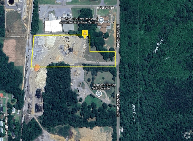
43385 Nicholsville Rd, Bay Minette, AL 36507
NEARBY LISTINGS FOR SALE OR LEASE
Property Detail
43385 Nicholsville Rd
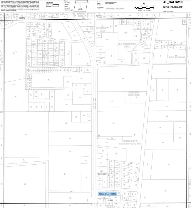
23-05-21-4-000-001.000
Hand Land Co
Officebuilding
10 AC (C) COMM AT SE COR OF SEC 21-T2S-R3E RUN TH N 1520'(S ) TH W 34' TO POB TH CONT W'LY 1190.48' TO E R/W OF RR RD, T H N
X
Baldwin
01003C0407M
Alabama
2024
10 AC
2024
Baldwin County
010600
Mobile
1,515 SF
Daphne-Fairhope-Foley, AL
DEMOGRAPHICS near 43385 Nicholsville Rd
1 Mile
3 Mile
5 Mile
2024 Total Population
1,417
9,417
13,489
2029 Population
1,578
10,485
15,015
Pop Growth 2024-2029
+ 11.36%
+ 11.34%
+ 11.31%
Average Age
38
39
40
2024 Total Households
507
3,421
4,975
HH Growth 2024-2029
+ 11.24%
+ 10.87%
+ 10.75%
Median Household Inc
$40,409
$41,696
$44,649
Avg Household Size
2.50
2.50
2.50
2024 Avg HH Vehicles
2.00
2.00
2.00
Median Home Value
$113,372
$134,648
$153,484
Median Year Built
1987
1979
1981
Nearby Places
Map Layers
Map Styles
 Street
 Aerial
- Restaurants
- Banks
- Shops
- Fitness
- Groceries
PUBLIC TRANSPORTATION
AIRPORT
Mobile International
DRIVE
WALK
Distance
Mobile International
47 min
33.8 mi
Freight Ports
Port of Mobile
DRIVE
WALK
Distance
Port of Mobile
42 min
30.5 mi
Nearby Properties
Address
Land Use
TOTAL SIZE
Lot Size
Zoning
Address
Land Use
TOTAL SIZE
Lot Size
Zoning
607,068 SF
27 AC
Address
Land Use
TOTAL SIZE
Lot Size
Zoning
2.07 AC
Address
Land Use
TOTAL SIZE
Lot Size
Zoning
277,491 SF
10 AC
Address
Land Use
TOTAL SIZE
Lot Size
Zoning
413,566 SF
15 AC
Address
Land Use
TOTAL SIZE
Lot Size
Zoning
100,986 SF
9.30 AC
Address
Land Use
TOTAL SIZE
Lot Size
Zoning
160,371 SF
16 AC
Address
Land Use
TOTAL SIZE
Lot Size
Zoning
3.40 AC
Address
Land Use
TOTAL SIZE
Lot Size
Zoning
6,515 SF
25 AC
Address
Land Use
TOTAL SIZE
Lot Size
Zoning
Address
Land Use
TOTAL SIZE
Lot Size
Zoning
Address
Land Use
TOTAL SIZE
Lot Size
Zoning
136,192 SF
20 AC
Address
Land Use
TOTAL SIZE
Lot Size
Zoning
8.90 AC
Address
Land Use
TOTAL SIZE
Lot Size
Zoning
253,248 SF
15 AC
Address
Land Use
TOTAL SIZE
Lot Size
Zoning
139,745 SF
18 AC
Address
Land Use
TOTAL SIZE
Lot Size
Zoning
88,482 SF
6.30 AC
Address
Land Use
TOTAL SIZE
Lot Size
Zoning
8,551 SF
12 AC
Address
Land Use
TOTAL SIZE
Lot Size
Zoning
3.05 AC
Address
Land Use
TOTAL SIZE
Lot Size
Zoning
100,607 SF
7.70 AC
Address
Land Use
TOTAL SIZE
Lot Size
Zoning
51,468 SF
5.40 AC
Address
Land Use
TOTAL SIZE
Lot Size
Zoning
35,005 SF
3.36 AC
Address
Land Use
TOTAL SIZE
Lot Size
Zoning
6,183 SF
0.04 AC
Address
Land Use
TOTAL SIZE
Lot Size
Zoning
133,733 SF
25 AC
Address
Land Use
TOTAL SIZE
Lot Size
Zoning
3,786 SF
13 AC
Address
Land Use
TOTAL SIZE
Lot Size
Zoning
6,401 SF
29 AC
Address
Land Use
TOTAL SIZE
Lot Size
Zoning
52,427 SF
12 AC
Address
Land Use
TOTAL SIZE
Lot Size
Zoning
384 SF
20 AC
Address
Land Use
TOTAL SIZE
Lot Size
Zoning
4.90 AC
Address
Land Use
TOTAL SIZE
Lot Size
Zoning
576 SF
33 AC
Address
Land Use
TOTAL SIZE
Lot Size
Zoning
13,410 SF
1.46 AC
Address
Land Use
TOTAL SIZE
Lot Size
Zoning
5,882 SF
4.38 AC
The World's #1 Commercial Real Estate Marketplace
Connect with us
© 2025 CoStar Group
The information above has been obtained from sources believed reliable. While we do not doubt its accuracy we have not verified it and make no guarantee, warranty or representation about it. It is your responsibility to independently confirm its accuracy and completeness. Any projections, opinions, assumptions, or estimates used are for example only and do not represent the current or future performance of the property. The value of this transaction to you depends on tax and other factors which should be evaluated by your tax, financial, and legal advisors. You and your advisors should conduct a careful, independent investigation of the property to determine to your satisfaction the suitability of the property for your needs.