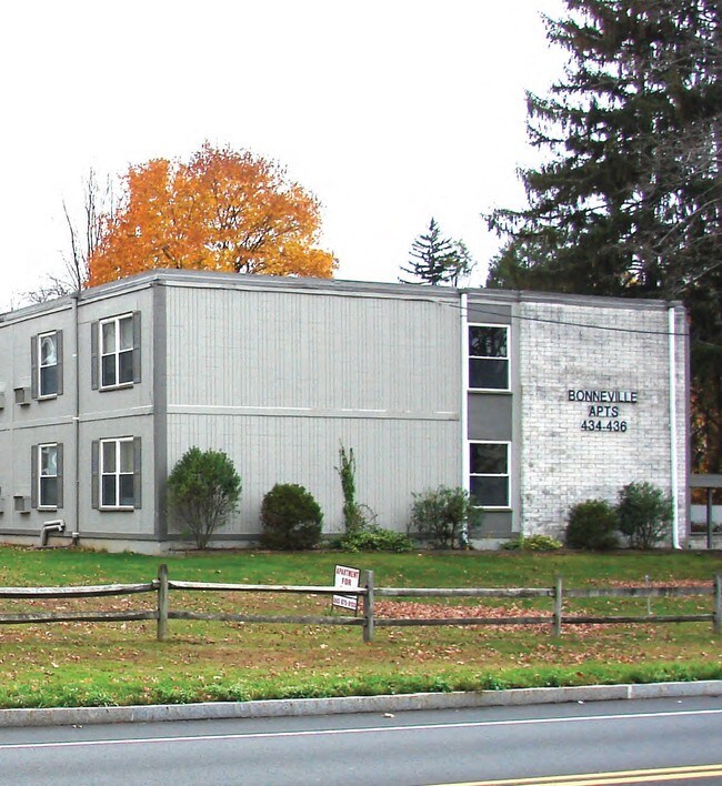
Property Record
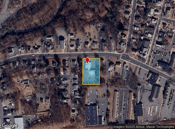
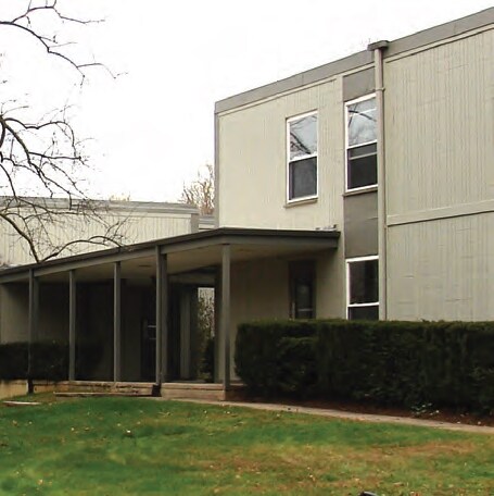
434 N Main St, Manchester, CT 06042
NEARBY LISTINGS FOR SALE OR LEASE
Property Detail
434 N Main St
MANC-000058-004170-000434
Hartford
Apartmenthouse5plusunits
Connecticut
X
434
09003C0392F
1.04 AC
2025
Robertson
2025
Hartford
514200
Hartford-West Hartford-East Hartford, CT
13,120 SF
DEMOGRAPHICS near 434 N Main St
1 Mile
3 Mile
5 Mile
2024 Total Population
12,061
68,292
129,208
2029 Population
12,053
68,031
128,654
Pop Growth 2024-2029
(0.07%)
(0.38%)
(0.43%)
Average Age
38
40
41
2024 Total Households
5,172
28,671
52,415
HH Growth 2024-2029
(0.06%)
(0.43%)
(0.47%)
Median Household Inc
$80,290
$80,425
$84,780
Avg Household Size
2.30
2.30
2.40
2024 Avg HH Vehicles
2.00
2.00
2.00
Median Home Value
$180,911
$219,393
$243,019
Median Year Built
1975
1966
1967
Nearby Places
Map Layers
Map Styles
 Street
 Aerial
- Restaurants
- Banks
- Shops
- Fitness
- Groceries
PUBLIC TRANSPORTATION
COMMUTER RAIL
Hartford Amtrak Station (Amtrak Hartford Line - Amtrak, Northeast Regional - Amtrak, Valley Flyer - Amtrak, Vermonter - Amtrak)
DRIVE
WALK
Distance
Hartford Amtrak Station (Amtrak Hartford Line - Amtrak, Northeast Regional - Amtrak, Valley Flyer - Amtrak, Vermonter - Amtrak)
15 min
9.4 mi
Windsor (Amtrak Hartford Line - Amtrak, Hartford Line - Amtrak, Northeast Regional - Amtrak, Valley Flyer - Amtrak)
DRIVE
WALK
Distance
Windsor (Amtrak Hartford Line - Amtrak, Hartford Line - Amtrak, Northeast Regional - Amtrak, Valley Flyer - Amtrak)
17 min
9.7 mi
AIRPORT
Bradley International
DRIVE
WALK
Distance
Bradley International
37 min
20.5 mi
Freight Ports
Port of New Haven
DRIVE
WALK
Distance
Port of New Haven
61 min
45.9 mi
Nearby Properties
Address
Land Use
TOTAL SIZE
Lot Size
Zoning
Address
Land Use
TOTAL SIZE
Lot Size
Zoning
159 AC
RR
Address
Land Use
TOTAL SIZE
Lot Size
Zoning
12.54 AC
Address
Land Use
TOTAL SIZE
Lot Size
Zoning
194,971 SF
162.43 AC
IND
Address
Land Use
TOTAL SIZE
Lot Size
Zoning
467,349 SF
13.83 AC
CUD
Address
Land Use
TOTAL SIZE
Lot Size
Zoning
20,384 SF
40 AC
PRD
Address
Land Use
TOTAL SIZE
Lot Size
Zoning
28,608 SF
25.37 AC
CUD
Address
Land Use
TOTAL SIZE
Lot Size
Zoning
43.60 AC
PRD
Address
Land Use
TOTAL SIZE
Lot Size
Zoning
12,068 SF
21.79 AC
CUD
Address
Land Use
TOTAL SIZE
Lot Size
Zoning
238.11 AC
GD
Address
Land Use
TOTAL SIZE
Lot Size
Zoning
29,744 SF
29.50 AC
PRD
Address
Land Use
TOTAL SIZE
Lot Size
Zoning
24.02 AC
COMMER
Address
Land Use
TOTAL SIZE
Lot Size
Zoning
10.59 AC
GD
Address
Land Use
TOTAL SIZE
Lot Size
Zoning
175,936 SF
18.28 AC
GD
Address
Land Use
TOTAL SIZE
Lot Size
Zoning
26.65 AC
GB
Address
Land Use
TOTAL SIZE
Lot Size
Zoning
1,920 SF
31 AC
RC
Address
Land Use
TOTAL SIZE
Lot Size
Zoning
29.90 AC
PRD
Address
Land Use
TOTAL SIZE
Lot Size
Zoning
53.59 AC
RA
Address
Land Use
TOTAL SIZE
Lot Size
Zoning
219,479 SF
9.32 AC
H
Address
Land Use
TOTAL SIZE
Lot Size
Zoning
498,105 SF
29.55 AC
IND
Address
Land Use
TOTAL SIZE
Lot Size
Zoning
149,322 SF
16.76 AC
A30
Address
Land Use
TOTAL SIZE
Lot Size
Zoning
111,800 SF
5.80 AC
GD
Address
Land Use
TOTAL SIZE
Lot Size
Zoning
156,929 SF
43 AC
GD
Address
Land Use
TOTAL SIZE
Lot Size
Zoning
19.60 AC
GB
Address
Land Use
TOTAL SIZE
Lot Size
Zoning
36 AC
RR
Address
Land Use
TOTAL SIZE
Lot Size
Zoning
22.12 AC
FBZ
Address
Land Use
TOTAL SIZE
Lot Size
Zoning
68,988 SF
9.17 AC
GB
Address
Land Use
TOTAL SIZE
Lot Size
Zoning
13,056 SF
17.43 AC
RB
Address
Land Use
TOTAL SIZE
Lot Size
Zoning
43,394 SF
35 AC
A30
Address
Land Use
TOTAL SIZE
Lot Size
Zoning
187,657 SF
30.80 AC
RR
Address
Land Use
TOTAL SIZE
Lot Size
Zoning
6.38 AC
CBD
The World's #1 Commercial Real Estate Marketplace
Connect with us
© 2025 CoStar Group
The information above has been obtained from sources believed reliable. While we do not doubt its accuracy we have not verified it and make no guarantee, warranty or representation about it. It is your responsibility to independently confirm its accuracy and completeness. Any projections, opinions, assumptions, or estimates used are for example only and do not represent the current or future performance of the property. The value of this transaction to you depends on tax and other factors which should be evaluated by your tax, financial, and legal advisors. You and your advisors should conduct a careful, independent investigation of the property to determine to your satisfaction the suitability of the property for your needs.