Property Record
4340 N Henry Blvd, Stockbridge, GA 30281
NEARBY LISTINGS FOR SALE OR LEASE
Property Detail
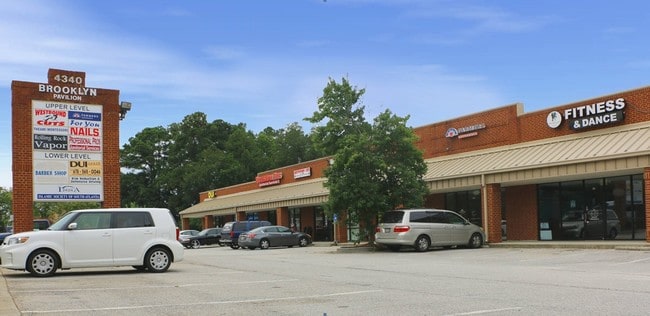
4340 N Henry Blvd
0S32-03-030-000
Miqdad Husen 1
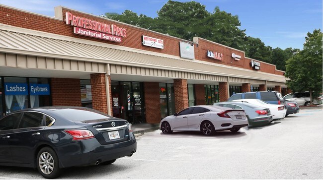
Stripcommercialcenter
LAND LOT: 62 /LAND DISTRICT: 12; COMMERCIAL
X
Henry
13151C0086D
Georgia
2025
2 AC
2025
Forest Park/Morrow
070113
Atlanta
29,040 SF
Atlanta-Sandy Springs-Roswell, GA
DEMOGRAPHICS near 4340 N Henry Blvd
1 Mile
3 Mile
5 Mile
2024 Total Population
3,249
42,799
107,809
2029 Population
3,537
46,265
114,082
Pop Growth 2024-2029
+ 8.86%
+ 8.10%
+ 5.82%
Average Age
36
38
38
2024 Total Households
1,201
15,673
38,421
HH Growth 2024-2029
+ 8.83%
+ 8.10%
+ 5.78%
Median Household Inc
$52,054
$58,505
$67,471
Avg Household Size
2.70
2.70
2.70
2024 Avg HH Vehicles
2.00
2.00
2.00
Median Home Value
$162,181
$192,786
$211,476
Median Year Built
1989
1993
1994
Nearby Places
Map Layers
Map Styles
 Street
 Aerial
- Restaurants
- Banks
- Shops
- Fitness
- Groceries
PUBLIC TRANSPORTATION
AIRPORT
Hartsfield - Jackson Atlanta International
DRIVE
WALK
Distance
Hartsfield - Jackson Atlanta International
25 min
16.4 mi
Freight Ports
Georgia Ports - Savannah
DRIVE
WALK
Distance
Georgia Ports - Savannah
258 min
229.0 mi
SALE & LEASE HISTORY
LISTING DATE
SALE/LEASE

Sep 25, 2016
For Lease
Sep 23, 2016
For Sale
Sep 08, 2017
For Sale
Dec 09, 2016
For Lease
Nearby Properties
Address
Land Use
TOTAL SIZE
Lot Size
Zoning
Address
Land Use
TOTAL SIZE
Lot Size
Zoning
22,400 SF
45.37 AC
RM
Address
Land Use
TOTAL SIZE
Lot Size
Zoning
35,082 SF
31.82 AC
C3
Address
Land Use
TOTAL SIZE
Lot Size
Zoning
476,716 SF
28.93 AC
C2
Address
Land Use
TOTAL SIZE
Lot Size
Zoning
4,010 SF
37.60 AC
C2
Address
Land Use
TOTAL SIZE
Lot Size
Zoning
17,862 SF
30 AC
PD
Address
Land Use
TOTAL SIZE
Lot Size
Zoning
19,140 SF
40.11 AC
RM
Address
Land Use
TOTAL SIZE
Lot Size
Zoning
21,678 SF
26.44 AC
RM
Address
Land Use
TOTAL SIZE
Lot Size
Zoning
13,072 SF
32.50 AC
RM
Address
Land Use
TOTAL SIZE
Lot Size
Zoning
707,800 SF
27.81 AC
M1
Address
Land Use
TOTAL SIZE
Lot Size
Zoning
2,426 SF
19.79 AC
RM
Address
Land Use
TOTAL SIZE
Lot Size
Zoning
25,952 SF
28.88 AC
RM
Address
Land Use
TOTAL SIZE
Lot Size
Zoning
9,264 SF
26.63 AC
RM
Address
Land Use
TOTAL SIZE
Lot Size
Zoning
510,053 SF
39.93 AC
M1
Address
Land Use
TOTAL SIZE
Lot Size
Zoning
25,508 SF
26.03 AC
RM
Address
Land Use
TOTAL SIZE
Lot Size
Zoning
439,225 SF
19.81 AC
M1
Address
Land Use
TOTAL SIZE
Lot Size
Zoning
399,189 SF
29.60 AC
M1
Address
Land Use
TOTAL SIZE
Lot Size
Zoning
269,100 SF
30.64 AC
Address
Land Use
TOTAL SIZE
Lot Size
Zoning
74,395 SF
49.35 AC
PD
Address
Land Use
TOTAL SIZE
Lot Size
Zoning
216,361 SF
27.44 AC
C3
Address
Land Use
TOTAL SIZE
Lot Size
Zoning
1,638 SF
12.79 AC
RM
Address
Land Use
TOTAL SIZE
Lot Size
Zoning
391,708 SF
20.04 AC
C2
Address
Land Use
TOTAL SIZE
Lot Size
Zoning
127,735 SF
20.74 AC
M1
Address
Land Use
TOTAL SIZE
Lot Size
Zoning
26,018 SF
11.03 AC
GB
Address
Land Use
TOTAL SIZE
Lot Size
Zoning
62,142 SF
4.36 AC
C1
Address
Land Use
TOTAL SIZE
Lot Size
Zoning
8,590 SF
11.09 AC
R3
Address
Land Use
TOTAL SIZE
Lot Size
Zoning
14,862 SF
10.18 AC
GB
Address
Land Use
TOTAL SIZE
Lot Size
Zoning
466,048 SF
6.51 AC
RA
Address
Land Use
TOTAL SIZE
Lot Size
Zoning
66,194 SF
9.67 AC
C3
Address
Land Use
TOTAL SIZE
Lot Size
Zoning
46,186 SF
9.99 AC
C2
Address
Land Use
TOTAL SIZE
Lot Size
Zoning
46,964 SF
2.72 AC
The World's #1 Commercial Real Estate Marketplace
Connect with us
© 2026 CoStar Group
The information above has been obtained from sources believed reliable. While we do not doubt its accuracy we have not verified it and make no guarantee, warranty or representation about it. It is your responsibility to independently confirm its accuracy and completeness. Any projections, opinions, assumptions, or estimates used are for example only and do not represent the current or future performance of the property. The value of this transaction to you depends on tax and other factors which should be evaluated by your tax, financial, and legal advisors. You and your advisors should conduct a careful, independent investigation of the property to determine to your satisfaction the suitability of the property for your needs.