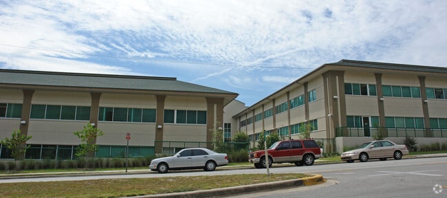
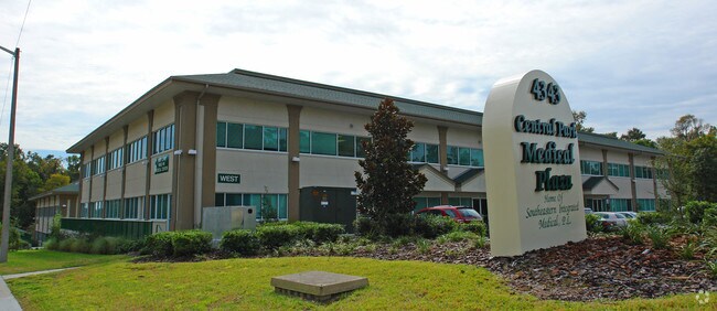
Property Record
4343 Newberry Rd, Gainesville, FL 32607

Property Detail
4343 Newberry Rd
06547-038-000
COM NE COR SEC RUN S 1590.86 FT TO S LINE SR 26 POB RUN W/LY ALONG R/W 200 FT S 562.13 FT E 185 FT N 484.43 FT POB LESS ADD R/W OR 2874/0894 (LESS THAT PT OF THE FOLLOWING DESC: COM NE COR SEC S 1590.86 FT WLY 200 FT POB S 21.60 FT S 67 DEG E 65.17 F
Officebuilding
Alachua
PD
Florida
B and X Area of moderate flood hazard, usually the area between the limits of the 100-year and 500-year floods.
8.01 AC
2025
West Gainesville
2025
Other Market Areas
001605
Gainesville, FL
81,884 SF
NEARBY LISTINGS FOR SALE OR LEASE
DEMOGRAPHICS near 4343 Newberry Rd
1 mile
3 mile
5 mile
2025 Total Population
8,093
96,025
189,562
2030 Population
8,370
99,212
196,068
Pop Growth 2025-2030
+ 3.42%
+ 3.32%
+ 3.43%
Average Age
37
34
35
2025 Total Households
3,502
38,864
78,218
HH Growth 2025-2030
+ 4.00%
+ 3.77%
+ 3.96%
Median Household Inc
$57,142
$52,449
$57,655
Avg Household Size
2.20
2.20
2.20
2025 Avg HH Vehicles
2.00
2.00
2.00
Median Home Value
$311,111
$338,273
$328,923
Median Year Built
1977
1986
1986
Nearby Places
Map Layers
Map Styles
 Street
 Aerial
Layers
 Traffic
 Biking
Places
Listings with unknown addresses are not visible on the map
- Restaurants
- Banks
- Shops
- Fitness
- Groceries
PUBLIC TRANSPORTATION
AIRPORT
Gainesville Regional
Drive
Walk
Distance
Gainesville Regional
22 min
10.0 mi
Nearby Properties
Address
Land Use
TOTAL SIZE
Lot Size
Zoning
Address
Land Use
TOTAL SIZE
Lot Size
Zoning
3,617,778 SF
276.74 AC
ED
Address
Land Use
TOTAL SIZE
Lot Size
Zoning
790,340 SF
526 AC
ED
Address
Land Use
TOTAL SIZE
Lot Size
Zoning
108,640 SF
20 AC
ED
Address
Land Use
TOTAL SIZE
Lot Size
Zoning
17.87 AC
ED
Address
Land Use
TOTAL SIZE
Lot Size
Zoning
382,760 SF
109.58 AC
MD
Address
Land Use
TOTAL SIZE
Lot Size
Zoning
430,590 SF
16.95 AC
ED
Address
Land Use
TOTAL SIZE
Lot Size
Zoning
682,400 SF
20 AC
ED
Address
Land Use
TOTAL SIZE
Lot Size
Zoning
959,910 SF
2.50 AC
PD
Address
Land Use
TOTAL SIZE
Lot Size
Zoning
399,130 SF
18.13 AC
ED
Address
Land Use
TOTAL SIZE
Lot Size
Zoning
1,005,666 SF
11.60 AC
MD
Address
Land Use
TOTAL SIZE
Lot Size
Zoning
20.95 AC
MD
Address
Land Use
TOTAL SIZE
Lot Size
Zoning
416,200 SF
20 AC
ED
Address
Land Use
TOTAL SIZE
Lot Size
Zoning
325,519 SF
1.25 AC
U8
Address
Land Use
TOTAL SIZE
Lot Size
Zoning
582,311 SF
20 AC
ED
Address
Land Use
TOTAL SIZE
Lot Size
Zoning
348,458 SF
81.44 AC
ED
Address
Land Use
TOTAL SIZE
Lot Size
Zoning
372,990 SF
20 AC
ED
Address
Land Use
TOTAL SIZE
Lot Size
Zoning
357,020 SF
20 AC
ED
Address
Land Use
TOTAL SIZE
Lot Size
Zoning
508,106 SF
27.40 AC
PD
Address
Land Use
TOTAL SIZE
Lot Size
Zoning
233,910 SF
3.64 AC
PD
Address
Land Use
TOTAL SIZE
Lot Size
Zoning
571,635 SF
55.49 AC
RMF6
Address
Land Use
TOTAL SIZE
Lot Size
Zoning
392,241 SF
25 AC
U9
Address
Land Use
TOTAL SIZE
Lot Size
Zoning
362,539 SF
2.11 AC
U8
Address
Land Use
TOTAL SIZE
Lot Size
Zoning
414,780 SF
1.99 AC
PD
Address
Land Use
TOTAL SIZE
Lot Size
Zoning
790,684 SF
57.09 AC
U8
Address
Land Use
TOTAL SIZE
Lot Size
Zoning
392,717 SF
47.62 AC
R-2
Address
Land Use
TOTAL SIZE
Lot Size
Zoning
318,578 SF
21.24 AC
RMF7
Address
Land Use
TOTAL SIZE
Lot Size
Zoning
295,990 SF
20 AC
ED
Address
Land Use
TOTAL SIZE
Lot Size
Zoning
219,150 SF
9.99 AC
PD
Address
Land Use
TOTAL SIZE
Lot Size
Zoning
280,840 SF
20 AC
ED
Address
Land Use
TOTAL SIZE
Lot Size
Zoning
495,440 SF
14.88 AC
U9
The World's #1 Commercial Real Estate Marketplace
Connect with us
© 2026 CoStar Group
The information above has been obtained from sources believed reliable. While we do not doubt its accuracy we have not verified it and make no guarantee, warranty or representation about it. It is your responsibility to independently confirm its accuracy and completeness. Any projections, opinions, assumptions, or estimates used are for example only and do not represent the current or future performance of the property. The value of this transaction to you depends on tax and other factors which should be evaluated by your tax, financial, and legal advisors. You and your advisors should conduct a careful, independent investigation of the property to determine to your satisfaction the suitability of the property for your needs.