Property Record
43450 Highway 27, Davenport, FL 33837


NEARBY LISTINGS FOR SALE OR LEASE
Property Detail
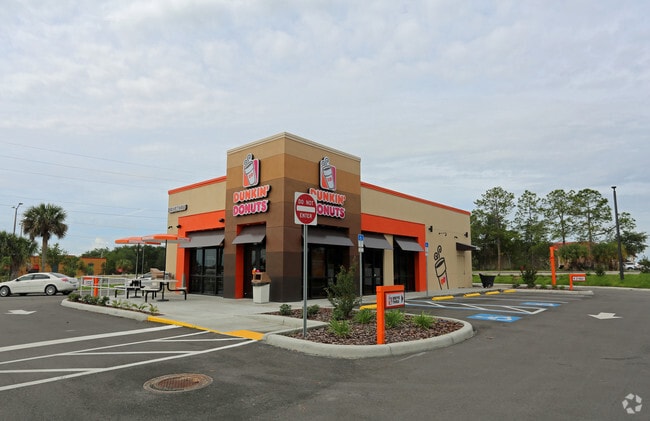
43450 Highway 27
27-26-18-000000-014150
Summit Point
Restaurantdrivein
BEG INTER OF S-LINE OF NW1/4 OF NE1/4 & W R/W US 27 RUN N 27 DEG 53 MIN 56 SEC W ALONG R/W 86.39 FT TO POB S 62 DEG 06 MIN 04 SEC W 166.8 FT N 27 DEG 53 MIN 56 SEC W 157 FT N 62 DEG 06 MIN 04 SEC E 166.8 FT TO WLY R/W US 27 S 27 DEG 53 MIN 56 SEC E A
X
Polk
12105C0225G
Florida
2024
0.62 AC
2025
Polk County
012411
Tampa/St Petersburg
1,860 SF
Lakeland-Winter Haven, FL
DEMOGRAPHICS near 43450 Highway 27
1 Mile
3 Mile
5 Mile
2024 Total Population
3,983
30,110
89,001
2029 Population
4,994
37,853
111,455
Pop Growth 2024-2029
+ 25.38%
+ 25.72%
+ 25.23%
Average Age
47
40
39
2024 Total Households
1,659
11,209
32,422
HH Growth 2024-2029
+ 25.50%
+ 25.85%
+ 25.27%
Median Household Inc
$68,571
$67,760
$66,285
Avg Household Size
2.40
2.60
2.70
2024 Avg HH Vehicles
2.00
2.00
2.00
Median Home Value
$198,961
$242,361
$261,231
Median Year Built
2007
2008
2008
Nearby Places
Map Layers
Map Styles
 Street
 Aerial
- Restaurants
- Banks
- Shops
- Fitness
- Groceries
PUBLIC TRANSPORTATION
AIRPORT
Orlando International
DRIVE
WALK
Distance
Orlando International
31 min
30.0 mi
SALE & LEASE HISTORY
LISTING DATE
SALE/LEASE

Mar 31, 2017
For Sale
Apr 06, 2017
For Sale
Nearby Properties
Address
Land Use
TOTAL SIZE
Lot Size
Zoning
Address
Land Use
TOTAL SIZE
Lot Size
Zoning
736,399 SF
23.59 AC
OPD
Address
Land Use
TOTAL SIZE
Lot Size
Zoning
1,125,150 SF
51.12 AC
RC
Address
Land Use
TOTAL SIZE
Lot Size
Zoning
969,150 SF
91.98 AC
RC
Address
Land Use
TOTAL SIZE
Lot Size
Zoning
336,380 SF
19.05 AC
Address
Land Use
TOTAL SIZE
Lot Size
Zoning
480,104 SF
12.37 AC
Address
Land Use
TOTAL SIZE
Lot Size
Zoning
403,448 SF
14.96 AC
Address
Land Use
TOTAL SIZE
Lot Size
Zoning
322,095 SF
16.88 AC
Address
Land Use
TOTAL SIZE
Lot Size
Zoning
301,623 SF
20.06 AC
Address
Land Use
TOTAL SIZE
Lot Size
Zoning
412,886 SF
10.72 AC
Address
Land Use
TOTAL SIZE
Lot Size
Zoning
372,655 SF
17.06 AC
C5
Address
Land Use
TOTAL SIZE
Lot Size
Zoning
354,600 SF
14.93 AC
Address
Land Use
TOTAL SIZE
Lot Size
Zoning
306,788 SF
13.35 AC
XX
Address
Land Use
TOTAL SIZE
Lot Size
Zoning
308,973 SF
18.38 AC
Address
Land Use
TOTAL SIZE
Lot Size
Zoning
328,817 SF
12.62 AC
Address
Land Use
TOTAL SIZE
Lot Size
Zoning
491,027 SF
18.81 AC
RC
Address
Land Use
TOTAL SIZE
Lot Size
Zoning
601,750 SF
32.69 AC
Address
Land Use
TOTAL SIZE
Lot Size
Zoning
450,000 SF
34.23 AC
Address
Land Use
TOTAL SIZE
Lot Size
Zoning
236,745 SF
26.56 AC
Address
Land Use
TOTAL SIZE
Lot Size
Zoning
406,208 SF
59.48 AC
Address
Land Use
TOTAL SIZE
Lot Size
Zoning
404,725 SF
26.87 AC
Address
Land Use
TOTAL SIZE
Lot Size
Zoning
192,257 SF
5.79 AC
Address
Land Use
TOTAL SIZE
Lot Size
Zoning
319,770 SF
40.72 AC
XX
Address
Land Use
TOTAL SIZE
Lot Size
Zoning
447,000 SF
23.26 AC
Address
Land Use
TOTAL SIZE
Lot Size
Zoning
398,850 SF
21.96 AC
Address
Land Use
TOTAL SIZE
Lot Size
Zoning
394,505 SF
25.69 AC
Address
Land Use
TOTAL SIZE
Lot Size
Zoning
252,318 SF
31.22 AC
Address
Land Use
TOTAL SIZE
Lot Size
Zoning
228,683 SF
13.54 AC
RC
Address
Land Use
TOTAL SIZE
Lot Size
Zoning
374,850 SF
19.02 AC
Address
Land Use
TOTAL SIZE
Lot Size
Zoning
148,181 SF
20.36 AC
Address
Land Use
TOTAL SIZE
Lot Size
Zoning
293,982 SF
12.25 AC
The World's #1 Commercial Real Estate Marketplace
Connect with us
© 2025 CoStar Group
The information above has been obtained from sources believed reliable. While we do not doubt its accuracy we have not verified it and make no guarantee, warranty or representation about it. It is your responsibility to independently confirm its accuracy and completeness. Any projections, opinions, assumptions, or estimates used are for example only and do not represent the current or future performance of the property. The value of this transaction to you depends on tax and other factors which should be evaluated by your tax, financial, and legal advisors. You and your advisors should conduct a careful, independent investigation of the property to determine to your satisfaction the suitability of the property for your needs.