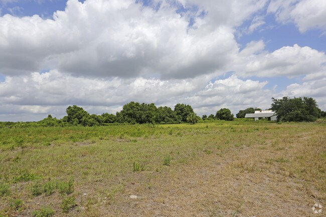
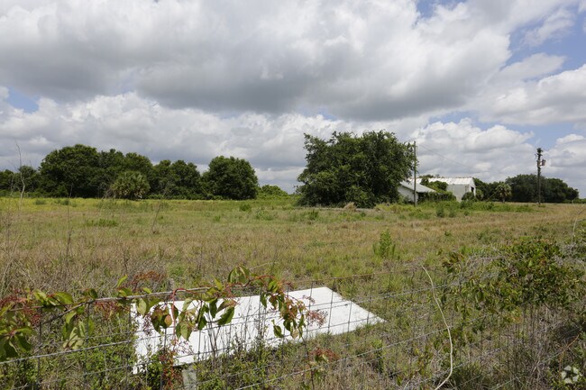
Property Record
4346 Sw Hull Ave, Arcadia, FL 34269
NEARBY LISTINGS FOR SALE OR LEASE
Property Detail
4346 Sw Hull Ave
33-38-24-0000-0040-0000
BEG AT INT OF S SEC LI & W R/W SCL RR FOR POB TH N 44D38M10S E ALG R/W 490.48 FT TH N 45D21 M50S W 150 FT TH S 44D38M10S W & // TO W R/W SAID RR 22.48 FT TH N 45D21M50S W 162.18 FT TH S 30D22M10S W 638.66 FT TO S LI SAID SEC TH S 89D38M50S E ALG S LI
Autorepair
DeSoto
X
Florida
12027C0281C
3 AC
2024
Florida Central South Area
2024
Other Market Areas
010406
Arcadia, FL
5,232 SF
DEMOGRAPHICS near 4346 Sw Hull Ave
1 Mile
3 Mile
5 Mile
2024 Total Population
44
1,550
3,667
2029 Population
47
1,708
4,050
Pop Growth 2024-2029
+ 6.82%
+ 10.19%
+ 10.44%
Average Age
41
40
40
2024 Total Households
16
545
1,291
HH Growth 2024-2029
+ 6.25%
+ 11.19%
+ 11.39%
Median Household Inc
$47,500
$49,332
$48,052
Avg Household Size
2.60
2.70
2.70
2024 Avg HH Vehicles
2.00
2.00
2.00
Median Home Value
$274,999
$216,956
$183,581
Median Year Built
1989
1991
1989
Nearby Places
Map Layers
Map Styles
 Street
 Aerial
- Restaurants
- Banks
- Shops
- Fitness
- Groceries
PUBLIC TRANSPORTATION
AIRPORT
Punta Gorda
DRIVE
WALK
Distance
Punta Gorda
25 min
17.9 mi
Freight Ports
Port Manatee
DRIVE
WALK
Distance
Port Manatee
90 min
65.3 mi
Nearby Properties
Address
Land Use
TOTAL SIZE
Lot Size
Zoning
Address
Land Use
TOTAL SIZE
Lot Size
Zoning
83,273 SF
13.94 AC
ROI
Address
Land Use
TOTAL SIZE
Lot Size
Zoning
7,514 SF
121.57 AC
A-5
Address
Land Use
TOTAL SIZE
Lot Size
Zoning
10,972 SF
6.77 AC
RSF-3
Address
Land Use
TOTAL SIZE
Lot Size
Zoning
98.17 AC
A-10
Address
Land Use
TOTAL SIZE
Lot Size
Zoning
640 AC
A-10
Address
Land Use
TOTAL SIZE
Lot Size
Zoning
7,895 SF
2.47 AC
CG
Address
Land Use
TOTAL SIZE
Lot Size
Zoning
4,220 SF
312.23 AC
A-5
Address
Land Use
TOTAL SIZE
Lot Size
Zoning
7,555 SF
1.21 AC
RM
Address
Land Use
TOTAL SIZE
Lot Size
Zoning
3,426 SF
6.87 AC
IL
Address
Land Use
TOTAL SIZE
Lot Size
Zoning
9,230 SF
1.29 AC
CG
Address
Land Use
TOTAL SIZE
Lot Size
Zoning
126 AC
A-10
Address
Land Use
TOTAL SIZE
Lot Size
Zoning
1,430 SF
186.36 AC
A-10
Address
Land Use
TOTAL SIZE
Lot Size
Zoning
76 AC
A-10
Address
Land Use
TOTAL SIZE
Lot Size
Zoning
323.91 AC
A-10
Address
Land Use
TOTAL SIZE
Lot Size
Zoning
120 AC
A-10
Address
Land Use
TOTAL SIZE
Lot Size
Zoning
6,312 SF
6 AC
ROI
Address
Land Use
TOTAL SIZE
Lot Size
Zoning
16,420 SF
1.88 AC
CG
Address
Land Use
TOTAL SIZE
Lot Size
Zoning
292 AC
A-10
Address
Land Use
TOTAL SIZE
Lot Size
Zoning
4,469 SF
6.35 AC
A-10
Address
Land Use
TOTAL SIZE
Lot Size
Zoning
59 AC
A-10
Address
Land Use
TOTAL SIZE
Lot Size
Zoning
2,653 SF
37.40 AC
A-5
Address
Land Use
TOTAL SIZE
Lot Size
Zoning
2,721 SF
7.92 AC
A-10
Address
Land Use
TOTAL SIZE
Lot Size
Zoning
2,948 SF
5.02 AC
A-10
Address
Land Use
TOTAL SIZE
Lot Size
Zoning
7,489 SF
5.79 AC
RMF-M
Address
Land Use
TOTAL SIZE
Lot Size
Zoning
1,807 SF
10 AC
A-5
Address
Land Use
TOTAL SIZE
Lot Size
Zoning
9,100 SF
1.87 AC
RMF-M
Address
Land Use
TOTAL SIZE
Lot Size
Zoning
8,100 SF
2.26 AC
A-5
Address
Land Use
TOTAL SIZE
Lot Size
Zoning
4,514 SF
1.44 AC
CN
Address
Land Use
TOTAL SIZE
Lot Size
Zoning
8,100 SF
1.45 AC
A-10
Address
Land Use
TOTAL SIZE
Lot Size
Zoning
4,454 SF
16.40 AC
IL
The World's #1 Commercial Real Estate Marketplace
Connect with us
© 2025 CoStar Group
The information above has been obtained from sources believed reliable. While we do not doubt its accuracy we have not verified it and make no guarantee, warranty or representation about it. It is your responsibility to independently confirm its accuracy and completeness. Any projections, opinions, assumptions, or estimates used are for example only and do not represent the current or future performance of the property. The value of this transaction to you depends on tax and other factors which should be evaluated by your tax, financial, and legal advisors. You and your advisors should conduct a careful, independent investigation of the property to determine to your satisfaction the suitability of the property for your needs.