Property Record
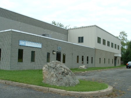
435 Bellvale Rd, Chester, NY 10918

NEARBY LISTINGS FOR SALE OR LEASE
Property Detail
435 Bellvale Rd
New York-Jersey City-White Plains, NY-NJ
H & M Kania
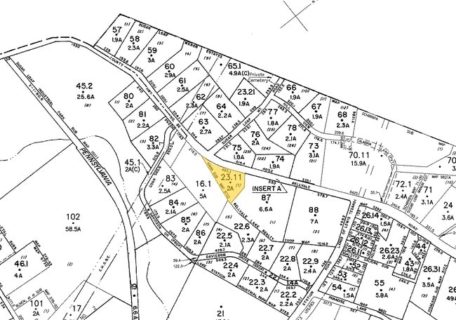
332289-017-000-0001-023.110-0000
LT 1 H & M KANIA SUB MAP 6733 PARTIAL ASSESSMENT
Industrialgeneral
Orange
X
New York
36071C0467E
23.11
2024
2 AC
2024
Orange County
014302
Northern New Jersey
16,540 SF
DEMOGRAPHICS near 435 Bellvale Rd
1 Mile
3 Mile
5 Mile
2024 Total Population
2,205
10,497
35,948
2029 Population
2,223
10,609
36,576
Pop Growth 2024-2029
+ 0.82%
+ 1.07%
+ 1.75%
Average Age
40
40
41
2024 Total Households
742
3,384
12,712
HH Growth 2024-2029
+ 0.94%
+ 1.15%
+ 1.80%
Median Household Inc
$121,559
$135,737
$125,402
Avg Household Size
2.90
2.90
2.70
2024 Avg HH Vehicles
2.00
2.00
2.00
Median Home Value
$305,725
$373,620
$373,505
Median Year Built
1983
1983
1978
Nearby Places
Map Layers
Map Styles
 Street
 Aerial
- Restaurants
- Banks
- Shops
- Fitness
- Groceries
PUBLIC TRANSPORTATION
AIRPORT
New York Stewart International
DRIVE
WALK
Distance
New York Stewart International
38 min
19.8 mi
Freight Ports
Maher Terminal
DRIVE
WALK
Distance
Maher Terminal
89 min
64.2 mi
Nearby Properties
Address
Land Use
TOTAL SIZE
Lot Size
Zoning
Address
Land Use
TOTAL SIZE
Lot Size
Zoning
219,579 SF
34 AC
00220
Address
Land Use
TOTAL SIZE
Lot Size
Zoning
12.80 AC
AR3
Address
Land Use
TOTAL SIZE
Lot Size
Zoning
103,055 SF
145.60 AC
AR3*
Address
Land Use
TOTAL SIZE
Lot Size
Zoning
5 AC
IP
Address
Land Use
TOTAL SIZE
Lot Size
Zoning
18.30 AC
AR3*
Address
Land Use
TOTAL SIZE
Lot Size
Zoning
7 AC
IP
Address
Land Use
TOTAL SIZE
Lot Size
Zoning
65,130 SF
5 AC
IP
Address
Land Use
TOTAL SIZE
Lot Size
Zoning
34,152 SF
9.60 AC
IP
Address
Land Use
TOTAL SIZE
Lot Size
Zoning
45,000 SF
4.20 AC
IP
Address
Land Use
TOTAL SIZE
Lot Size
Zoning
62,940 SF
60.40 AC
00230
Address
Land Use
TOTAL SIZE
Lot Size
Zoning
12,000 SF
2 AC
AR3*
Address
Land Use
TOTAL SIZE
Lot Size
Zoning
55,200 SF
31.40 AC
IP
Address
Land Use
TOTAL SIZE
Lot Size
Zoning
47,553 SF
99.10 AC
AR3
Address
Land Use
TOTAL SIZE
Lot Size
Zoning
54,689 SF
10.20 AC
I
Address
Land Use
TOTAL SIZE
Lot Size
Zoning
24,000 SF
1.80 AC
IP
Address
Land Use
TOTAL SIZE
Lot Size
Zoning
7,288 SF
54.40 AC
LBSL
Address
Land Use
TOTAL SIZE
Lot Size
Zoning
10,464 SF
3.10 AC
Address
Land Use
TOTAL SIZE
Lot Size
Zoning
17,400 SF
4 AC
IP
Address
Land Use
TOTAL SIZE
Lot Size
Zoning
54 AC
AP
Address
Land Use
TOTAL SIZE
Lot Size
Zoning
13,764 SF
2.20 AC
IP
Address
Land Use
TOTAL SIZE
Lot Size
Zoning
194.40 AC
AR3*
Address
Land Use
TOTAL SIZE
Lot Size
Zoning
5,592 SF
110.60 AC
AR3
Address
Land Use
TOTAL SIZE
Lot Size
Zoning
7,210 SF
1.90 AC
LBSL
Address
Land Use
TOTAL SIZE
Lot Size
Zoning
6,366 SF
123.20 AC
AR3*
Address
Land Use
TOTAL SIZE
Lot Size
Zoning
21,840 SF
4 AC
IP
Address
Land Use
TOTAL SIZE
Lot Size
Zoning
47.20 AC
I
Address
Land Use
TOTAL SIZE
Lot Size
Zoning
7,166 SF
39.90 AC
AR3
Address
Land Use
TOTAL SIZE
Lot Size
Zoning
29,925 SF
2.70 AC
IP
Address
Land Use
TOTAL SIZE
Lot Size
Zoning
19.60 AC
IP
The World's #1 Commercial Real Estate Marketplace
Connect with us
© 2025 CoStar Group
The information above has been obtained from sources believed reliable. While we do not doubt its accuracy we have not verified it and make no guarantee, warranty or representation about it. It is your responsibility to independently confirm its accuracy and completeness. Any projections, opinions, assumptions, or estimates used are for example only and do not represent the current or future performance of the property. The value of this transaction to you depends on tax and other factors which should be evaluated by your tax, financial, and legal advisors. You and your advisors should conduct a careful, independent investigation of the property to determine to your satisfaction the suitability of the property for your needs.