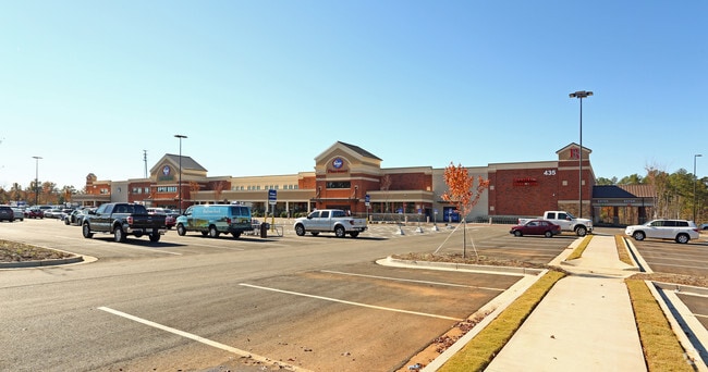
Property Record
435 Lewiston Rd, Grovetown, GA 30813

Property Detail
435 Lewiston Rd
061-2906
18.653 ACS
Realpropertynec
COLUMBIA
B and X Area of moderate flood hazard, usually the area between the limits of the 100-year and 500-year floods.
Georgia
2025
18.65 AC
2025
Outlying Columbia County
030312
Augusta/Richmond County
176 SF
Augusta-Richmond County, GA-SC
NEARBY LISTINGS FOR SALE OR LEASE
DEMOGRAPHICS near 435 Lewiston Rd
1 mile
3 mile
5 mile
2025 Total Population
2,590
45,474
95,395
2030 Population
2,735
48,116
100,635
Pop Growth 2025-2030
+ 5.60%
+ 5.81%
+ 5.49%
Average Age
36
36
37
2025 Total Households
911
15,453
32,777
HH Growth 2025-2030
+ 5.82%
+ 5.86%
+ 5.58%
Median Household Inc
$109,840
$96,985
$89,290
Avg Household Size
2.80
2.90
2.80
2025 Avg HH Vehicles
2.00
2.00
2.00
Median Home Value
$359,064
$332,712
$308,535
Median Year Built
2010
2007
2004
Nearby Places
Map Layers
Map Styles
 Street
 Aerial
Layers
 Traffic
 Biking
Places
Listings with unknown addresses are not visible on the map
- Restaurants
- Banks
- Shops
- Fitness
- Groceries
PUBLIC TRANSPORTATION
AIRPORT
Augusta Regional at Bush Field
Drive
Walk
Distance
Augusta Regional at Bush Field
31 min
19.9 mi
SALE & LEASE HISTORY
LISTING DATE
SALE/LEASE

Sep 05, 2019
For Lease
Oct 09, 2018
For Sale
Dec 07, 2016
For Lease
Nearby Properties
Address
Land Use
TOTAL SIZE
Lot Size
Zoning
Address
Land Use
TOTAL SIZE
Lot Size
Zoning
26,790 SF
40.46 AC
Address
Land Use
TOTAL SIZE
Lot Size
Zoning
2,627 SF
23.57 AC
Address
Land Use
TOTAL SIZE
Lot Size
Zoning
1,380 SF
65.42 AC
Address
Land Use
TOTAL SIZE
Lot Size
Zoning
118,470 SF
54 AC
Address
Land Use
TOTAL SIZE
Lot Size
Zoning
736 SF
14.23 AC
R-2;GENERA
Address
Land Use
TOTAL SIZE
Lot Size
Zoning
19,736 SF
27.20 AC
Address
Land Use
TOTAL SIZE
Lot Size
Zoning
Address
Land Use
TOTAL SIZE
Lot Size
Zoning
191,892 SF
184.39 AC
Address
Land Use
TOTAL SIZE
Lot Size
Zoning
520,414 SF
40.73 AC
Address
Land Use
TOTAL SIZE
Lot Size
Zoning
1,120 SF
9.69 AC
Address
Land Use
TOTAL SIZE
Lot Size
Zoning
Address
Land Use
TOTAL SIZE
Lot Size
Zoning
103,028 SF
30.64 AC
Address
Land Use
TOTAL SIZE
Lot Size
Zoning
640 SF
157.81 AC
Address
Land Use
TOTAL SIZE
Lot Size
Zoning
154,011 SF
18.45 AC
C-2;GEN CO
Address
Land Use
TOTAL SIZE
Lot Size
Zoning
71,867 SF
16.20 AC
Address
Land Use
TOTAL SIZE
Lot Size
Zoning
Address
Land Use
TOTAL SIZE
Lot Size
Zoning
27,361 SF
11.17 AC
Address
Land Use
TOTAL SIZE
Lot Size
Zoning
858 SF
2.70 AC
Address
Land Use
TOTAL SIZE
Lot Size
Zoning
Address
Land Use
TOTAL SIZE
Lot Size
Zoning
34,440 SF
10.75 AC
Address
Land Use
TOTAL SIZE
Lot Size
Zoning
348 SF
2.59 AC
Address
Land Use
TOTAL SIZE
Lot Size
Zoning
Address
Land Use
TOTAL SIZE
Lot Size
Zoning
21,144 SF
5.35 AC
R-3;HI DEN
Address
Land Use
TOTAL SIZE
Lot Size
Zoning
85,234 SF
5.69 AC
R-3;HI DEN
Address
Land Use
TOTAL SIZE
Lot Size
Zoning
Address
Land Use
TOTAL SIZE
Lot Size
Zoning
10,649 SF
13.74 AC
Address
Land Use
TOTAL SIZE
Lot Size
Zoning
6,405 SF
18.70 AC
Address
Land Use
TOTAL SIZE
Lot Size
Zoning
30,000 SF
10.29 AC
Address
Land Use
TOTAL SIZE
Lot Size
Zoning
4,020 SF
12.63 AC
PUD
The World's #1 Commercial Real Estate Marketplace
Connect with us
© 2026 CoStar Group
The information above has been obtained from sources believed reliable. While we do not doubt its accuracy we have not verified it and make no guarantee, warranty or representation about it. It is your responsibility to independently confirm its accuracy and completeness. Any projections, opinions, assumptions, or estimates used are for example only and do not represent the current or future performance of the property. The value of this transaction to you depends on tax and other factors which should be evaluated by your tax, financial, and legal advisors. You and your advisors should conduct a careful, independent investigation of the property to determine to your satisfaction the suitability of the property for your needs.