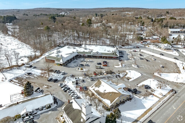
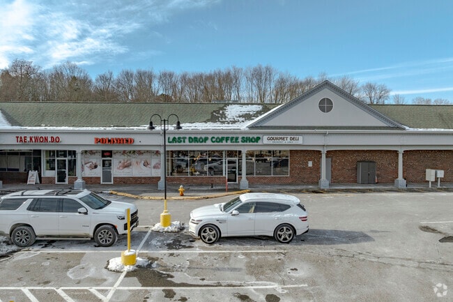
Property Record
435 Main St, Monroe, CT 06468

Property Detail
435 Main St
MONR-000046-000004
Greater Bridgeport
Commercialnec
Connecticut
B1
4 AC
B and X Area of moderate flood hazard, usually the area between the limits of the 100-year and 500-year floods.
Monroe
2025
Westchester/So Connecticut
2025
Bridgeport-Stamford-Danbury, CT
100100
NEARBY LISTINGS FOR SALE OR LEASE
DEMOGRAPHICS near 435 Main St
1 mile
3 mile
5 mile
2025 Total Population
1,656
17,337
49,444
2030 Population
1,710
17,867
50,801
Pop Growth 2025-2030
+ 3.26%
+ 3.06%
+ 2.74%
Average Age
43
43
43
2025 Total Households
610
6,211
17,099
HH Growth 2025-2030
+ 3.28%
+ 3.12%
+ 2.77%
Median Household Inc
$155,000
$167,148
$171,248
Avg Household Size
2.70
2.70
2.80
2025 Avg HH Vehicles
2.00
2.00
2.00
Median Home Value
$553,435
$566,905
$585,994
Median Year Built
1981
1978
1973
Nearby Places
Map Layers
Map Styles
 Street
 Aerial
Transit
 Traffic
 Biking
Places
Listings with unknown addresses are not visible on the map
- Restaurants
- Banks
- Shops
- Fitness
- Groceries
PUBLIC TRANSPORTATION
AIRPORT
Tweed/New Haven
Drive
Walk
Distance
Tweed/New Haven
47 min
26.3 mi
Westchester County
Drive
Walk
Distance
Westchester County
62 min
40.7 mi
Freight Ports
Port of New Haven
Drive
Walk
Distance
Port of New Haven
42 min
23.5 mi
Nearby Properties
Address
Land Use
TOTAL SIZE
Lot Size
Zoning
Address
Land Use
TOTAL SIZE
Lot Size
Zoning
71.97 AC
RF2
Address
Land Use
TOTAL SIZE
Lot Size
Zoning
150,135 SF
9 AC
AA
Address
Land Use
TOTAL SIZE
Lot Size
Zoning
17.76 AC
BC
Address
Land Use
TOTAL SIZE
Lot Size
Zoning
114,000 SF
10.37 AC
IL2
Address
Land Use
TOTAL SIZE
Lot Size
Zoning
167,262 SF
26.01 AC
I3
Address
Land Use
TOTAL SIZE
Lot Size
Zoning
63,784 SF
4.60 AC
Address
Land Use
TOTAL SIZE
Lot Size
Zoning
110,520 SF
9.21 AC
IL2
Address
Land Use
TOTAL SIZE
Lot Size
Zoning
8.44 AC
B1
Address
Land Use
TOTAL SIZE
Lot Size
Zoning
175 AC
RF3 R
Address
Land Use
TOTAL SIZE
Lot Size
Zoning
4,000 SF
238.88 AC
AAA
Address
Land Use
TOTAL SIZE
Lot Size
Zoning
9,796 SF
24.75 AC
I3
Address
Land Use
TOTAL SIZE
Lot Size
Zoning
60,749 SF
7.25 AC
B1
Address
Land Use
TOTAL SIZE
Lot Size
Zoning
80,580 SF
6.49 AC
IL2
Address
Land Use
TOTAL SIZE
Lot Size
Zoning
61,723 SF
15.26 AC
RF1
Address
Land Use
TOTAL SIZE
Lot Size
Zoning
58,767 SF
32.50 AC
RF2
Address
Land Use
TOTAL SIZE
Lot Size
Zoning
86,611 SF
6.46 AC
IL
Address
Land Use
TOTAL SIZE
Lot Size
Zoning
53,439 SF
4.97 AC
IL2
Address
Land Use
TOTAL SIZE
Lot Size
Zoning
53,107 SF
5.02 AC
B2
Address
Land Use
TOTAL SIZE
Lot Size
Zoning
48,501 SF
5.84 AC
B1
Address
Land Use
TOTAL SIZE
Lot Size
Zoning
85,649 SF
16.15 AC
I2
Address
Land Use
TOTAL SIZE
Lot Size
Zoning
58,455 SF
5.75 AC
I-1
Address
Land Use
TOTAL SIZE
Lot Size
Zoning
3,424 SF
6.99 AC
LOR
Address
Land Use
TOTAL SIZE
Lot Size
Zoning
3.15 AC
BC
Address
Land Use
TOTAL SIZE
Lot Size
Zoning
107,298 SF
8.86 AC
I-L
Address
Land Use
TOTAL SIZE
Lot Size
Zoning
114,140 SF
10.35 AC
I3
Address
Land Use
TOTAL SIZE
Lot Size
Zoning
15.72 AC
I2
Address
Land Use
TOTAL SIZE
Lot Size
Zoning
44,722 SF
3.68 AC
IL2
Address
Land Use
TOTAL SIZE
Lot Size
Zoning
41,569 SF
7.15 AC
I2
Address
Land Use
TOTAL SIZE
Lot Size
Zoning
54,494 SF
10.83 AC
LOR
Address
Land Use
TOTAL SIZE
Lot Size
Zoning
42,060 SF
16.64 AC
I2
The World's #1 Commercial Real Estate Marketplace
Connect with us
© 2026 CoStar Group
The information above has been obtained from sources believed reliable. While we do not doubt its accuracy we have not verified it and make no guarantee, warranty or representation about it. It is your responsibility to independently confirm its accuracy and completeness. Any projections, opinions, assumptions, or estimates used are for example only and do not represent the current or future performance of the property. The value of this transaction to you depends on tax and other factors which should be evaluated by your tax, financial, and legal advisors. You and your advisors should conduct a careful, independent investigation of the property to determine to your satisfaction the suitability of the property for your needs.