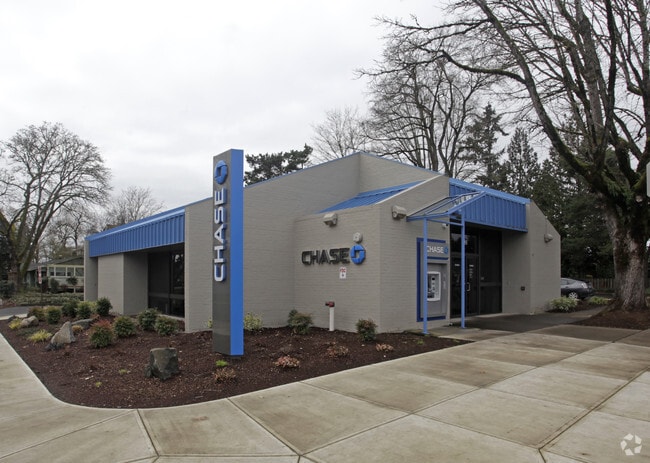
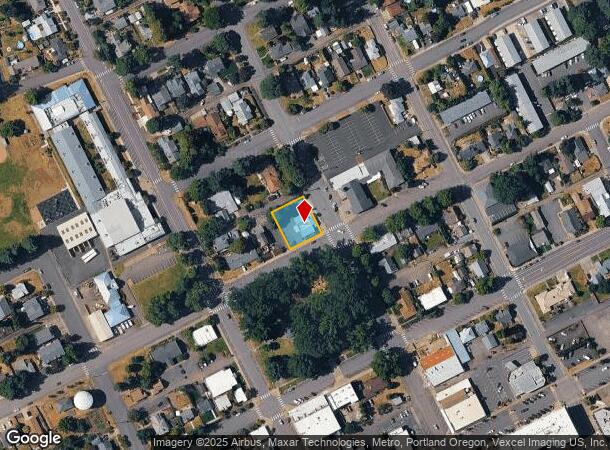
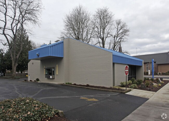
Property Record
435 N Holly St, Canby, OR 97013
NEARBY LISTINGS FOR SALE OR LEASE
Property Detail
435 N Holly St
Portland-Vancouver-Hillsboro, OR-WA
Canby
00791780
14 CANBY LT 1&2 BLK 23
Commercialbuilding
Clackamas
X
Oregon
41067C0650E
1,2
2025
0.26 AC
2025
SE Outlying
022904
Portland
DEMOGRAPHICS near 435 N Holly St
1 Mile
3 Mile
5 Mile
2024 Total Population
13,137
22,061
42,674
2029 Population
13,453
22,595
43,622
Pop Growth 2024-2029
+ 2.41%
+ 2.42%
+ 2.22%
Average Age
41
42
42
2024 Total Households
4,781
8,040
16,642
HH Growth 2024-2029
+ 2.43%
+ 2.43%
+ 2.23%
Median Household Inc
$82,213
$86,040
$82,907
Avg Household Size
2.70
2.70
2.50
2024 Avg HH Vehicles
2.00
2.00
2.00
Median Home Value
$421,337
$453,818
$495,172
Median Year Built
1984
1990
1990
Nearby Places
Map Layers
Map Styles
 Street
 Aerial
- Restaurants
- Banks
- Shops
- Fitness
- Groceries
PUBLIC TRANSPORTATION
COMMUTER RAIL
Wilsonville (Westside Express Service - Tri-County Metropolitan Transportation District of Oregon Rail (TriMet Rail))
DRIVE
WALK
Distance
Wilsonville (Westside Express Service - Tri-County Metropolitan Transportation District of Oregon Rail (TriMet Rail))
16 min
8.4 mi
DRIVE
WALK
Distance
18 min
9.9 mi
AIRPORT
Portland International
DRIVE
WALK
Distance
Portland International
44 min
27.6 mi
Freight Ports
Port of Portland
DRIVE
WALK
Distance
Port of Portland
41 min
27.2 mi
Nearby Properties
Address
Land Use
TOTAL SIZE
Lot Size
Zoning
Address
Land Use
TOTAL SIZE
Lot Size
Zoning
Address
Land Use
TOTAL SIZE
Lot Size
Zoning
35.33 AC
M1
Address
Land Use
TOTAL SIZE
Lot Size
Zoning
1,432 SF
12.96 AC
CM
Address
Land Use
TOTAL SIZE
Lot Size
Zoning
10 AC
M2
Address
Land Use
TOTAL SIZE
Lot Size
Zoning
4.88 AC
R1.5
Address
Land Use
TOTAL SIZE
Lot Size
Zoning
9.26 AC
M1
Address
Land Use
TOTAL SIZE
Lot Size
Zoning
17.39 AC
M1
Address
Land Use
TOTAL SIZE
Lot Size
Zoning
15.17 AC
M2
Address
Land Use
TOTAL SIZE
Lot Size
Zoning
Address
Land Use
TOTAL SIZE
Lot Size
Zoning
1 SF
7 AC
C2
Address
Land Use
TOTAL SIZE
Lot Size
Zoning
828 SF
0.74 AC
C1
Address
Land Use
TOTAL SIZE
Lot Size
Zoning
6.11 AC
M1
Address
Land Use
TOTAL SIZE
Lot Size
Zoning
7 AC
M2
Address
Land Use
TOTAL SIZE
Lot Size
Zoning
13.91 AC
M1
Address
Land Use
TOTAL SIZE
Lot Size
Zoning
3 AC
CM
Address
Land Use
TOTAL SIZE
Lot Size
Zoning
4.39 AC
R2
Address
Land Use
TOTAL SIZE
Lot Size
Zoning
9.48 AC
M1
Address
Land Use
TOTAL SIZE
Lot Size
Zoning
11.34 AC
M1
Address
Land Use
TOTAL SIZE
Lot Size
Zoning
Address
Land Use
TOTAL SIZE
Lot Size
Zoning
1,863 SF
0.32 AC
R2
Address
Land Use
TOTAL SIZE
Lot Size
Zoning
47.55 AC
M1
Address
Land Use
TOTAL SIZE
Lot Size
Zoning
5 AC
M2
Address
Land Use
TOTAL SIZE
Lot Size
Zoning
Address
Land Use
TOTAL SIZE
Lot Size
Zoning
5.84 AC
Address
Land Use
TOTAL SIZE
Lot Size
Zoning
4.89 AC
M1
Address
Land Use
TOTAL SIZE
Lot Size
Zoning
7.95 AC
R2
Address
Land Use
TOTAL SIZE
Lot Size
Zoning
16.26 AC
M1
Address
Land Use
TOTAL SIZE
Lot Size
Zoning
3 AC
M2
Address
Land Use
TOTAL SIZE
Lot Size
Zoning
5.93 AC
M1
Address
Land Use
TOTAL SIZE
Lot Size
Zoning
9 AC
M1
The World's #1 Commercial Real Estate Marketplace
Connect with us
© 2026 CoStar Group
The information above has been obtained from sources believed reliable. While we do not doubt its accuracy we have not verified it and make no guarantee, warranty or representation about it. It is your responsibility to independently confirm its accuracy and completeness. Any projections, opinions, assumptions, or estimates used are for example only and do not represent the current or future performance of the property. The value of this transaction to you depends on tax and other factors which should be evaluated by your tax, financial, and legal advisors. You and your advisors should conduct a careful, independent investigation of the property to determine to your satisfaction the suitability of the property for your needs.