Property Record
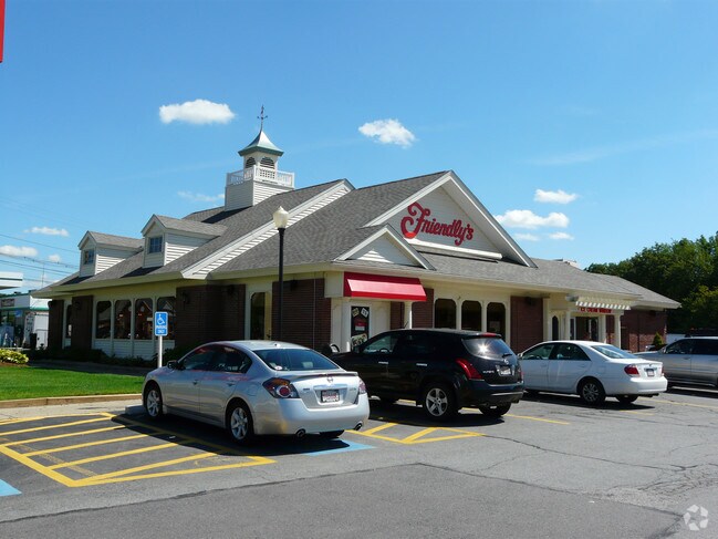
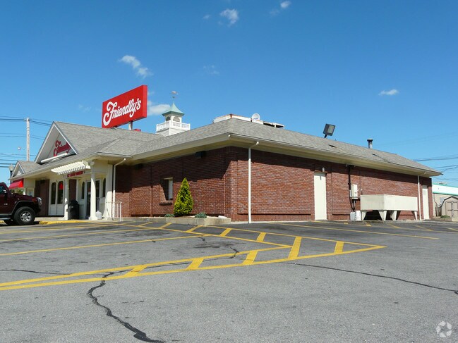
435 New State Hwy, Raynham, MA 02767

Property Detail
435 New State Hwy
14 0 218 5
Bristol
Restaurantbuilding
Massachusetts
B and X Area of moderate flood hazard, usually the area between the limits of the 100-year and 500-year floods.
5
2025
1.09 AC
2025
Attleboro/New Bedford
612202
Boston
4,752 SF
Providence-Warwick, RI-MA
NEARBY LISTINGS FOR SALE OR LEASE
DEMOGRAPHICS near 435 New State Hwy
1 mile
3 mile
5 mile
2025 Total Population
2,787
44,386
82,583
2030 Population
2,883
45,136
84,014
Pop Growth 2025-2030
+ 3.44%
+ 1.69%
+ 1.73%
Average Age
45
41
41
2025 Total Households
1,049
17,612
32,096
HH Growth 2025-2030
+ 3.53%
+ 1.73%
+ 1.76%
Median Household Inc
$115,624
$73,790
$82,952
Avg Household Size
2.60
2.40
2.50
2025 Avg HH Vehicles
2.00
2.00
2.00
Median Home Value
$468,243
$452,072
$462,600
Median Year Built
1987
1964
1973
Nearby Places
Map Layers
Map Styles
 Street
 Aerial
Transit
 Traffic
 Biking
Places
Listings with unknown addresses are not visible on the map
- Restaurants
- Banks
- Shops
- Fitness
- Groceries
PUBLIC TRANSPORTATION
COMMUTER RAIL
Middleborough/Lakeville (Middleborough/Lakeville Line - Massachusetts Bay Transportation Authority Commuter Rail (Purple Line))
Drive
Walk
Distance
Middleborough/Lakeville (Middleborough/Lakeville Line - Massachusetts Bay Transportation Authority Commuter Rail (Purple Line))
12 min
7.6 mi
Bridgewater (Middleborough/Lakeville Line - Massachusetts Bay Transportation Authority Commuter Rail (Purple Line))
Drive
Walk
Distance
Bridgewater (Middleborough/Lakeville Line - Massachusetts Bay Transportation Authority Commuter Rail (Purple Line))
18 min
10.0 mi
AIRPORT
Rhode Island Tf Green International
Drive
Walk
Distance
Rhode Island Tf Green International
48 min
27.8 mi
General Edward Lawrence Logan International
Drive
Walk
Distance
General Edward Lawrence Logan International
51 min
37.9 mi
SALE & LEASE HISTORY
LISTING DATE
SALE/LEASE

Mar 03, 2021
For Lease
Nearby Properties
Address
Land Use
TOTAL SIZE
Lot Size
Zoning
Address
Land Use
TOTAL SIZE
Lot Size
Zoning
279,756 SF
11.62 AC
OFFDIS
Address
Land Use
TOTAL SIZE
Lot Size
Zoning
850,008 SF
172.89 AC
INDUST
Address
Land Use
TOTAL SIZE
Lot Size
Zoning
133,652 SF
2 AC
Address
Land Use
TOTAL SIZE
Lot Size
Zoning
147,285 SF
0.79 AC
CENBIZ
Address
Land Use
TOTAL SIZE
Lot Size
Zoning
157.20 AC
OPSPAC
Address
Land Use
TOTAL SIZE
Lot Size
Zoning
Address
Land Use
TOTAL SIZE
Lot Size
Zoning
117,752 SF
22.37 AC
Address
Land Use
TOTAL SIZE
Lot Size
Zoning
217,011 SF
73.55 AC
OPSPAC
Address
Land Use
TOTAL SIZE
Lot Size
Zoning
27 AC
INDUST
Address
Land Use
TOTAL SIZE
Lot Size
Zoning
149,234 SF
40.69 AC
Address
Land Use
TOTAL SIZE
Lot Size
Zoning
136,122 SF
49.49 AC
Address
Land Use
TOTAL SIZE
Lot Size
Zoning
67,588 SF
18.81 AC
SUBRES
Address
Land Use
TOTAL SIZE
Lot Size
Zoning
39,910 SF
1.05 AC
CENBIZ
Address
Land Use
TOTAL SIZE
Lot Size
Zoning
14.43 AC
Address
Land Use
TOTAL SIZE
Lot Size
Zoning
351,320 SF
42 AC
INDUST
Address
Land Use
TOTAL SIZE
Lot Size
Zoning
137,710 SF
26.66 AC
Address
Land Use
TOTAL SIZE
Lot Size
Zoning
127,092 SF
9.37 AC
INDUST
Address
Land Use
TOTAL SIZE
Lot Size
Zoning
6.53 AC
URBRES
Address
Land Use
TOTAL SIZE
Lot Size
Zoning
45,786 SF
16 AC
URBRES
Address
Land Use
TOTAL SIZE
Lot Size
Zoning
10,680 SF
79.73 AC
Address
Land Use
TOTAL SIZE
Lot Size
Zoning
206,139 SF
21.55 AC
Address
Land Use
TOTAL SIZE
Lot Size
Zoning
16 AC
URBRES
Address
Land Use
TOTAL SIZE
Lot Size
Zoning
8,000 SF
22.31 AC
Address
Land Use
TOTAL SIZE
Lot Size
Zoning
124,465 SF
15.08 AC
INDUST
Address
Land Use
TOTAL SIZE
Lot Size
Zoning
1,783 SF
9.29 AC
Address
Land Use
TOTAL SIZE
Lot Size
Zoning
61,128 SF
0.98 AC
Address
Land Use
TOTAL SIZE
Lot Size
Zoning
107,794 SF
12.51 AC
Address
Land Use
TOTAL SIZE
Lot Size
Zoning
13 AC
HIWABZ
Address
Land Use
TOTAL SIZE
Lot Size
Zoning
96,208 SF
1.70 AC
URBRES
Address
Land Use
TOTAL SIZE
Lot Size
Zoning
137,952 SF
20.99 AC
INDUST
The World's #1 Commercial Real Estate Marketplace
Connect with us
© 2026 CoStar Group
The information above has been obtained from sources believed reliable. While we do not doubt its accuracy we have not verified it and make no guarantee, warranty or representation about it. It is your responsibility to independently confirm its accuracy and completeness. Any projections, opinions, assumptions, or estimates used are for example only and do not represent the current or future performance of the property. The value of this transaction to you depends on tax and other factors which should be evaluated by your tax, financial, and legal advisors. You and your advisors should conduct a careful, independent investigation of the property to determine to your satisfaction the suitability of the property for your needs.