Property Record
435 State Route 34 N, Colts Neck, NJ 07722
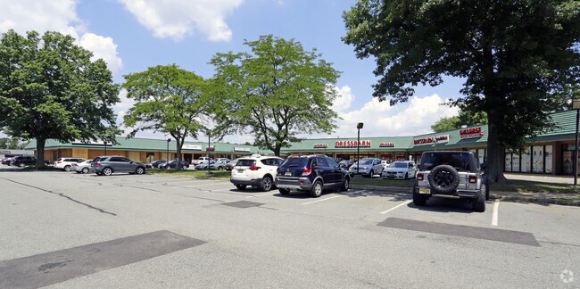

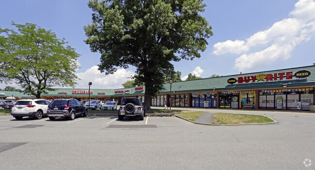
Property Detail
435 State Route 34 N
10-00032-0000-00003
MONMOUTH
Vacantlandnec
New Jersey
SF80
3
B and X Area of moderate flood hazard, usually the area between the limits of the 100-year and 500-year floods.
1.20 AC
2024
South Edison
2025
Northern New Jersey
809901
Lakewood-New Brunswick, NJ
NEARBY LISTINGS FOR SALE OR LEASE
DEMOGRAPHICS near 435 State Route 34 N
1 mile
3 mile
5 mile
2025 Total Population
6,952
72,252
170,573
2030 Population
7,249
74,176
174,630
Pop Growth 2025-2030
+ 4.27%
+ 2.66%
+ 2.38%
Average Age
47
42
42
2025 Total Households
2,811
28,400
64,268
HH Growth 2025-2030
+ 4.34%
+ 2.69%
+ 2.39%
Median Household Inc
$101,339
$99,637
$107,293
Avg Household Size
2.40
2.50
2.60
2025 Avg HH Vehicles
2.00
2.00
2.00
Median Home Value
$480,564
$471,010
$474,513
Median Year Built
1980
1974
1971
Nearby Places
Map Layers
Map Styles
 Street
 Aerial
Layers
 Traffic
 Biking
Places
Listings with unknown addresses are not visible on the map
- Restaurants
- Banks
- Shops
- Fitness
- Groceries
PUBLIC TRANSPORTATION
COMMUTER RAIL
Red Bank (North Jersey Coast Line - NJ Transit Commuter Rail (NJ Transit))
Drive
Walk
Distance
Red Bank (North Jersey Coast Line - NJ Transit Commuter Rail (NJ Transit))
16 min
9.5 mi
AIRPORT
Newark Liberty International
Drive
Walk
Distance
Newark Liberty International
53 min
39.7 mi
Freight Ports
New York Container Terminal
Drive
Walk
Distance
New York Container Terminal
46 min
32.6 mi
SALE & LEASE HISTORY
LISTING DATE
SALE/LEASE

Sep 25, 2016
For Lease
Mar 13, 2018
For Lease
Jul 24, 2019
For Lease
Nearby Properties
Address
Land Use
TOTAL SIZE
Lot Size
Zoning
Address
Land Use
TOTAL SIZE
Lot Size
Zoning
3.65 AC
SF80
Address
Land Use
TOTAL SIZE
Lot Size
Zoning
69.99 AC
SF80
Address
Land Use
TOTAL SIZE
Lot Size
Zoning
241.06 AC
AG
Address
Land Use
TOTAL SIZE
Lot Size
Zoning
1.06 AC
SF80
Address
Land Use
TOTAL SIZE
Lot Size
Zoning
22.95 AC
A-1
Address
Land Use
TOTAL SIZE
Lot Size
Zoning
1,686 SF
122.17 AC
P
Address
Land Use
TOTAL SIZE
Lot Size
Zoning
2,860 SF
115.57 AC
P
Address
Land Use
TOTAL SIZE
Lot Size
Zoning
18,128 SF
6 AC
Address
Land Use
TOTAL SIZE
Lot Size
Zoning
3,663 SF
179.80 AC
SF80
Address
Land Use
TOTAL SIZE
Lot Size
Zoning
13,365 SF
3 AC
AG
Address
Land Use
TOTAL SIZE
Lot Size
Zoning
39,321 SF
6.77 AC
C125
Address
Land Use
TOTAL SIZE
Lot Size
Zoning
3,917 SF
66.41 AC
P
Address
Land Use
TOTAL SIZE
Lot Size
Zoning
71.40 AC
P
Address
Land Use
TOTAL SIZE
Lot Size
Zoning
6,072 SF
31.59 AC
OB0
Address
Land Use
TOTAL SIZE
Lot Size
Zoning
17,199 SF
4 AC
Address
Land Use
TOTAL SIZE
Lot Size
Zoning
27.87 AC
A-1
Address
Land Use
TOTAL SIZE
Lot Size
Zoning
15.17 AC
SF80
Address
Land Use
TOTAL SIZE
Lot Size
Zoning
10,734 SF
25.16 AC
SF80
Address
Land Use
TOTAL SIZE
Lot Size
Zoning
154,800 SF
19.25 AC
ROWL10
Address
Land Use
TOTAL SIZE
Lot Size
Zoning
50,565 SF
4 AC
B
Address
Land Use
TOTAL SIZE
Lot Size
Zoning
13,626 SF
2.35 AC
AG
Address
Land Use
TOTAL SIZE
Lot Size
Zoning
7.84 AC
LI
Address
Land Use
TOTAL SIZE
Lot Size
Zoning
33,408 SF
8.27 AC
B-1
Address
Land Use
TOTAL SIZE
Lot Size
Zoning
76,502 SF
8.98 AC
LI
Address
Land Use
TOTAL SIZE
Lot Size
Zoning
17,296 SF
12.54 AC
AG
Address
Land Use
TOTAL SIZE
Lot Size
Zoning
29,202 SF
21.34 AC
LI
Address
Land Use
TOTAL SIZE
Lot Size
Zoning
16,997 SF
4.30 AC
C125
Address
Land Use
TOTAL SIZE
Lot Size
Zoning
12,339 SF
1 AC
AG
Address
Land Use
TOTAL SIZE
Lot Size
Zoning
13,103 SF
2 AC
Address
Land Use
TOTAL SIZE
Lot Size
Zoning
34.78 AC
P
The World's #1 Commercial Real Estate Marketplace
Connect with us
© 2026 CoStar Group
The information above has been obtained from sources believed reliable. While we do not doubt its accuracy we have not verified it and make no guarantee, warranty or representation about it. It is your responsibility to independently confirm its accuracy and completeness. Any projections, opinions, assumptions, or estimates used are for example only and do not represent the current or future performance of the property. The value of this transaction to you depends on tax and other factors which should be evaluated by your tax, financial, and legal advisors. You and your advisors should conduct a careful, independent investigation of the property to determine to your satisfaction the suitability of the property for your needs.