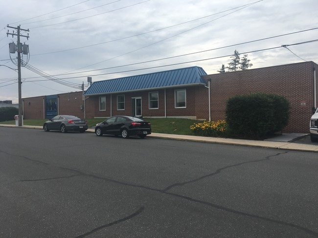
Property Record
435 W Main St, Ephrata, PA 17522
NEARBY LISTINGS FOR SALE OR LEASE
Property Detail
435 W Main St
480-99592-0-0000
494 W BROAD ST
Shipyard
Lancaster
X
Pennsylvania
42071C0405F
11
2024
0.28 AC
2025
Lancaster County
012800
Philadelphia
4,176 SF
Lancaster, PA
DEMOGRAPHICS near 435 W Main St
1 Mile
3 Mile
5 Mile
2024 Total Population
4,314
15,183
31,005
2029 Population
4,353
15,316
31,005
Pop Growth 2024-2029
+ 0.90%
+ 0.88%
0.00%
Average Age
41
42
40
2024 Total Households
1,750
5,578
10,651
HH Growth 2024-2029
+ 0.97%
+ 1.08%
+ 0.15%
Median Household Inc
$61,968
$70,594
$74,568
Avg Household Size
2.40
2.60
2.80
2024 Avg HH Vehicles
2.00
2.00
2.00
Median Home Value
$202,370
$262,302
$281,878
Median Year Built
1964
1979
1976
Nearby Places
Map Layers
Map Styles
 Street
 Aerial
- Restaurants
- Banks
- Shops
- Fitness
- Groceries
SALE & LEASE HISTORY
LISTING DATE
SALE/LEASE

Jun 29, 2018
For Sale
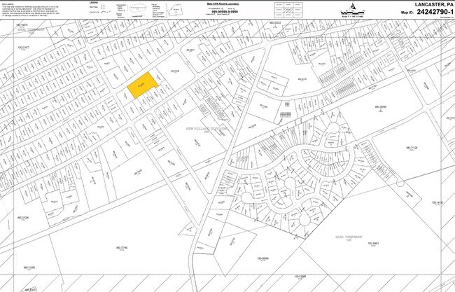
Nearby Properties
Address
Land Use
TOTAL SIZE
Lot Size
Zoning
Address
Land Use
TOTAL SIZE
Lot Size
Zoning
881,497 SF
88.68 AC
R
Address
Land Use
TOTAL SIZE
Lot Size
Zoning
243,536 SF
12 AC
Address
Land Use
TOTAL SIZE
Lot Size
Zoning
273,642 SF
48.10 AC
RA
Address
Land Use
TOTAL SIZE
Lot Size
Zoning
196,406 SF
26.89 AC
R-1
Address
Land Use
TOTAL SIZE
Lot Size
Zoning
115,750 SF
35.58 AC
Address
Land Use
TOTAL SIZE
Lot Size
Zoning
678,098 SF
40.91 AC
Address
Land Use
TOTAL SIZE
Lot Size
Zoning
335,767 SF
22.20 AC
I
Address
Land Use
TOTAL SIZE
Lot Size
Zoning
117,469 SF
12.63 AC
Address
Land Use
TOTAL SIZE
Lot Size
Zoning
52,884 SF
6.81 AC
R
Address
Land Use
TOTAL SIZE
Lot Size
Zoning
137,682 SF
8.73 AC
R-2
Address
Land Use
TOTAL SIZE
Lot Size
Zoning
232,238 SF
74.26 AC
M
Address
Land Use
TOTAL SIZE
Lot Size
Zoning
90,944 SF
8.92 AC
Address
Land Use
TOTAL SIZE
Lot Size
Zoning
83,852 SF
11.59 AC
I
Address
Land Use
TOTAL SIZE
Lot Size
Zoning
148,232 SF
10.61 AC
I
Address
Land Use
TOTAL SIZE
Lot Size
Zoning
35,563 SF
87.01 AC
R
Address
Land Use
TOTAL SIZE
Lot Size
Zoning
148,917 SF
9.85 AC
C-2
Address
Land Use
TOTAL SIZE
Lot Size
Zoning
109,250 SF
8.25 AC
IL
Address
Land Use
TOTAL SIZE
Lot Size
Zoning
44,663 SF
10.40 AC
AG
Address
Land Use
TOTAL SIZE
Lot Size
Zoning
112,160 SF
8.20 AC
M
Address
Land Use
TOTAL SIZE
Lot Size
Zoning
133,788 SF
10.10 AC
I
Address
Land Use
TOTAL SIZE
Lot Size
Zoning
129,024 SF
15.80 AC
M
Address
Land Use
TOTAL SIZE
Lot Size
Zoning
52,215 SF
8.91 AC
Address
Land Use
TOTAL SIZE
Lot Size
Zoning
109,396 SF
19.60 AC
I
Address
Land Use
TOTAL SIZE
Lot Size
Zoning
64,363 SF
9.10 AC
C
Address
Land Use
TOTAL SIZE
Lot Size
Zoning
66,473 SF
4.40 AC
I
Address
Land Use
TOTAL SIZE
Lot Size
Zoning
42,438 SF
6.47 AC
I
Address
Land Use
TOTAL SIZE
Lot Size
Zoning
67,400 SF
9.50 AC
I
Address
Land Use
TOTAL SIZE
Lot Size
Zoning
9,387 SF
16.55 AC
Address
Land Use
TOTAL SIZE
Lot Size
Zoning
117,436 SF
2 AC
C
Address
Land Use
TOTAL SIZE
Lot Size
Zoning
106,816 SF
8.50 AC
R-2
The World's #1 Commercial Real Estate Marketplace
Connect with us
© 2025 CoStar Group
The information above has been obtained from sources believed reliable. While we do not doubt its accuracy we have not verified it and make no guarantee, warranty or representation about it. It is your responsibility to independently confirm its accuracy and completeness. Any projections, opinions, assumptions, or estimates used are for example only and do not represent the current or future performance of the property. The value of this transaction to you depends on tax and other factors which should be evaluated by your tax, financial, and legal advisors. You and your advisors should conduct a careful, independent investigation of the property to determine to your satisfaction the suitability of the property for your needs.