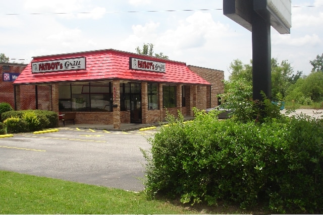
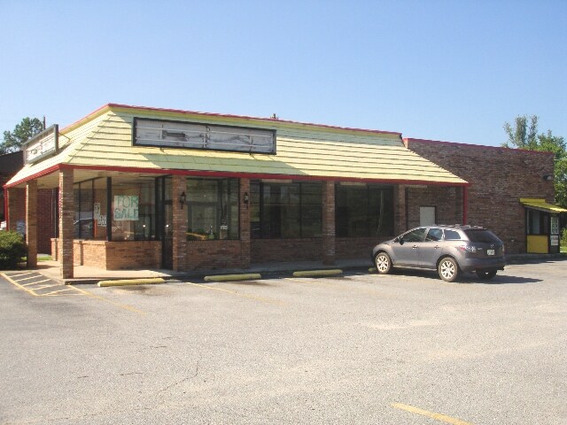
Property Record
4351 Pio Nono Ave, Macon, GA 31206
NEARBY LISTINGS FOR SALE OR LEASE
Property Detail
4351 Pio Nono Ave
O104-0020
Tharpe Hgts
Restaurantbuilding
THARPE HGTS RESUB
AE
Bibb
13021C0141G
Georgia
2025
2.18 AC
2025
Suburban Macon
013900
Atlanta
1,923 SF
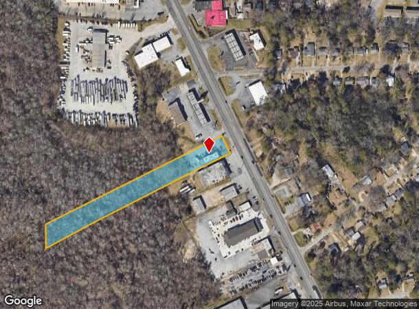
Macon-Bibb County, GA
DEMOGRAPHICS near 4351 Pio Nono Ave
1 Mile
3 Mile
5 Mile
2024 Total Population
3,464
32,004
73,955
2029 Population
3,515
32,065
74,183
Pop Growth 2024-2029
+ 1.47%
+ 0.19%
+ 0.31%
Average Age
36
36
37
2024 Total Households
1,262
11,748
28,956
HH Growth 2024-2029
+ 1.58%
+ 0.31%
+ 0.39%
Median Household Inc
$27,500
$30,563
$34,462
Avg Household Size
2.50
2.50
2.40
2024 Avg HH Vehicles
1.00
1.00
1.00
Median Home Value
$69,592
$79,187
$103,029
Median Year Built
1958
1965
1968
Nearby Places
Map Layers
Map Styles
 Street
 Aerial
- Restaurants
- Banks
- Shops
- Fitness
- Groceries
SALE & LEASE HISTORY
LISTING DATE
SALE/LEASE

Sep 24, 2016
For Sale
Dec 14, 2017
For Sale
Nearby Properties
Address
Land Use
TOTAL SIZE
Lot Size
Zoning
Address
Land Use
TOTAL SIZE
Lot Size
Zoning
616,986 SF
130.58 AC
M-2
Address
Land Use
TOTAL SIZE
Lot Size
Zoning
983,943 SF
136.41 AC
M-2
Address
Land Use
TOTAL SIZE
Lot Size
Zoning
181,396 SF
44.77 AC
R-1A
Address
Land Use
TOTAL SIZE
Lot Size
Zoning
12,817 SF
357.49 AC
M-2
Address
Land Use
TOTAL SIZE
Lot Size
Zoning
1,428 SF
64.46 AC
R-1A
Address
Land Use
TOTAL SIZE
Lot Size
Zoning
18,128 SF
95 AC
M-2
Address
Land Use
TOTAL SIZE
Lot Size
Zoning
98,928 SF
12.32 AC
R-3
Address
Land Use
TOTAL SIZE
Lot Size
Zoning
110,153 SF
22 AC
R-2
Address
Land Use
TOTAL SIZE
Lot Size
Zoning
46,288 SF
1.80 AC
PDE
Address
Land Use
TOTAL SIZE
Lot Size
Zoning
33,248 SF
10.18 AC
R-3
Address
Land Use
TOTAL SIZE
Lot Size
Zoning
133,862 SF
25.44 AC
C-2
Address
Land Use
TOTAL SIZE
Lot Size
Zoning
108,418 SF
24.45 AC
R-1A
Address
Land Use
TOTAL SIZE
Lot Size
Zoning
13,596 SF
9.04 AC
R-3
Address
Land Use
TOTAL SIZE
Lot Size
Zoning
44,323 SF
2.76 AC
PDE
Address
Land Use
TOTAL SIZE
Lot Size
Zoning
1,590 SF
10.52 AC
R-3
Address
Land Use
TOTAL SIZE
Lot Size
Zoning
32,300 SF
24.40 AC
R-2
Address
Land Use
TOTAL SIZE
Lot Size
Zoning
174,764 SF
Address
Land Use
TOTAL SIZE
Lot Size
Zoning
100,192 SF
30.29 AC
C-2
Address
Land Use
TOTAL SIZE
Lot Size
Zoning
6,776 SF
7.89 AC
C-2
Address
Land Use
TOTAL SIZE
Lot Size
Zoning
3,196 SF
12.94 AC
R-3
Address
Land Use
TOTAL SIZE
Lot Size
Zoning
280,569 SF
Address
Land Use
TOTAL SIZE
Lot Size
Zoning
6,120 SF
4.95 AC
C-2
Address
Land Use
TOTAL SIZE
Lot Size
Zoning
3,500 SF
6.07 AC
R-3
Address
Land Use
TOTAL SIZE
Lot Size
Zoning
62,151 SF
2.23 AC
R-1A
Address
Land Use
TOTAL SIZE
Lot Size
Zoning
201,615 SF
20.36 AC
M-1
Address
Land Use
TOTAL SIZE
Lot Size
Zoning
64,723 SF
6.12 AC
R-1
Address
Land Use
TOTAL SIZE
Lot Size
Zoning
105,296 SF
18.25 AC
C-2
Address
Land Use
TOTAL SIZE
Lot Size
Zoning
214,303 SF
5.91 AC
M-2
Address
Land Use
TOTAL SIZE
Lot Size
Zoning
76,779 SF
7.08 AC
C-2
Address
Land Use
TOTAL SIZE
Lot Size
Zoning
42,946 SF
6.54 AC
R-2
The World's #1 Commercial Real Estate Marketplace
Connect with us
© 2025 CoStar Group
The information above has been obtained from sources believed reliable. While we do not doubt its accuracy we have not verified it and make no guarantee, warranty or representation about it. It is your responsibility to independently confirm its accuracy and completeness. Any projections, opinions, assumptions, or estimates used are for example only and do not represent the current or future performance of the property. The value of this transaction to you depends on tax and other factors which should be evaluated by your tax, financial, and legal advisors. You and your advisors should conduct a careful, independent investigation of the property to determine to your satisfaction the suitability of the property for your needs.