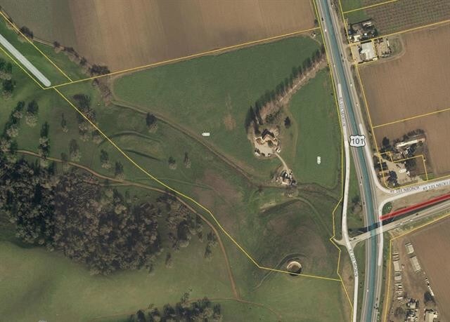
Property Record
4355 Monterey Rd, Gilroy, CA 95020

Property Detail
4355 Monterey Rd
810-35-008
Santa Clara
Agriculturalland
California
A
18.31 AC
AH Areas with a 1% annual chance of shallow flooding, usually in the form of a pond, withan average depth ranging from 1 to 3 feet. These areas have a 26% chance of flooding over the life of a 30-year mortgage.
Outlying Santa Clara Cnty
2024
South Bay/San Jose
2025
San Jose-Sunnyvale-Santa Clara, CA
512510
NEARBY LISTINGS FOR SALE OR LEASE
-
-
-
-
-
-
No Photo
-
-
View all Gilroy listings for lease on LoopNet.com
DEMOGRAPHICS near 4355 Monterey Rd
1 mile
3 mile
5 mile
2025 Total Population
55
15,140
52,428
2030 Population
55
15,521
53,560
Pop Growth 2025-2030
0.00%
+ 2.52%
+ 2.16%
Average Age
42
37
38
2025 Total Households
18
4,163
15,394
HH Growth 2025-2030
0.00%
+ 2.50%
+ 2.16%
Median Household Inc
$143,749
$130,789
$118,289
Avg Household Size
3.10
3.40
3.30
2025 Avg HH Vehicles
2.00
2.00
2.00
Median Home Value
$999,999
$929,507
$913,694
Median Year Built
1999
1988
1986
Nearby Places
Map Layers
Map Styles
 Street
 Aerial
Transit
 Traffic
 Biking
Places
Listings with unknown addresses are not visible on the map
- Restaurants
- Banks
- Shops
- Fitness
- Groceries
PUBLIC TRANSPORTATION
COMMUTER RAIL
Gilroy Caltrain Station Southbound (South Santa Clara County Connector - Caltrain (Caltrain))
Drive
Walk
Distance
Gilroy Caltrain Station Southbound (South Santa Clara County Connector - Caltrain (Caltrain))
6 min
3.7 mi
Freight Ports
Port of Redwood City
Drive
Walk
Distance
Port of Redwood City
69 min
56.9 mi
SALE & LEASE HISTORY
LISTING DATE
SALE/LEASE

Sep 19, 2019
For Lease
Nearby Properties
Address
Land Use
TOTAL SIZE
Lot Size
Zoning
Address
Land Use
TOTAL SIZE
Lot Size
Zoning
270,205 SF
6.65 AC
M2
Address
Land Use
TOTAL SIZE
Lot Size
Zoning
921,750 SF
40.33 AC
M2
Address
Land Use
TOTAL SIZE
Lot Size
Zoning
189,303 SF
28.73 AC
CM
Address
Land Use
TOTAL SIZE
Lot Size
Zoning
55.03 AC
AW
Address
Land Use
TOTAL SIZE
Lot Size
Zoning
172,348 SF
9.58 AC
A140
Address
Land Use
TOTAL SIZE
Lot Size
Zoning
11.04 AC
M2
Address
Land Use
TOTAL SIZE
Lot Size
Zoning
9.90 AC
M2
Address
Land Use
TOTAL SIZE
Lot Size
Zoning
59.87 AC
M2
Address
Land Use
TOTAL SIZE
Lot Size
Zoning
4,853 SF
11.59 AC
HC
Address
Land Use
TOTAL SIZE
Lot Size
Zoning
123,709 SF
9.26 AC
M2
Address
Land Use
TOTAL SIZE
Lot Size
Zoning
56,020 SF
2.61 AC
M2
Address
Land Use
TOTAL SIZE
Lot Size
Zoning
20,140.41 AC
SJ
Address
Land Use
TOTAL SIZE
Lot Size
Zoning
163,200 SF
8.62 AC
M-2
Address
Land Use
TOTAL SIZE
Lot Size
Zoning
1.51 AC
CM
Address
Land Use
TOTAL SIZE
Lot Size
Zoning
77,519 SF
3.05 AC
HC
Address
Land Use
TOTAL SIZE
Lot Size
Zoning
146,682 SF
11.83 AC
A1-25
Address
Land Use
TOTAL SIZE
Lot Size
Zoning
5.52 AC
M2
Address
Land Use
TOTAL SIZE
Lot Size
Zoning
88,408 SF
7.63 AC
PUD
Address
Land Use
TOTAL SIZE
Lot Size
Zoning
120,665 SF
6.25 AC
M2
Address
Land Use
TOTAL SIZE
Lot Size
Zoning
141,205 SF
11.69 AC
M2
Address
Land Use
TOTAL SIZE
Lot Size
Zoning
107,824 SF
12.20 AC
PUD
Address
Land Use
TOTAL SIZE
Lot Size
Zoning
8.68 AC
M2
Address
Land Use
TOTAL SIZE
Lot Size
Zoning
285,686 SF
19.99 AC
M2
Address
Land Use
TOTAL SIZE
Lot Size
Zoning
3,621 SF
3 AC
C2
Address
Land Use
TOTAL SIZE
Lot Size
Zoning
33,569 SF
2.26 AC
M1
Address
Land Use
TOTAL SIZE
Lot Size
Zoning
62,400 SF
2.57 AC
M2
Address
Land Use
TOTAL SIZE
Lot Size
Zoning
13,844 SF
5.85 AC
CT
Address
Land Use
TOTAL SIZE
Lot Size
Zoning
8.68 AC
M1
Address
Land Use
TOTAL SIZE
Lot Size
Zoning
162,155 SF
8.25 AC
M2
The World's #1 Commercial Real Estate Marketplace
Connect with us
© 2026 CoStar Group
The information above has been obtained from sources believed reliable. While we do not doubt its accuracy we have not verified it and make no guarantee, warranty or representation about it. It is your responsibility to independently confirm its accuracy and completeness. Any projections, opinions, assumptions, or estimates used are for example only and do not represent the current or future performance of the property. The value of this transaction to you depends on tax and other factors which should be evaluated by your tax, financial, and legal advisors. You and your advisors should conduct a careful, independent investigation of the property to determine to your satisfaction the suitability of the property for your needs.