Property Record
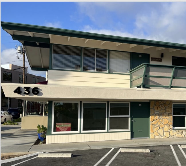
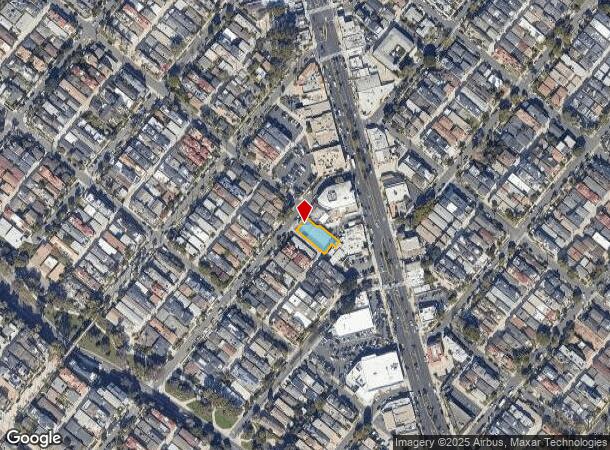
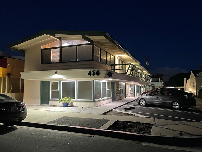
436 Heliotrope Ave, Corona Del Mar, CA 92625
Current Lease Availabilities
NEARBY LISTINGS FOR SALE OR LEASE
Property Detail
436 Heliotrope Ave
Anaheim-Santa Ana-Irvine, CA
Corona Del Mar
459-182-09
A TR CORONA DEL MAR BLK 435 LOT 20 CORONA DEL MAR LOT 20 BLK 435 NELY 16 FT(AND ALL
Commercialnec
Orange
X
California
06059C0401J
20
2024
0.16 AC
2025
Newport Beach
062702
Orange County (California)
5,920 SF
DEMOGRAPHICS near 436 Heliotrope Ave
1 Mile
3 Mile
5 Mile
2024 Total Population
11,524
62,635
200,629
2029 Population
11,466
62,742
200,296
Pop Growth 2024-2029
(0.50%)
+ 0.17%
(0.17%)
Average Age
51
47
40
2024 Total Households
5,522
28,614
77,579
HH Growth 2024-2029
(0.89%)
+ 0.07%
(0.13%)
Median Household Inc
$190,965
$160,208
$120,615
Avg Household Size
2.00
2.10
2.30
2024 Avg HH Vehicles
2.00
2.00
2.00
Median Home Value
$1,145,090
$1,139,475
$1,096,983
Median Year Built
1972
1976
1977
Nearby Places
- Restaurants
- Banks
- Shops
- Fitness
- Groceries
PUBLIC TRANSPORTATION
COMMUTER RAIL
Tustin (Inland Empire-Orange County Line - Southern California Regional Rail Authority (Metrolink), Orange County Line - Southern California Regional Rail Authority (Metrolink))
DRIVE
WALK
Distance
Tustin (Inland Empire-Orange County Line - Southern California Regional Rail Authority (Metrolink), Orange County Line - Southern California Regional Rail Authority (Metrolink))
15 min
9.5 mi
AIRPORT
John Wayne/Orange County
DRIVE
WALK
Distance
John Wayne/Orange County
11 min
7.0 mi
Long Beach (Daugherty Field)
DRIVE
WALK
Distance
Long Beach (Daugherty Field)
34 min
27.1 mi
Ontario International
DRIVE
WALK
Distance
Ontario International
59 min
43.1 mi
Freight Ports
Port of Long Beach
DRIVE
WALK
Distance
Port of Long Beach
40 min
26.7 mi
Nearby Properties
Address
Land Use
TOTAL SIZE
Lot Size
Zoning
Address
Land Use
TOTAL SIZE
Lot Size
Zoning
Address
Land Use
TOTAL SIZE
Lot Size
Zoning
Address
Land Use
TOTAL SIZE
Lot Size
Zoning
Address
Land Use
TOTAL SIZE
Lot Size
Zoning
28,716 SF
14.90 AC
Address
Land Use
TOTAL SIZE
Lot Size
Zoning
21,258 SF
14.09 AC
Address
Land Use
TOTAL SIZE
Lot Size
Zoning
Address
Land Use
TOTAL SIZE
Lot Size
Zoning
Address
Land Use
TOTAL SIZE
Lot Size
Zoning
Address
Land Use
TOTAL SIZE
Lot Size
Zoning
286,165 SF
11.11 AC
Address
Land Use
TOTAL SIZE
Lot Size
Zoning
12.82 AC
Address
Land Use
TOTAL SIZE
Lot Size
Zoning
Address
Land Use
TOTAL SIZE
Lot Size
Zoning
592,966 SF
28.35 AC
Address
Land Use
TOTAL SIZE
Lot Size
Zoning
Address
Land Use
TOTAL SIZE
Lot Size
Zoning
Address
Land Use
TOTAL SIZE
Lot Size
Zoning
Address
Land Use
TOTAL SIZE
Lot Size
Zoning
Address
Land Use
TOTAL SIZE
Lot Size
Zoning
Address
Land Use
TOTAL SIZE
Lot Size
Zoning
Address
Land Use
TOTAL SIZE
Lot Size
Zoning
Address
Land Use
TOTAL SIZE
Lot Size
Zoning
Address
Land Use
TOTAL SIZE
Lot Size
Zoning
Address
Land Use
TOTAL SIZE
Lot Size
Zoning
Address
Land Use
TOTAL SIZE
Lot Size
Zoning
Address
Land Use
TOTAL SIZE
Lot Size
Zoning
Address
Land Use
TOTAL SIZE
Lot Size
Zoning
Address
Land Use
TOTAL SIZE
Lot Size
Zoning
Address
Land Use
TOTAL SIZE
Lot Size
Zoning
13.71 AC
Address
Land Use
TOTAL SIZE
Lot Size
Zoning
25.12 AC
Address
Land Use
TOTAL SIZE
Lot Size
Zoning
77,764 SF
2.15 AC
Address
Land Use
TOTAL SIZE
Lot Size
Zoning
14.45 AC
The World's #1 Commercial Real Estate Marketplace
Connect with us
© 2025 CoStar Group
The information above has been obtained from sources believed reliable. While we do not doubt its accuracy we have not verified it and make no guarantee, warranty or representation about it. It is your responsibility to independently confirm its accuracy and completeness. Any projections, opinions, assumptions, or estimates used are for example only and do not represent the current or future performance of the property. The value of this transaction to you depends on tax and other factors which should be evaluated by your tax, financial, and legal advisors. You and your advisors should conduct a careful, independent investigation of the property to determine to your satisfaction the suitability of the property for your needs.