No Photo
Property Record
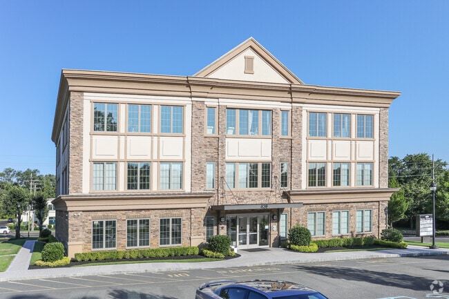
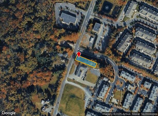
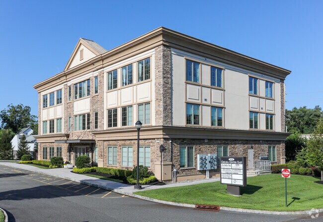
424 State Route 79, Morganville, NJ 07751
Current Lease Availabilities
NEARBY LISTINGS FOR SALE OR LEASE
Property Detail
424 State Route 79
New York-Jersey City-White Plains, NY-NJ
Monmouth
30-00132-0000-00016
New Jersey
Sfr
0.34 AC
X
Western Monmouth
34023C0188F
Northern New Jersey
1,318 SF
DEMOGRAPHICS near 424 State Route 79
1 Mile
3 Mile
5 Mile
2024 Total Population
4,128
44,442
134,908
2029 Population
4,045
43,846
133,843
Pop Growth 2024-2029
(2.01%)
(1.34%)
(0.79%)
Average Age
41
41
43
2024 Total Households
1,399
15,495
49,699
HH Growth 2024-2029
(2.22%)
(1.59%)
(0.89%)
Median Household Inc
$127,351
$140,821
$116,314
Avg Household Size
2.90
2.80
2.60
2024 Avg HH Vehicles
2.00
2.00
2.00
Median Home Value
$646,657
$495,989
$465,313
Median Year Built
1990
1982
1977
Nearby Places
Map Layers
Map Styles
 Street
 Aerial
- Restaurants
- Banks
- Shops
- Fitness
- Groceries
PUBLIC TRANSPORTATION
COMMUTER RAIL
Aberdeen Matawan (North Jersey Coast Line - NJ Transit Commuter Rail (NJ Transit))
DRIVE
WALK
Distance
Aberdeen Matawan (North Jersey Coast Line - NJ Transit Commuter Rail (NJ Transit))
5 min
3.4 mi
Hazlet (North Jersey Coast Line - NJ Transit Commuter Rail (NJ Transit))
DRIVE
WALK
Distance
Hazlet (North Jersey Coast Line - NJ Transit Commuter Rail (NJ Transit))
9 min
4.4 mi
AIRPORT
Newark Liberty International
DRIVE
WALK
Distance
Newark Liberty International
43 min
33.2 mi
Freight Ports
New York Container Terminal
DRIVE
WALK
Distance
New York Container Terminal
37 min
25.3 mi
Nearby Properties
Address
Land Use
TOTAL SIZE
Lot Size
Zoning
Address
Land Use
TOTAL SIZE
Lot Size
Zoning
197,568 SF
1.39 AC
Address
Land Use
TOTAL SIZE
Lot Size
Zoning
Address
Land Use
TOTAL SIZE
Lot Size
Zoning
3.98 AC
MUD
Address
Land Use
TOTAL SIZE
Lot Size
Zoning
30.96 AC
MFD
Address
Land Use
TOTAL SIZE
Lot Size
Zoning
192,538 SF
45.11 AC
R100
Address
Land Use
TOTAL SIZE
Lot Size
Zoning
70,854 SF
14.30 AC
MF0
Address
Land Use
TOTAL SIZE
Lot Size
Zoning
7,902 SF
62.41 AC
R20
Address
Land Use
TOTAL SIZE
Lot Size
Zoning
26.84 AC
CF
Address
Land Use
TOTAL SIZE
Lot Size
Zoning
12,614 SF
32.36 AC
IOR
Address
Land Use
TOTAL SIZE
Lot Size
Zoning
15.35 AC
Address
Land Use
TOTAL SIZE
Lot Size
Zoning
109,643 SF
1.87 AC
SB
Address
Land Use
TOTAL SIZE
Lot Size
Zoning
287,915 SF
31.10 AC
I
Address
Land Use
TOTAL SIZE
Lot Size
Zoning
85,752 SF
8.92 AC
Address
Land Use
TOTAL SIZE
Lot Size
Zoning
91,171 SF
25.94 AC
PC
Address
Land Use
TOTAL SIZE
Lot Size
Zoning
98,617 SF
10 AC
A/LC
Address
Land Use
TOTAL SIZE
Lot Size
Zoning
15.92 AC
R20
Address
Land Use
TOTAL SIZE
Lot Size
Zoning
1,824 SF
21.72 AC
R40B
Address
Land Use
TOTAL SIZE
Lot Size
Zoning
6.87 AC
APTH
Address
Land Use
TOTAL SIZE
Lot Size
Zoning
46,120 SF
7.04 AC
RC
Address
Land Use
TOTAL SIZE
Lot Size
Zoning
24,760 SF
3.58 AC
GB
Address
Land Use
TOTAL SIZE
Lot Size
Zoning
0.70 AC
GB
Address
Land Use
TOTAL SIZE
Lot Size
Zoning
18,752 SF
0.17 AC
MU0
Address
Land Use
TOTAL SIZE
Lot Size
Zoning
2,719 SF
67 AC
P
Address
Land Use
TOTAL SIZE
Lot Size
Zoning
3.91 AC
GB
Address
Land Use
TOTAL SIZE
Lot Size
Zoning
9.14 AC
SC
Address
Land Use
TOTAL SIZE
Lot Size
Zoning
74,632 SF
14.66 AC
R40B
Address
Land Use
TOTAL SIZE
Lot Size
Zoning
411 AC
ROS
Address
Land Use
TOTAL SIZE
Lot Size
Zoning
4 AC
RM
Address
Land Use
TOTAL SIZE
Lot Size
Zoning
57,271 SF
11.57 AC
PC
Address
Land Use
TOTAL SIZE
Lot Size
Zoning
60,436 SF
9.23 AC
C-2
The World's #1 Commercial Real Estate Marketplace
Connect with us
© 2026 CoStar Group
The information above has been obtained from sources believed reliable. While we do not doubt its accuracy we have not verified it and make no guarantee, warranty or representation about it. It is your responsibility to independently confirm its accuracy and completeness. Any projections, opinions, assumptions, or estimates used are for example only and do not represent the current or future performance of the property. The value of this transaction to you depends on tax and other factors which should be evaluated by your tax, financial, and legal advisors. You and your advisors should conduct a careful, independent investigation of the property to determine to your satisfaction the suitability of the property for your needs.