Property Record
4360 Rim Rock Rd, Winnemucca, NV 89445


NEARBY LISTINGS FOR SALE OR LEASE
Property Detail
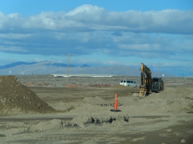
4360 Rim Rock Rd
16-0651-14
PARCEL 12 OF ROS/BLA FOR EAST HORIZON HOLDING LLC & NEW VISION DEVELOPMENT LLC, LYING WITHIN SEC: 21 TWN: 36 RNG: 38 ACRES: 26.02 MDB&M CITY OF WMCA. RECORDED 07/12/13 FILE#2013-3135 - PARCEL 12 OF PM FOR LEE A BOSCH & BOSCH FAM TR WITHIN A PORTION O
Commercialnec
Humboldt
X
Nevada
32013C4130C
26.02 AC
2025
Carson City/Nevada Area
2025
Other Market Areas
010702
Winnemucca, NV
1,040 SF
DEMOGRAPHICS near 4360 Rim Rock Rd
1 Mile
3 Mile
5 Mile
2024 Total Population
848
9,357
10,247
2029 Population
838
9,342
10,241
Pop Growth 2024-2029
(1.18%)
(0.16%)
(0.06%)
Average Age
36
37
37
2024 Total Households
286
3,692
4,018
HH Growth 2024-2029
(1.05%)
(0.03%)
+ 0.05%
Median Household Inc
$61,000
$69,982
$70,979
Avg Household Size
2.90
2.50
2.50
2024 Avg HH Vehicles
2.00
2.00
2.00
Median Home Value
$385,483
$305,912
$306,676
Median Year Built
1987
1984
1985
Nearby Places
Map Layers
Map Styles
 Street
 Aerial
- Restaurants
- Banks
- Shops
- Fitness
- Groceries
PUBLIC TRANSPORTATION
COMMUTER RAIL
Winnemucca Amtrak (California Zephyr - Amtrak)
DRIVE
WALK
Distance
Winnemucca Amtrak (California Zephyr - Amtrak)
6 min
2.1 mi
Freight Ports
Port of Stockton
DRIVE
WALK
Distance
Port of Stockton
372 min
346.6 mi
Nearby Properties
Address
Land Use
TOTAL SIZE
Lot Size
Zoning
Address
Land Use
TOTAL SIZE
Lot Size
Zoning
202,337 SF
5.72 AC
P-F
Address
Land Use
TOTAL SIZE
Lot Size
Zoning
155,453 SF
40 AC
P-F
Address
Land Use
TOTAL SIZE
Lot Size
Zoning
68,112 SF
11.05 AC
P-F
Address
Land Use
TOTAL SIZE
Lot Size
Zoning
75,000 SF
13.56 AC
P-F
Address
Land Use
TOTAL SIZE
Lot Size
Zoning
115,173 SF
10.35 AC
P-F
Address
Land Use
TOTAL SIZE
Lot Size
Zoning
36,021 SF
4.21 AC
R-1-6
Address
Land Use
TOTAL SIZE
Lot Size
Zoning
28,204 SF
5 AC
P-F
Address
Land Use
TOTAL SIZE
Lot Size
Zoning
42,962 SF
1.94 AC
G-C
Address
Land Use
TOTAL SIZE
Lot Size
Zoning
32,831 SF
4.36 AC
P-F
Address
Land Use
TOTAL SIZE
Lot Size
Zoning
7,968 SF
5 AC
G-C
Address
Land Use
TOTAL SIZE
Lot Size
Zoning
64,635 SF
2.12 AC
R-3
Address
Land Use
TOTAL SIZE
Lot Size
Zoning
59,436 SF
10.34 AC
P-F
Address
Land Use
TOTAL SIZE
Lot Size
Zoning
7,400 SF
3.30 AC
MULT
Address
Land Use
TOTAL SIZE
Lot Size
Zoning
74,206 SF
3.27 AC
G-C
Address
Land Use
TOTAL SIZE
Lot Size
Zoning
46,657 SF
12.22 AC
G-C
Address
Land Use
TOTAL SIZE
Lot Size
Zoning
9,609 SF
8.29 AC
G-C
Address
Land Use
TOTAL SIZE
Lot Size
Zoning
43,889 SF
2.25 AC
G-C
Address
Land Use
TOTAL SIZE
Lot Size
Zoning
70,600 SF
8.40 AC
M-1
Address
Land Use
TOTAL SIZE
Lot Size
Zoning
49,874 SF
2.63 AC
P-F
Address
Land Use
TOTAL SIZE
Lot Size
Zoning
65,366 SF
0.89 AC
G-C
Address
Land Use
TOTAL SIZE
Lot Size
Zoning
10,326 SF
3.40 AC
M-1
Address
Land Use
TOTAL SIZE
Lot Size
Zoning
6,592 SF
3 AC
R-3
Address
Land Use
TOTAL SIZE
Lot Size
Zoning
42,284 SF
1.74 AC
G-C
Address
Land Use
TOTAL SIZE
Lot Size
Zoning
34,541 SF
5.17 AC
M-1
Address
Land Use
TOTAL SIZE
Lot Size
Zoning
5,776 SF
4.53 AC
R-3
Address
Land Use
TOTAL SIZE
Lot Size
Zoning
6,248 SF
2.24 AC
G-C
Address
Land Use
TOTAL SIZE
Lot Size
Zoning
5,952 SF
4.37 AC
M-1
Address
Land Use
TOTAL SIZE
Lot Size
Zoning
40,976 SF
1.37 AC
G-C
Address
Land Use
TOTAL SIZE
Lot Size
Zoning
68,220 SF
4.82 AC
G-C
Address
Land Use
TOTAL SIZE
Lot Size
Zoning
37,334 SF
2.72 AC
M-1
The World's #1 Commercial Real Estate Marketplace
Connect with us
© 2025 CoStar Group
The information above has been obtained from sources believed reliable. While we do not doubt its accuracy we have not verified it and make no guarantee, warranty or representation about it. It is your responsibility to independently confirm its accuracy and completeness. Any projections, opinions, assumptions, or estimates used are for example only and do not represent the current or future performance of the property. The value of this transaction to you depends on tax and other factors which should be evaluated by your tax, financial, and legal advisors. You and your advisors should conduct a careful, independent investigation of the property to determine to your satisfaction the suitability of the property for your needs.