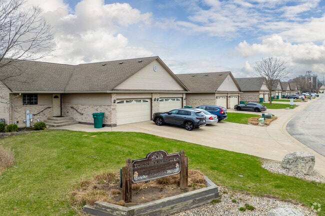
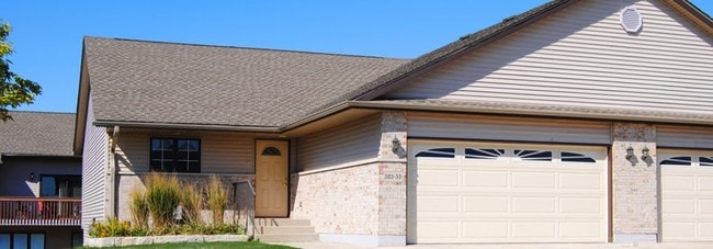
Property Record
437 Deerpath Ln W, Dekalb, IL 60115

Property Detail
437 Deerpath Ln W
Chicago-Naperville-Elgin, IL-IN
LOTS 1 THRU 65 - MASON TOWNHOME SUITES SUBDIVISION
08-21-426-093
DeKalb
Commercialnec
Illinois
B and X Area of moderate flood hazard, usually the area between the limits of the 100-year and 500-year floods.
1-65
2023
0.05 AC
2024
DeKalb
001400
Chicago
NEARBY LISTINGS FOR SALE OR LEASE
DEMOGRAPHICS near 437 Deerpath Ln W
1 mile
3 mile
5 mile
2025 Total Population
14,109
41,157
52,234
2030 Population
14,464
41,696
52,908
Pop Growth 2025-2030
+ 2.52%
+ 1.31%
+ 1.29%
Average Age
30
33
35
2025 Total Households
4,973
15,672
19,963
HH Growth 2025-2030
+ 3.10%
+ 1.51%
+ 1.43%
Median Household Inc
$47,103
$50,530
$57,642
Avg Household Size
2.20
2.30
2.30
2025 Avg HH Vehicles
2.00
2.00
2.00
Median Home Value
$241,804
$213,794
$212,535
Median Year Built
1979
1976
1978
Nearby Places
Map Layers
Map Styles
 Street
 Aerial
Layers
 Traffic
 Biking
Places
Listings with unknown addresses are not visible on the map
- Restaurants
- Banks
- Shops
- Fitness
- Groceries
PUBLIC TRANSPORTATION
AIRPORT
Chicago/Rockford International
Drive
Walk
Distance
Chicago/Rockford International
52 min
38.7 mi
Freight Ports
Port Milwaukee
Drive
Walk
Distance
Port Milwaukee
145 min
104.2 mi
Nearby Properties
Address
Land Use
TOTAL SIZE
Lot Size
Zoning
Address
Land Use
TOTAL SIZE
Lot Size
Zoning
71.90 AC
Address
Land Use
TOTAL SIZE
Lot Size
Zoning
49.71 AC
Address
Land Use
TOTAL SIZE
Lot Size
Zoning
58.65 AC
Address
Land Use
TOTAL SIZE
Lot Size
Zoning
33.65 AC
Address
Land Use
TOTAL SIZE
Lot Size
Zoning
49.73 AC
Address
Land Use
TOTAL SIZE
Lot Size
Zoning
98.56 AC
Address
Land Use
TOTAL SIZE
Lot Size
Zoning
43.10 AC
Address
Land Use
TOTAL SIZE
Lot Size
Zoning
94.65 AC
Address
Land Use
TOTAL SIZE
Lot Size
Zoning
47.87 AC
Address
Land Use
TOTAL SIZE
Lot Size
Zoning
21.61 AC
Address
Land Use
TOTAL SIZE
Lot Size
Zoning
15.79 AC
Address
Land Use
TOTAL SIZE
Lot Size
Zoning
25.70 AC
Address
Land Use
TOTAL SIZE
Lot Size
Zoning
9.39 AC
Address
Land Use
TOTAL SIZE
Lot Size
Zoning
21.35 AC
Address
Land Use
TOTAL SIZE
Lot Size
Zoning
9.04 AC
Address
Land Use
TOTAL SIZE
Lot Size
Zoning
9.88 AC
Address
Land Use
TOTAL SIZE
Lot Size
Zoning
8.70 AC
A1
Address
Land Use
TOTAL SIZE
Lot Size
Zoning
11.50 AC
Address
Land Use
TOTAL SIZE
Lot Size
Zoning
57.46 AC
Address
Land Use
TOTAL SIZE
Lot Size
Zoning
13.48 AC
Address
Land Use
TOTAL SIZE
Lot Size
Zoning
9.56 AC
RC2
Address
Land Use
TOTAL SIZE
Lot Size
Zoning
21.35 AC
Address
Land Use
TOTAL SIZE
Lot Size
Zoning
24.39 AC
Address
Land Use
TOTAL SIZE
Lot Size
Zoning
23.25 AC
Address
Land Use
TOTAL SIZE
Lot Size
Zoning
Address
Land Use
TOTAL SIZE
Lot Size
Zoning
7.41 AC
Address
Land Use
TOTAL SIZE
Lot Size
Zoning
5.59 AC
Address
Land Use
TOTAL SIZE
Lot Size
Zoning
5.77 AC
RC2
Address
Land Use
TOTAL SIZE
Lot Size
Zoning
8.78 AC
The World's #1 Commercial Real Estate Marketplace
Connect with us
© 2026 CoStar Group
The information above has been obtained from sources believed reliable. While we do not doubt its accuracy we have not verified it and make no guarantee, warranty or representation about it. It is your responsibility to independently confirm its accuracy and completeness. Any projections, opinions, assumptions, or estimates used are for example only and do not represent the current or future performance of the property. The value of this transaction to you depends on tax and other factors which should be evaluated by your tax, financial, and legal advisors. You and your advisors should conduct a careful, independent investigation of the property to determine to your satisfaction the suitability of the property for your needs.