Property Record
4370 S Miller Rd, Buckeye, AZ 85326


Save to a Folder
{{folder.Name}}
{{folder.ListingIds.length}} Properties
{{folder.ListingIds.length}} Property
Create a New Folder
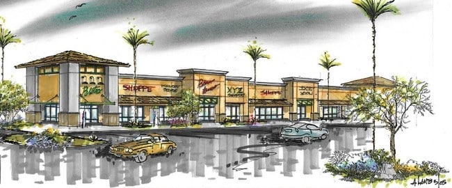
Property Detail
4370 S Miller Rd
504-26-977
VILLAGE ON BROADWAY MCR 1269-20
Restaurantdrivein
MARICOPA
CC
Arizona
C and X Area of minimal flood hazard, usually depicted on FIRMs as above the 500-year flood level.
3
2025
0.80 AC
2025
South Buckeye
050617
Phoenix
5,324 SF
Phoenix-Mesa-Chandler, AZ
NEARBY LISTINGS FOR SALE OR LEASE
DEMOGRAPHICS near 4370 S Miller Rd
1 mile
3 mile
5 mile
2025 Total Population
6,489
42,766
61,724
2030 Population
7,058
45,653
65,333
Pop Growth 2025-2030
+ 8.77%
+ 6.75%
+ 5.85%
Average Age
34
34
35
2025 Total Households
1,868
12,725
18,480
HH Growth 2025-2030
+ 8.99%
+ 6.84%
+ 5.93%
Median Household Inc
$107,374
$88,332
$91,367
Avg Household Size
3.40
3.30
3.30
2025 Avg HH Vehicles
2.00
2.00
2.00
Median Home Value
$387,301
$360,865
$374,643
Median Year Built
2010
2008
2007
Nearby Places
Map Layers
Map Styles
 Street
 Aerial
Layers
 Traffic
 Biking
Places
Listings with unknown addresses are not visible on the map
- Restaurants
- Banks
- Shops
- Fitness
- Groceries
SALE & LEASE HISTORY
LISTING DATE
SALE/LEASE

Sep 25, 2016
For Lease
Nearby Properties
Address
Land Use
TOTAL SIZE
Lot Size
Zoning
Address
Land Use
TOTAL SIZE
Lot Size
Zoning
2,310,631 SF
215.58 AC
Address
Land Use
TOTAL SIZE
Lot Size
Zoning
1,207,360 SF
67.69 AC
Address
Land Use
TOTAL SIZE
Lot Size
Zoning
862,622 SF
75.39 AC
GC
Address
Land Use
TOTAL SIZE
Lot Size
Zoning
1,834,456 SF
142.44 AC
C-G
Address
Land Use
TOTAL SIZE
Lot Size
Zoning
18.64 AC
Address
Land Use
TOTAL SIZE
Lot Size
Zoning
510,427 SF
64.69 AC
GC
Address
Land Use
TOTAL SIZE
Lot Size
Zoning
290,752 SF
21.32 AC
SU
Address
Land Use
TOTAL SIZE
Lot Size
Zoning
269,665 SF
54.66 AC
PC
Address
Land Use
TOTAL SIZE
Lot Size
Zoning
13.06 AC
Address
Land Use
TOTAL SIZE
Lot Size
Zoning
326,103 SF
21.54 AC
Address
Land Use
TOTAL SIZE
Lot Size
Zoning
217,965 SF
23.03 AC
PAD
Address
Land Use
TOTAL SIZE
Lot Size
Zoning
174.17 AC
Address
Land Use
TOTAL SIZE
Lot Size
Zoning
93,337 SF
15.37 AC
PC
Address
Land Use
TOTAL SIZE
Lot Size
Zoning
78,774 SF
7.57 AC
PUD
Address
Land Use
TOTAL SIZE
Lot Size
Zoning
108,818 SF
10.65 AC
C-C
Address
Land Use
TOTAL SIZE
Lot Size
Zoning
122,714 SF
12.27 AC
C-C
Address
Land Use
TOTAL SIZE
Lot Size
Zoning
78,165 SF
15.81 AC
PUD
Address
Land Use
TOTAL SIZE
Lot Size
Zoning
858,000 SF
69.08 AC
GC
Address
Land Use
TOTAL SIZE
Lot Size
Zoning
138,134 SF
13.14 AC
PAD
Address
Land Use
TOTAL SIZE
Lot Size
Zoning
68,255 SF
3.16 AC
PUD
Address
Land Use
TOTAL SIZE
Lot Size
Zoning
72,254 SF
13.66 AC
PAD
Address
Land Use
TOTAL SIZE
Lot Size
Zoning
3.34 AC
Address
Land Use
TOTAL SIZE
Lot Size
Zoning
75,026 SF
14.07 AC
PAD
Address
Land Use
TOTAL SIZE
Lot Size
Zoning
57,950 SF
9.89 AC
PAD
Address
Land Use
TOTAL SIZE
Lot Size
Zoning
85,712 SF
15.18 AC
PR
Address
Land Use
TOTAL SIZE
Lot Size
Zoning
60,201 SF
14.10 AC
PUD
Address
Land Use
TOTAL SIZE
Lot Size
Zoning
125,120 SF
8.49 AC
SU
Address
Land Use
TOTAL SIZE
Lot Size
Zoning
181,308 SF
20.19 AC
C-G
Address
Land Use
TOTAL SIZE
Lot Size
Zoning
20,248 SF
23.16 AC
SU
Address
Land Use
TOTAL SIZE
Lot Size
Zoning
3.10 AC
The World's #1 Commercial Real Estate Marketplace
Connect with us
© 2026 CoStar Group
The information above has been obtained from sources believed reliable. While we do not doubt its accuracy we have not verified it and make no guarantee, warranty or representation about it. It is your responsibility to independently confirm its accuracy and completeness. Any projections, opinions, assumptions, or estimates used are for example only and do not represent the current or future performance of the property. The value of this transaction to you depends on tax and other factors which should be evaluated by your tax, financial, and legal advisors. You and your advisors should conduct a careful, independent investigation of the property to determine to your satisfaction the suitability of the property for your needs.