Property Record
43725 Spinks Ferry Rd, Leesburg, VA 20176


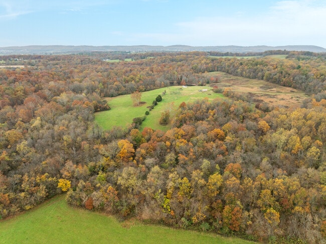
This Property Is For Sale
NEARBY LISTINGS FOR SALE OR LEASE
-
-
View all Leesburg listings for sale on LoopNet.com
Property Detail
43725 Spinks Ferry Rd
075-38-7424
Lost Corner
Commercialnec
LOST CORNER 2399--2373 767--596
AE
Loudoun
51107C0130E
Virginia
2025
223.95 AC
2025
Leesburg/West Loudoun
610503
Washington, DC
625 SF
Washington-Arlington-Alexandria, DC-VA-MD-WV
DEMOGRAPHICS near 43725 Spinks Ferry Rd
1 Mile
3 Mile
5 Mile
2024 Total Population
149
2,473
6,613
2029 Population
162
2,661
7,055
Pop Growth 2024-2029
+ 8.72%
+ 7.60%
+ 6.68%
Average Age
38
38
40
2024 Total Households
44
738
2,108
HH Growth 2024-2029
+ 9.09%
+ 7.59%
+ 6.74%
Median Household Inc
$216,667
$211,282
$186,464
Avg Household Size
3.30
3.20
3.10
2024 Avg HH Vehicles
2.00
2.00
2.00
Median Home Value
$712,963
$707,093
$740,082
Median Year Built
2005
2003
1999
Nearby Places
Map Layers
Map Styles
 Street
 Aerial
- Restaurants
- Banks
- Shops
- Fitness
- Groceries
PUBLIC TRANSPORTATION
AIRPORT
Washington Dulles International
DRIVE
WALK
Distance
Washington Dulles International
46 min
27.6 mi
Freight Ports
Port of Baltimore
DRIVE
WALK
Distance
Port of Baltimore
89 min
68.5 mi
Nearby Properties
Address
Land Use
TOTAL SIZE
Lot Size
Zoning
Address
Land Use
TOTAL SIZE
Lot Size
Zoning
55,005 SF
15.83 AC
A
Address
Land Use
TOTAL SIZE
Lot Size
Zoning
41,594 SF
15.30 AC
CR4
Address
Land Use
TOTAL SIZE
Lot Size
Zoning
18,010 SF
14.36 AC
AR1
Address
Land Use
TOTAL SIZE
Lot Size
Zoning
373,179 SF
668.23 AC
IH2.5
Address
Land Use
TOTAL SIZE
Lot Size
Zoning
1,827 SF
151.26 AC
AR1
Address
Land Use
TOTAL SIZE
Lot Size
Zoning
17,642 SF
408.80 AC
AR1
Address
Land Use
TOTAL SIZE
Lot Size
Zoning
13,945 SF
101 AC
AR1
Address
Land Use
TOTAL SIZE
Lot Size
Zoning
89.89 AC
IH2.5
Address
Land Use
TOTAL SIZE
Lot Size
Zoning
12,680 SF
5.16 AC
IM2.5
Address
Land Use
TOTAL SIZE
Lot Size
Zoning
5,438 SF
50.52 AC
AR1
Address
Land Use
TOTAL SIZE
Lot Size
Zoning
18,390 SF
4.78 AC
CR4
Address
Land Use
TOTAL SIZE
Lot Size
Zoning
1,408 SF
2.08 AC
RC
Address
Land Use
TOTAL SIZE
Lot Size
Zoning
4,672 SF
358.75 AC
AR
Address
Land Use
TOTAL SIZE
Lot Size
Zoning
3,780 SF
48.50 AC
AR1
Address
Land Use
TOTAL SIZE
Lot Size
Zoning
10,091 SF
244.33 AC
AR
Address
Land Use
TOTAL SIZE
Lot Size
Zoning
408.38 AC
AR
Address
Land Use
TOTAL SIZE
Lot Size
Zoning
10 AC
CR1
Address
Land Use
TOTAL SIZE
Lot Size
Zoning
7,522 SF
1.07 AC
RC
Address
Land Use
TOTAL SIZE
Lot Size
Zoning
8,969 SF
15.07 AC
AR
Address
Land Use
TOTAL SIZE
Lot Size
Zoning
2,489 SF
17.89 AC
AR1
Address
Land Use
TOTAL SIZE
Lot Size
Zoning
5,549 SF
234.19 AC
AR
Address
Land Use
TOTAL SIZE
Lot Size
Zoning
4,584 SF
80.73 AC
AR
Address
Land Use
TOTAL SIZE
Lot Size
Zoning
4,424 SF
49.71 AC
AR
Address
Land Use
TOTAL SIZE
Lot Size
Zoning
227.29 AC
AR
Address
Land Use
TOTAL SIZE
Lot Size
Zoning
5,252 SF
26.93 AC
AR
Address
Land Use
TOTAL SIZE
Lot Size
Zoning
1,236 SF
20 AC
AR1
Address
Land Use
TOTAL SIZE
Lot Size
Zoning
4,447 SF
15.70 AC
AR
Address
Land Use
TOTAL SIZE
Lot Size
Zoning
4,396 SF
31.35 AC
AR
Address
Land Use
TOTAL SIZE
Lot Size
Zoning
4,257 SF
25 AC
AR
The World's #1 Commercial Real Estate Marketplace
Connect with us
© 2025 CoStar Group
The information above has been obtained from sources believed reliable. While we do not doubt its accuracy we have not verified it and make no guarantee, warranty or representation about it. It is your responsibility to independently confirm its accuracy and completeness. Any projections, opinions, assumptions, or estimates used are for example only and do not represent the current or future performance of the property. The value of this transaction to you depends on tax and other factors which should be evaluated by your tax, financial, and legal advisors. You and your advisors should conduct a careful, independent investigation of the property to determine to your satisfaction the suitability of the property for your needs.