Property Record
4375 S 300 W, Ogden, UT 84405


Property Detail
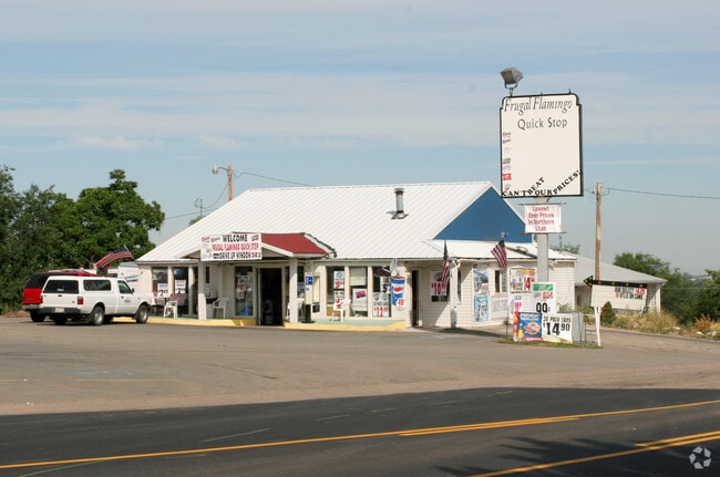
4375 S 300 W
Ogden, UT
PART OF LOT A, BLOCK 23, COUNTRY CLUB ACRES ANNEX TO OGDEN CITY, WEBER COUNTY, UTAH, AND THAT PART OF LOT 2, BLOCK 3, PARCEL
06-020-0037
Weber
Conveniencestore
Utah
B and X Area of moderate flood hazard, usually the area between the limits of the 100-year and 500-year floods.
2a
2025
0.25 AC
2025
Davis/Weber Counties
211000
Salt Lake City
1,980 SF
NEARBY LISTINGS FOR SALE OR LEASE
DEMOGRAPHICS near 4375 S 300 W
1 mile
3 mile
5 mile
2025 Total Population
11,899
82,162
183,289
2030 Population
12,247
84,690
189,810
Pop Growth 2025-2030
+ 2.92%
+ 3.08%
+ 3.56%
Average Age
35
37
36
2025 Total Households
4,287
30,103
64,919
HH Growth 2025-2030
+ 3.24%
+ 3.42%
+ 3.85%
Median Household Inc
$74,147
$77,305
$82,360
Avg Household Size
2.70
2.60
2.70
2025 Avg HH Vehicles
2.00
2.00
2.00
Median Home Value
$350,470
$393,055
$406,785
Median Year Built
1970
1972
1978
Nearby Places
Map Layers
Map Styles
 Street
 Aerial
Layers
 Traffic
 Biking
Places
Listings with unknown addresses are not visible on the map
- Restaurants
- Banks
- Shops
- Fitness
- Groceries
PUBLIC TRANSPORTATION
COMMUTER RAIL
Ogden (FrontRunner North - Utah Transit Authority (UTA))
Drive
Walk
Distance
Ogden (FrontRunner North - Utah Transit Authority (UTA))
7 min
3.3 mi
Roy (FrontRunner North - Utah Transit Authority (UTA))
Drive
Walk
Distance
Roy (FrontRunner North - Utah Transit Authority (UTA))
11 min
4.5 mi
AIRPORT
Salt Lake City International
Drive
Walk
Distance
Salt Lake City International
45 min
35.0 mi
Nearby Properties
Address
Land Use
TOTAL SIZE
Lot Size
Zoning
Address
Land Use
TOTAL SIZE
Lot Size
Zoning
790,525 SF
57.26 AC
Address
Land Use
TOTAL SIZE
Lot Size
Zoning
2,657 SF
16.26 AC
Address
Land Use
TOTAL SIZE
Lot Size
Zoning
13,376 SF
11.50 AC
Address
Land Use
TOTAL SIZE
Lot Size
Zoning
200,509 SF
12.75 AC
Address
Land Use
TOTAL SIZE
Lot Size
Zoning
35,219 SF
58.98 AC
Address
Land Use
TOTAL SIZE
Lot Size
Zoning
7,492 SF
8.96 AC
Address
Land Use
TOTAL SIZE
Lot Size
Zoning
83,038 SF
7.54 AC
Address
Land Use
TOTAL SIZE
Lot Size
Zoning
71,940 SF
11 AC
Address
Land Use
TOTAL SIZE
Lot Size
Zoning
48,177 SF
5.54 AC
Address
Land Use
TOTAL SIZE
Lot Size
Zoning
98,660 SF
3.18 AC
Address
Land Use
TOTAL SIZE
Lot Size
Zoning
8,580 SF
6.40 AC
Address
Land Use
TOTAL SIZE
Lot Size
Zoning
119,043 SF
2.05 AC
Address
Land Use
TOTAL SIZE
Lot Size
Zoning
95,949 SF
3.29 AC
Address
Land Use
TOTAL SIZE
Lot Size
Zoning
115,094 SF
13.88 AC
Address
Land Use
TOTAL SIZE
Lot Size
Zoning
4,442 SF
7.19 AC
Address
Land Use
TOTAL SIZE
Lot Size
Zoning
166,800 SF
0.12 AC
Address
Land Use
TOTAL SIZE
Lot Size
Zoning
225,497 SF
20.33 AC
Address
Land Use
TOTAL SIZE
Lot Size
Zoning
19,594 SF
1.12 AC
Address
Land Use
TOTAL SIZE
Lot Size
Zoning
134,796 SF
3.93 AC
Address
Land Use
TOTAL SIZE
Lot Size
Zoning
63,343 SF
16.43 AC
Address
Land Use
TOTAL SIZE
Lot Size
Zoning
47,750 SF
2.10 AC
Address
Land Use
TOTAL SIZE
Lot Size
Zoning
255,596 SF
15.98 AC
Address
Land Use
TOTAL SIZE
Lot Size
Zoning
73,942 SF
8.87 AC
Address
Land Use
TOTAL SIZE
Lot Size
Zoning
2,938 SF
9.69 AC
The World's #1 Commercial Real Estate Marketplace
Connect with us
© 2026 CoStar Group
The information above has been obtained from sources believed reliable. While we do not doubt its accuracy we have not verified it and make no guarantee, warranty or representation about it. It is your responsibility to independently confirm its accuracy and completeness. Any projections, opinions, assumptions, or estimates used are for example only and do not represent the current or future performance of the property. The value of this transaction to you depends on tax and other factors which should be evaluated by your tax, financial, and legal advisors. You and your advisors should conduct a careful, independent investigation of the property to determine to your satisfaction the suitability of the property for your needs.