Property Record
438 Division Ave S, Grand Rapids, MI 49503


Property Detail
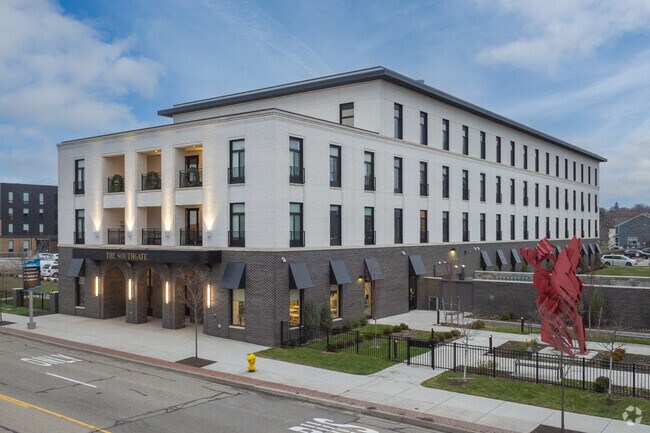
438 Division Ave S
Grand Rapids-Wyoming-Kentwood, MI
411431101034 LOTS 26 THRU 29 ALSO LOTS 46 47 ALSO PART OF LOTS 30 31 & 45 BLK 6 COM AT SE COR OF LOT 47 TH N 86D 57M 09S W
41-14-31-101-034
KENT
Commercialnec
Michigan
B and X Area of moderate flood hazard, usually the area between the limits of the 100-year and 500-year floods.
0.76 AC
0
Madison Area
2025
West Michigan
002800
NEARBY LISTINGS FOR SALE OR LEASE
DEMOGRAPHICS near 438 Division Ave S
1 mile
3 mile
5 mile
2025 Total Population
21,229
148,603
269,825
2030 Population
21,765
151,343
274,582
Pop Growth 2025-2030
+ 2.52%
+ 1.84%
+ 1.76%
Average Age
34
35
37
2025 Total Households
9,818
58,003
106,900
HH Growth 2025-2030
+ 2.79%
+ 2.08%
+ 1.90%
Median Household Inc
$61,730
$66,282
$70,771
Avg Household Size
2.00
2.40
2.40
2025 Avg HH Vehicles
1.00
2.00
2.00
Median Home Value
$297,750
$238,017
$251,436
Median Year Built
1948
1948
1956
Nearby Places
Map Layers
Map Styles
 Street
 Aerial
Layers
 Traffic
 Biking
Places
Listings with unknown addresses are not visible on the map
- Restaurants
- Banks
- Shops
- Fitness
- Groceries
PUBLIC TRANSPORTATION
COMMUTER RAIL
Grand Rapids Vernon J. Ehlers Station (Pere Marquette - Amtrak)
Drive
Walk
Distance
Grand Rapids Vernon J. Ehlers Station (Pere Marquette - Amtrak)
2 min
10 min
0.6 mi
AIRPORT
Gerald R Ford International
Drive
Walk
Distance
Gerald R Ford International
24 min
16.4 mi
Freight Ports
Port Milwaukee
Drive
Walk
Distance
Port Milwaukee
305 min
262.0 mi
Nearby Properties
Address
Land Use
TOTAL SIZE
Lot Size
Zoning
Address
Land Use
TOTAL SIZE
Lot Size
Zoning
226,925 SF
1.32 AC
TN-CC
Address
Land Use
TOTAL SIZE
Lot Size
Zoning
557,931 SF
2.12 AC
TN-CC
Address
Land Use
TOTAL SIZE
Lot Size
Zoning
333,281 SF
13.99 AC
SD-PRD
Address
Land Use
TOTAL SIZE
Lot Size
Zoning
265,905 SF
1.99 AC
TN-CC
Address
Land Use
TOTAL SIZE
Lot Size
Zoning
250,170 SF
16.13 AC
R-1
Address
Land Use
TOTAL SIZE
Lot Size
Zoning
211,760 SF
TN-CC
Address
Land Use
TOTAL SIZE
Lot Size
Zoning
768,153 SF
3.20 AC
TN-CC
Address
Land Use
TOTAL SIZE
Lot Size
Zoning
347,500 SF
1.51 AC
TN-CC
Address
Land Use
TOTAL SIZE
Lot Size
Zoning
491,288 SF
2.79 AC
SD-PRD
Address
Land Use
TOTAL SIZE
Lot Size
Zoning
96,528 SF
9.88 AC
SD-NOS
Address
Land Use
TOTAL SIZE
Lot Size
Zoning
138,122 SF
1.01 AC
TN-CC
Address
Land Use
TOTAL SIZE
Lot Size
Zoning
Address
Land Use
TOTAL SIZE
Lot Size
Zoning
281,488 SF
1.20 AC
TN-CC
Address
Land Use
TOTAL SIZE
Lot Size
Zoning
145,306 SF
0.75 AC
TN-CC
Address
Land Use
TOTAL SIZE
Lot Size
Zoning
164,591 SF
1.28 AC
TN-CC
Address
Land Use
TOTAL SIZE
Lot Size
Zoning
Address
Land Use
TOTAL SIZE
Lot Size
Zoning
201,100 SF
0.90 AC
TN-CC
Address
Land Use
TOTAL SIZE
Lot Size
Zoning
94,556 SF
1.03 AC
TN-TCC
Address
Land Use
TOTAL SIZE
Lot Size
Zoning
88,327 SF
2.74 AC
TN-CC
Address
Land Use
TOTAL SIZE
Lot Size
Zoning
366,447 SF
2.71 AC
TN-CC
Address
Land Use
TOTAL SIZE
Lot Size
Zoning
87.39 AC
I2
Address
Land Use
TOTAL SIZE
Lot Size
Zoning
18.65 AC
MCN-MDR
Address
Land Use
TOTAL SIZE
Lot Size
Zoning
363,503 SF
2.20 AC
TN-CC
Address
Land Use
TOTAL SIZE
Lot Size
Zoning
68,560 SF
2.76 AC
TN-TCC
Address
Land Use
TOTAL SIZE
Lot Size
Zoning
254,941 SF
0.79 AC
TN-CC
Address
Land Use
TOTAL SIZE
Lot Size
Zoning
109,482 SF
1.35 AC
SD-PRD
Address
Land Use
TOTAL SIZE
Lot Size
Zoning
310,790 SF
0.66 AC
TN-CC
Address
Land Use
TOTAL SIZE
Lot Size
Zoning
0.92 AC
TN-CC
Address
Land Use
TOTAL SIZE
Lot Size
Zoning
269,990 SF
1.28 AC
TN-CC
Address
Land Use
TOTAL SIZE
Lot Size
Zoning
3.31 AC
TN-CC
The World's #1 Commercial Real Estate Marketplace
Connect with us
© 2026 CoStar Group
The information above has been obtained from sources believed reliable. While we do not doubt its accuracy we have not verified it and make no guarantee, warranty or representation about it. It is your responsibility to independently confirm its accuracy and completeness. Any projections, opinions, assumptions, or estimates used are for example only and do not represent the current or future performance of the property. The value of this transaction to you depends on tax and other factors which should be evaluated by your tax, financial, and legal advisors. You and your advisors should conduct a careful, independent investigation of the property to determine to your satisfaction the suitability of the property for your needs.