Property Record
4380 Lapeer Rd, Port Huron, MI 48060
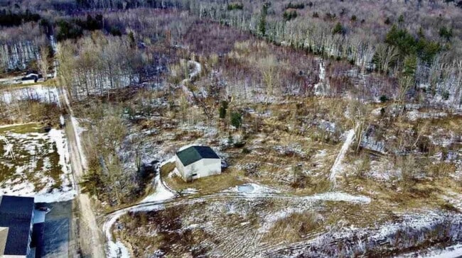

Property Detail
4380 Lapeer Rd
28-006-4002-000
THAT PART OF W 1/2 OF E 1/2 OF SW 1/4 LYING N OF LAPEER AVE SECTION 6 T6N R17E 32.04 A
Commercialnec
ST. CLAIR
B-3
Michigan
B and X Area of moderate flood hazard, usually the area between the limits of the 100-year and 500-year floods.
32.04 AC
2025
St Clair & Lapeer Counties
2025
Detroit
635000
Detroit-Warren-Dearborn, MI
NEARBY LISTINGS FOR SALE OR LEASE
DEMOGRAPHICS near 4380 Lapeer Rd
1 mile
3 mile
5 mile
2025 Total Population
2,662
25,856
64,524
2030 Population
2,616
25,623
64,321
Pop Growth 2025-2030
(1.73%)
(0.90%)
(0.31%)
Average Age
43
42
42
2025 Total Households
1,117
10,163
26,605
HH Growth 2025-2030
(1.88%)
(1.03%)
(0.38%)
Median Household Inc
$68,324
$66,479
$60,704
Avg Household Size
2.40
2.50
2.30
2025 Avg HH Vehicles
2.00
2.00
2.00
Median Home Value
$239,130
$190,533
$183,841
Median Year Built
1980
1971
1970
Nearby Places
Map Layers
Map Styles
 Street
 Aerial
Layers
 Traffic
 Biking
Places
Listings with unknown addresses are not visible on the map
- Restaurants
- Banks
- Shops
- Fitness
- Groceries
PUBLIC TRANSPORTATION
COMMUTER RAIL
Port Huron Amtrak Station (Blue Water - Amtrak)
Drive
Walk
Distance
Port Huron Amtrak Station (Blue Water - Amtrak)
8 min
4.1 mi
Sarnia (Toronto - Sarnia - VIA Rail)
Drive
Walk
Distance
Sarnia (Toronto - Sarnia - VIA Rail)
21 min
9.8 mi
Freight Ports
Port of Toledo
Drive
Walk
Distance
Port of Toledo
144 min
118.8 mi
SALE & LEASE HISTORY
LISTING DATE
SALE/LEASE

Oct 06, 2017
For Sale
May 08, 2019
For Sale
Nearby Properties
Address
Land Use
TOTAL SIZE
Lot Size
Zoning
Address
Land Use
TOTAL SIZE
Lot Size
Zoning
241,664 SF
50.15 AC
B-3
Address
Land Use
TOTAL SIZE
Lot Size
Zoning
137,720 SF
12.04 AC
B-3
Address
Land Use
TOTAL SIZE
Lot Size
Zoning
94,537 SF
12.63 AC
B-3
Address
Land Use
TOTAL SIZE
Lot Size
Zoning
39,747 SF
3.11 AC
R-2 RES
Address
Land Use
TOTAL SIZE
Lot Size
Zoning
112,566 SF
7.20 AC
B-3
Address
Land Use
TOTAL SIZE
Lot Size
Zoning
73,882 SF
6.50 AC
B-3
Address
Land Use
TOTAL SIZE
Lot Size
Zoning
333,076 SF
23.19 AC
M2
Address
Land Use
TOTAL SIZE
Lot Size
Zoning
198,647 SF
26.04 AC
B-3
Address
Land Use
TOTAL SIZE
Lot Size
Zoning
81,940 SF
3.50 AC
M1
Address
Land Use
TOTAL SIZE
Lot Size
Zoning
86,480 SF
4.40 AC
M1
Address
Land Use
TOTAL SIZE
Lot Size
Zoning
49,695 SF
9.30 AC
MD
Address
Land Use
TOTAL SIZE
Lot Size
Zoning
87,624 SF
11.32 AC
RM
Address
Land Use
TOTAL SIZE
Lot Size
Zoning
61,855 SF
4.51 AC
M1
Address
Land Use
TOTAL SIZE
Lot Size
Zoning
20,736 SF
10.20 AC
R-1
Address
Land Use
TOTAL SIZE
Lot Size
Zoning
5,359 SF
42.87 AC
R-4 RES
Address
Land Use
TOTAL SIZE
Lot Size
Zoning
7,785 SF
35.62 AC
C-2 COMM
Address
Land Use
TOTAL SIZE
Lot Size
Zoning
102,223 SF
6.71 AC
B-3
Address
Land Use
TOTAL SIZE
Lot Size
Zoning
78,320 SF
3.30 AC
M1
Address
Land Use
TOTAL SIZE
Lot Size
Zoning
112,176 SF
14.28 AC
B-3
Address
Land Use
TOTAL SIZE
Lot Size
Zoning
58,656 SF
12.03 AC
I-H
Address
Land Use
TOTAL SIZE
Lot Size
Zoning
42,720 SF
6.21 AC
C-2 COMM
Address
Land Use
TOTAL SIZE
Lot Size
Zoning
67,170 SF
4.13 AC
M1
Address
Land Use
TOTAL SIZE
Lot Size
Zoning
39,926 SF
8.94 AC
I-L
Address
Land Use
TOTAL SIZE
Lot Size
Zoning
35,397 SF
1.28 AC
B-3
Address
Land Use
TOTAL SIZE
Lot Size
Zoning
25,756 SF
4.79 AC
R-1
Address
Land Use
TOTAL SIZE
Lot Size
Zoning
41,654 SF
3.24 AC
B-3
Address
Land Use
TOTAL SIZE
Lot Size
Zoning
31,458 SF
2 AC
B-3
Address
Land Use
TOTAL SIZE
Lot Size
Zoning
896 SF
41.22 AC
RMH
Address
Land Use
TOTAL SIZE
Lot Size
Zoning
43.44 AC
RMH
Address
Land Use
TOTAL SIZE
Lot Size
Zoning
31,104 SF
1.32 AC
B-3
The World's #1 Commercial Real Estate Marketplace
Connect with us
© 2026 CoStar Group
The information above has been obtained from sources believed reliable. While we do not doubt its accuracy we have not verified it and make no guarantee, warranty or representation about it. It is your responsibility to independently confirm its accuracy and completeness. Any projections, opinions, assumptions, or estimates used are for example only and do not represent the current or future performance of the property. The value of this transaction to you depends on tax and other factors which should be evaluated by your tax, financial, and legal advisors. You and your advisors should conduct a careful, independent investigation of the property to determine to your satisfaction the suitability of the property for your needs.