Property Record
4381 S River Rd, Saint George, UT 84790
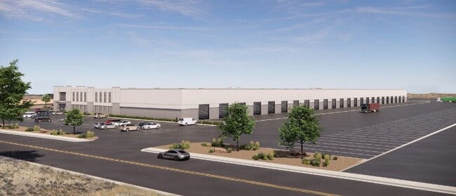

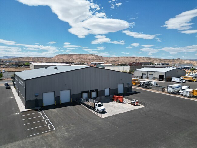
Property Detail
4381 S River Rd
St. George, UT
S: 20 T: 43S R: 15W BEGINNING AT A POINT SOUTH 11108 WEST 1632.14 FEET ALONG THE CENTER SECTION LINE AND NORTH 900000 WEST 505.32 FEET FROM THE NORTH 1/4 CORNER OF SECTION 20, TOWNSHIP 43 SOUTH, RANGE 15 WEST, SALT LAKE BASE AND MERIDIAN AND RUNNING
1100544
WASHINGTON
Commercialnec
Utah
B and X Area of moderate flood hazard, usually the area between the limits of the 100-year and 500-year floods.
49
2024
5.35 AC
2025
Cedar City & St George
271702
Other Market Areas
9,450 SF
NEARBY LISTINGS FOR SALE OR LEASE
DEMOGRAPHICS near 4381 S River Rd
1 mile
3 mile
5 mile
2025 Total Population
521
27,779
63,990
2030 Population
571
30,544
70,373
Pop Growth 2025-2030
+ 9.60%
+ 9.95%
+ 9.97%
Average Age
39
39
40
2025 Total Households
157
8,717
21,291
HH Growth 2025-2030
+ 9.55%
+ 9.99%
+ 10.04%
Median Household Inc
$108,333
$97,859
$88,258
Avg Household Size
3.20
3.20
2.90
2025 Avg HH Vehicles
2.00
2.00
2.00
Median Home Value
$680,555
$630,899
$602,251
Median Year Built
2010
2009
2006
Nearby Places
Map Layers
Map Styles
 Street
 Aerial
Layers
 Traffic
 Biking
Places
Listings with unknown addresses are not visible on the map
- Restaurants
- Banks
- Shops
- Fitness
- Groceries
PUBLIC TRANSPORTATION
AIRPORT
St George Regional
Drive
Walk
Distance
St George Regional
15 min
7.3 mi
Freight Ports
Port of Long Beach
Drive
Walk
Distance
Port of Long Beach
441 min
401.7 mi
SALE & LEASE HISTORY
LISTING DATE
SALE/LEASE

Nov 17, 2022
For Lease
Nearby Properties
Address
Land Use
TOTAL SIZE
Lot Size
Zoning
Address
Land Use
TOTAL SIZE
Lot Size
Zoning
823,767 SF
88.46 AC
Address
Land Use
TOTAL SIZE
Lot Size
Zoning
322,075 SF
26.62 AC
Address
Land Use
TOTAL SIZE
Lot Size
Zoning
1,063.96 AC
R110
Address
Land Use
TOTAL SIZE
Lot Size
Zoning
259,012 SF
22 AC
M-1
Address
Land Use
TOTAL SIZE
Lot Size
Zoning
173,917 SF
50 AC
M-1
Address
Land Use
TOTAL SIZE
Lot Size
Zoning
196,334 SF
22.87 AC
PDCOM
Address
Land Use
TOTAL SIZE
Lot Size
Zoning
152,090 SF
25 AC
M-1
Address
Land Use
TOTAL SIZE
Lot Size
Zoning
51,302 SF
56.23 AC
OST20
Address
Land Use
TOTAL SIZE
Lot Size
Zoning
87,750 SF
15.92 AC
Address
Land Use
TOTAL SIZE
Lot Size
Zoning
123,028 SF
12.87 AC
Address
Land Use
TOTAL SIZE
Lot Size
Zoning
91,798 SF
5 AC
M-1
Address
Land Use
TOTAL SIZE
Lot Size
Zoning
15,476 SF
7.71 AC
Address
Land Use
TOTAL SIZE
Lot Size
Zoning
169,923 SF
9.41 AC
Address
Land Use
TOTAL SIZE
Lot Size
Zoning
405 SF
407.69 AC
R110
Address
Land Use
TOTAL SIZE
Lot Size
Zoning
209,687 SF
7.54 AC
M-1
Address
Land Use
TOTAL SIZE
Lot Size
Zoning
16,800 SF
250 AC
OS
Address
Land Use
TOTAL SIZE
Lot Size
Zoning
40,908 SF
6.89 AC
Address
Land Use
TOTAL SIZE
Lot Size
Zoning
122,761 SF
10.22 AC
M-1
Address
Land Use
TOTAL SIZE
Lot Size
Zoning
221,863 SF
8.62 AC
Address
Land Use
TOTAL SIZE
Lot Size
Zoning
97,357 SF
5.67 AC
M-1
Address
Land Use
TOTAL SIZE
Lot Size
Zoning
100,110 SF
8.48 AC
M-1
Address
Land Use
TOTAL SIZE
Lot Size
Zoning
57,607 SF
11.03 AC
M-1
Address
Land Use
TOTAL SIZE
Lot Size
Zoning
77,649 SF
2.43 AC
Address
Land Use
TOTAL SIZE
Lot Size
Zoning
67,583 SF
2.99 AC
PDCOM
Address
Land Use
TOTAL SIZE
Lot Size
Zoning
22,954 SF
10.79 AC
Address
Land Use
TOTAL SIZE
Lot Size
Zoning
102,157 SF
8 AC
M-1
Address
Land Use
TOTAL SIZE
Lot Size
Zoning
53,536 SF
11.04 AC
M-1
Address
Land Use
TOTAL SIZE
Lot Size
Zoning
7,657 SF
31.73 AC
A20
Address
Land Use
TOTAL SIZE
Lot Size
Zoning
81,279 SF
4.92 AC
M-1
The World's #1 Commercial Real Estate Marketplace
Connect with us
© 2026 CoStar Group
The information above has been obtained from sources believed reliable. While we do not doubt its accuracy we have not verified it and make no guarantee, warranty or representation about it. It is your responsibility to independently confirm its accuracy and completeness. Any projections, opinions, assumptions, or estimates used are for example only and do not represent the current or future performance of the property. The value of this transaction to you depends on tax and other factors which should be evaluated by your tax, financial, and legal advisors. You and your advisors should conduct a careful, independent investigation of the property to determine to your satisfaction the suitability of the property for your needs.