Property Record
4382 N Haroldsen Dr, Idaho Falls, ID 83401
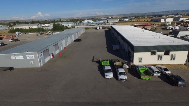

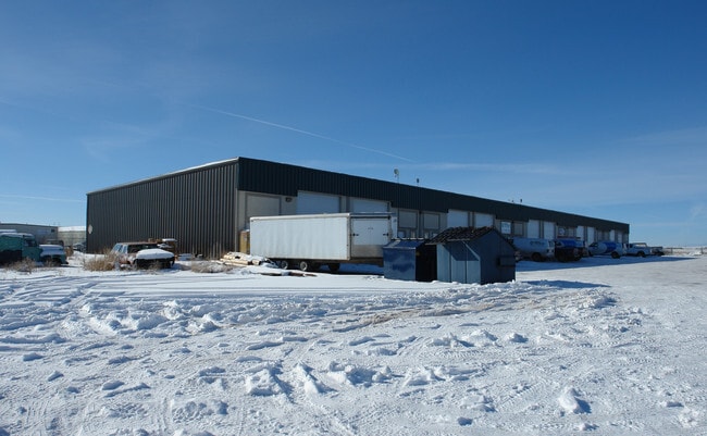
Property Detail
4382 N Haroldsen Dr
Idaho Falls, ID
LOT 6, BLOCK 2, TELFORD PARK NE1/4, SEC 5, T 2N, R 38
RPO5200002006O
Bonneville
Industrialpark
Idaho
R2
6
2025
2.90 AC
2025
Idaho South Area
970401
Other Market Areas
15,000 SF
NEARBY LISTINGS FOR SALE OR LEASE
DEMOGRAPHICS near 4382 N Haroldsen Dr
1 mile
3 mile
5 mile
2025 Total Population
293
32,126
101,784
2030 Population
313
33,912
106,929
Pop Growth 2025-2030
+ 6.83%
+ 5.56%
+ 5.05%
Average Age
40
35
36
2025 Total Households
104
11,157
35,923
HH Growth 2025-2030
+ 6.73%
+ 5.61%
+ 5.15%
Median Household Inc
$99,999
$65,782
$69,716
Avg Household Size
2.80
2.80
2.80
2025 Avg HH Vehicles
2.00
2.00
2.00
Median Home Value
$440,476
$323,483
$351,533
Median Year Built
2003
1980
1984
Nearby Places
Map Layers
Map Styles
 Street
 Aerial
Layers
 Traffic
 Biking
Places
Listings with unknown addresses are not visible on the map
- Restaurants
- Banks
- Shops
- Fitness
- Groceries
PUBLIC TRANSPORTATION
AIRPORT
Idaho Falls Regional
Drive
Walk
Distance
Idaho Falls Regional
11 min
5.9 mi
Freight Ports
Port of Portland
Drive
Walk
Distance
Port of Portland
745 min
714.7 mi
SALE & LEASE HISTORY
LISTING DATE
SALE/LEASE

Sep 25, 2016
For Lease
Sep 14, 2020
For Lease
Nearby Properties
Address
Land Use
TOTAL SIZE
Lot Size
Zoning
Address
Land Use
TOTAL SIZE
Lot Size
Zoning
400 SF
154.56 AC
Address
Land Use
TOTAL SIZE
Lot Size
Zoning
136,343 SF
10 AC
Address
Land Use
TOTAL SIZE
Lot Size
Zoning
4,363 SF
13.28 AC
Address
Land Use
TOTAL SIZE
Lot Size
Zoning
253,387 SF
18.33 AC
R2
Address
Land Use
TOTAL SIZE
Lot Size
Zoning
10,324 SF
8.73 AC
Address
Land Use
TOTAL SIZE
Lot Size
Zoning
61,948 SF
4.51 AC
Address
Land Use
TOTAL SIZE
Lot Size
Zoning
273,545 SF
15.89 AC
R2
Address
Land Use
TOTAL SIZE
Lot Size
Zoning
179,244 SF
16.56 AC
Address
Land Use
TOTAL SIZE
Lot Size
Zoning
1,472 SF
4.38 AC
Address
Land Use
TOTAL SIZE
Lot Size
Zoning
163,776 SF
9.56 AC
R2
Address
Land Use
TOTAL SIZE
Lot Size
Zoning
39,458 SF
7.13 AC
Address
Land Use
TOTAL SIZE
Lot Size
Zoning
Address
Land Use
TOTAL SIZE
Lot Size
Zoning
76,649 SF
3.96 AC
Address
Land Use
TOTAL SIZE
Lot Size
Zoning
1,573 SF
10.46 AC
Address
Land Use
TOTAL SIZE
Lot Size
Zoning
80,922 SF
10 AC
Address
Land Use
TOTAL SIZE
Lot Size
Zoning
91,889 SF
11.68 AC
R2
Address
Land Use
TOTAL SIZE
Lot Size
Zoning
80,772 SF
10.41 AC
R2
Address
Land Use
TOTAL SIZE
Lot Size
Zoning
67,657 SF
4.08 AC
R2
Address
Land Use
TOTAL SIZE
Lot Size
Zoning
Address
Land Use
TOTAL SIZE
Lot Size
Zoning
111,308 SF
31.86 AC
R2
Address
Land Use
TOTAL SIZE
Lot Size
Zoning
36,895 SF
14.06 AC
Address
Land Use
TOTAL SIZE
Lot Size
Zoning
55,291 SF
11.84 AC
Address
Land Use
TOTAL SIZE
Lot Size
Zoning
39,528 SF
6.47 AC
R2
Address
Land Use
TOTAL SIZE
Lot Size
Zoning
33,752 SF
1.99 AC
R2
Address
Land Use
TOTAL SIZE
Lot Size
Zoning
27,500 SF
5.50 AC
R2
Address
Land Use
TOTAL SIZE
Lot Size
Zoning
54,899 SF
4.51 AC
Address
Land Use
TOTAL SIZE
Lot Size
Zoning
22,182 SF
5.20 AC
Address
Land Use
TOTAL SIZE
Lot Size
Zoning
22,500 SF
6.19 AC
R2
Address
Land Use
TOTAL SIZE
Lot Size
Zoning
68,831 SF
6 AC
R2
Address
Land Use
TOTAL SIZE
Lot Size
Zoning
81,861 SF
4.89 AC
R2
The World's #1 Commercial Real Estate Marketplace
Connect with us
© 2026 CoStar Group
The information above has been obtained from sources believed reliable. While we do not doubt its accuracy we have not verified it and make no guarantee, warranty or representation about it. It is your responsibility to independently confirm its accuracy and completeness. Any projections, opinions, assumptions, or estimates used are for example only and do not represent the current or future performance of the property. The value of this transaction to you depends on tax and other factors which should be evaluated by your tax, financial, and legal advisors. You and your advisors should conduct a careful, independent investigation of the property to determine to your satisfaction the suitability of the property for your needs.