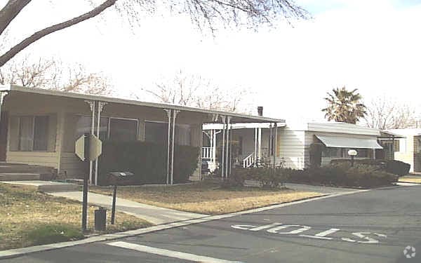
Property Record
43850 20Th St E, Lancaster, CA 93535


Property Detail
43850 20Th St E
3150-011-001
N 40.27 ACS (EX OF STS) OF LOT 2 IN SW 1/4 OF SEC 19 T 7N R 11W
Mobilemanufacturedhomeregardlessoflandownership
Los Angeles
X
California
06037C0450F
2
2024
37.90 AC
2025
Outlying LA County
900509
Los Angeles
11,323 SF
Los Angeles-Long Beach-Glendale, CA
NEARBY LISTINGS FOR SALE OR LEASE
-
-
View all Lancaster listings for sale on LoopNet.com
DEMOGRAPHICS near 43850 20Th St E
1 mile
3 mile
5 mile
2024 Total Population
19,518
80,112
125,192
2029 Population
18,771
77,752
121,514
Pop Growth 2024-2029
(3.83%)
(2.95%)
(2.94%)
Average Age
35
35
36
2024 Total Households
5,484
23,365
39,187
HH Growth 2024-2029
(4.14%)
(3.14%)
(3.11%)
Median Household Inc
$58,094
$50,624
$52,242
Avg Household Size
3.40
3.30
3.10
2024 Avg HH Vehicles
2.00
2.00
2.00
Median Home Value
$273,545
$224,514
$256,184
Median Year Built
1985
1983
1983
Nearby Places
Map Layers
Map Styles
 Street
 Aerial
Transit
 Traffic
 Biking
Places
Listings with unknown addresses are not visible on the map
- Restaurants
- Banks
- Shops
- Fitness
- Groceries
PUBLIC TRANSPORTATION
COMMUTER RAIL
Lancaster (Antelope Valley Line - Southern California Regional Rail Authority (Metrolink))
Drive
Walk
Distance
Lancaster (Antelope Valley Line - Southern California Regional Rail Authority (Metrolink))
6 min
3.7 mi
Palmdale (Antelope Valley Line - Southern California Regional Rail Authority (Metrolink))
Drive
Walk
Distance
Palmdale (Antelope Valley Line - Southern California Regional Rail Authority (Metrolink))
15 min
8.9 mi
Freight Ports
Port of Long Beach
Drive
Walk
Distance
Port of Long Beach
114 min
96.0 mi
Nearby Properties
Address
Land Use
TOTAL SIZE
Lot Size
Zoning
Address
Land Use
TOTAL SIZE
Lot Size
Zoning
143,852 SF
8.58 AC
LRHDR*
Address
Land Use
TOTAL SIZE
Lot Size
Zoning
106,569 SF
38.45 AC
LRRR2.5
Address
Land Use
TOTAL SIZE
Lot Size
Zoning
81,668 SF
5.67 AC
LRRPD65002
Address
Land Use
TOTAL SIZE
Lot Size
Zoning
876,730 SF
20.85 AC
LRCP
Address
Land Use
TOTAL SIZE
Lot Size
Zoning
166,272 SF
8.71 AC
LRRA7000*
Address
Land Use
TOTAL SIZE
Lot Size
Zoning
4,496 SF
58.75 AC
LRMHP
Address
Land Use
TOTAL SIZE
Lot Size
Zoning
90,429 SF
4.59 AC
LRHDR*
Address
Land Use
TOTAL SIZE
Lot Size
Zoning
90,429 SF
4.38 AC
LRHDR*
Address
Land Use
TOTAL SIZE
Lot Size
Zoning
481,066 SF
11.88 AC
LRRA7500*
Address
Land Use
TOTAL SIZE
Lot Size
Zoning
101,136 SF
4.18 AC
LRSP
Address
Land Use
TOTAL SIZE
Lot Size
Zoning
81,606 SF
3.55 AC
LRSP80-02*
Address
Land Use
TOTAL SIZE
Lot Size
Zoning
103,824 SF
3.58 AC
LRSP80-02*
Address
Land Use
TOTAL SIZE
Lot Size
Zoning
58,986 SF
4.11 AC
LRRPD65002
Address
Land Use
TOTAL SIZE
Lot Size
Zoning
1,256 SF
158.45 AC
PDM2 1/2*
Address
Land Use
TOTAL SIZE
Lot Size
Zoning
74,702 SF
3.54 AC
LRSP80-02*
Address
Land Use
TOTAL SIZE
Lot Size
Zoning
95,620 SF
3.59 AC
LRSP80-02*
Address
Land Use
TOTAL SIZE
Lot Size
Zoning
153,664 SF
9.23 AC
Address
Land Use
TOTAL SIZE
Lot Size
Zoning
88,730 SF
10.03 AC
LRSP*
Address
Land Use
TOTAL SIZE
Lot Size
Zoning
36.88 AC
LRD21*
Address
Land Use
TOTAL SIZE
Lot Size
Zoning
56,016 SF
5.26 AC
LRRPD65002
Address
Land Use
TOTAL SIZE
Lot Size
Zoning
63,090 SF
2.27 AC
LRSP80-02*
Address
Land Use
TOTAL SIZE
Lot Size
Zoning
71,300 SF
5.25 AC
LRMDRZ*
Address
Land Use
TOTAL SIZE
Lot Size
Zoning
6,205 SF
38.43 AC
LRMHP
Address
Land Use
TOTAL SIZE
Lot Size
Zoning
67,253 SF
12.24 AC
LRRA6500*
Address
Land Use
TOTAL SIZE
Lot Size
Zoning
48,826 SF
2.48 AC
LRHDR*
Address
Land Use
TOTAL SIZE
Lot Size
Zoning
48,826 SF
2.36 AC
LRHDR*
Address
Land Use
TOTAL SIZE
Lot Size
Zoning
113,960 SF
9 AC
LRD21*
Address
Land Use
TOTAL SIZE
Lot Size
Zoning
42,668 SF
3.49 AC
LRCPD
Address
Land Use
TOTAL SIZE
Lot Size
Zoning
106,485 SF
1.09 AC
LRC3*
Address
Land Use
TOTAL SIZE
Lot Size
Zoning
37,192 SF
2.65 AC
LRSP80-02*
The World's #1 Commercial Real Estate Marketplace
Connect with us
© 2026 CoStar Group
The information above has been obtained from sources believed reliable. While we do not doubt its accuracy we have not verified it and make no guarantee, warranty or representation about it. It is your responsibility to independently confirm its accuracy and completeness. Any projections, opinions, assumptions, or estimates used are for example only and do not represent the current or future performance of the property. The value of this transaction to you depends on tax and other factors which should be evaluated by your tax, financial, and legal advisors. You and your advisors should conduct a careful, independent investigation of the property to determine to your satisfaction the suitability of the property for your needs.