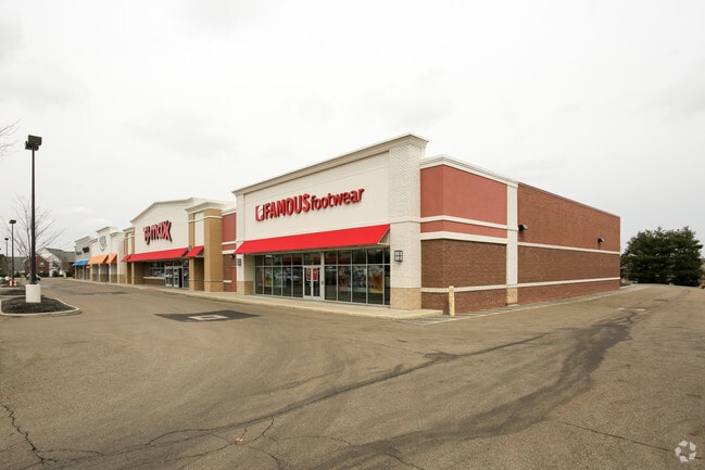
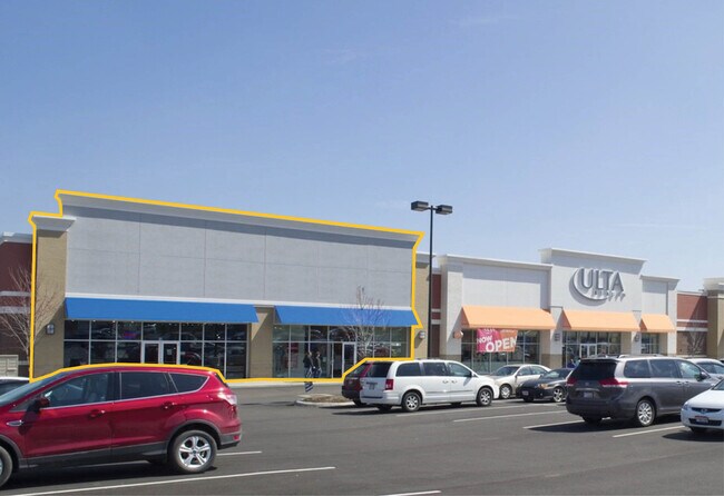
Property Record
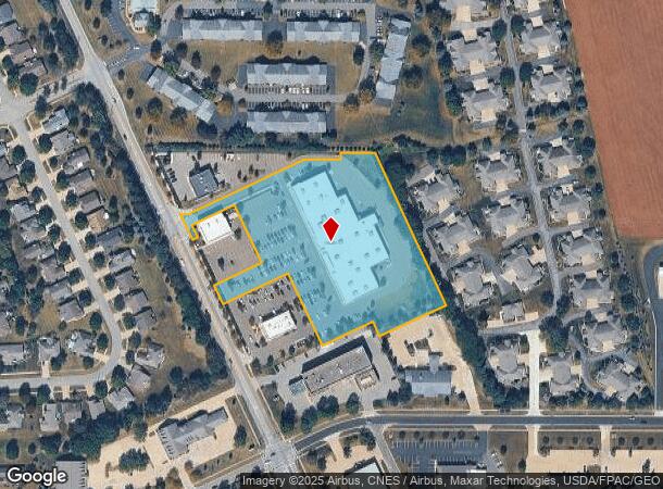
4369 Burbank Rd, Wooster, OH 44691

NEARBY LISTINGS FOR SALE OR LEASE
Property Detail
4369 Burbank Rd
Wooster, OH
Shoppes On Burbank
67-02862-003
SEC 21 LOT 9730 THE SHOPPES ON BURBANK 134.29' 4.574A MP 214
Communitycenter
Wayne
X
Ohio
39169C0202E
9730
2025
4.57 AC
2024
Ohio North Area
000700
Other Market Areas
45,230 SF
DEMOGRAPHICS near 4369 Burbank Rd
1 mile
3 mile
5 mile
2024 Total Population
2,178
21,049
37,319
2029 Population
2,182
21,204
37,590
Pop Growth 2024-2029
+ 0.18%
+ 0.74%
+ 0.73%
Average Age
47
44
41
2024 Total Households
950
9,114
15,209
HH Growth 2024-2029
(0.11%)
+ 0.59%
+ 0.64%
Median Household Inc
$64,275
$60,737
$56,568
Avg Household Size
2.20
2.20
2.20
2024 Avg HH Vehicles
2.00
2.00
2.00
Median Home Value
$260,648
$194,860
$182,017
Median Year Built
1993
1986
1975
Nearby Places
Map Layers
Map Styles
 Street
 Aerial
Transit
 Traffic
 Biking
Places
Listings with unknown addresses are not visible on the map
- Restaurants
- Banks
- Shops
- Fitness
- Groceries
PUBLIC TRANSPORTATION
AIRPORT
Akron-Canton Regional
Drive
Walk
Distance
Akron-Canton Regional
56 min
45.7 mi
Freight Ports
Port of Toledo
Drive
Walk
Distance
Port of Toledo
165 min
119.8 mi
SALE & LEASE HISTORY
LISTING DATE
SALE/LEASE

Oct 12, 2020
For Lease
Nearby Properties
Address
Land Use
TOTAL SIZE
Lot Size
Zoning
Address
Land Use
TOTAL SIZE
Lot Size
Zoning
3,488 SF
43.72 AC
CF
Address
Land Use
TOTAL SIZE
Lot Size
Zoning
70,726 SF
9 AC
CF
Address
Land Use
TOTAL SIZE
Lot Size
Zoning
152,523 SF
74.14 AC
CF
Address
Land Use
TOTAL SIZE
Lot Size
Zoning
81,133 SF
41.43 AC
CF
Address
Land Use
TOTAL SIZE
Lot Size
Zoning
608,111 SF
44 AC
Address
Land Use
TOTAL SIZE
Lot Size
Zoning
59.44 AC
Address
Land Use
TOTAL SIZE
Lot Size
Zoning
51.79 AC
M2
Address
Land Use
TOTAL SIZE
Lot Size
Zoning
227,500 SF
58.38 AC
Address
Land Use
TOTAL SIZE
Lot Size
Zoning
198,900 SF
17.94 AC
Address
Land Use
TOTAL SIZE
Lot Size
Zoning
46,230 SF
38.46 AC
Address
Land Use
TOTAL SIZE
Lot Size
Zoning
50,110 SF
19.26 AC
CF
Address
Land Use
TOTAL SIZE
Lot Size
Zoning
160,158 SF
14.21 AC
Address
Land Use
TOTAL SIZE
Lot Size
Zoning
62,910 SF
11.24 AC
C5
Address
Land Use
TOTAL SIZE
Lot Size
Zoning
125,350 SF
17.20 AC
C5
Address
Land Use
TOTAL SIZE
Lot Size
Zoning
98,810 SF
12.42 AC
CF
Address
Land Use
TOTAL SIZE
Lot Size
Zoning
2,536 SF
16.79 AC
R4
Address
Land Use
TOTAL SIZE
Lot Size
Zoning
62,976 SF
10.46 AC
CF
Address
Land Use
TOTAL SIZE
Lot Size
Zoning
81,724 SF
19.59 AC
CF
Address
Land Use
TOTAL SIZE
Lot Size
Zoning
41,173 SF
6.77 AC
Address
Land Use
TOTAL SIZE
Lot Size
Zoning
36,220 SF
2.68 AC
R1
Address
Land Use
TOTAL SIZE
Lot Size
Zoning
6,120 SF
12.43 AC
R4
Address
Land Use
TOTAL SIZE
Lot Size
Zoning
3,846 SF
129.65 AC
CF
Address
Land Use
TOTAL SIZE
Lot Size
Zoning
49,001 SF
9.79 AC
C5
Address
Land Use
TOTAL SIZE
Lot Size
Zoning
134,248 SF
14.37 AC
C5
Address
Land Use
TOTAL SIZE
Lot Size
Zoning
59,344 SF
1.91 AC
Address
Land Use
TOTAL SIZE
Lot Size
Zoning
6,631 SF
7.18 AC
R4
Address
Land Use
TOTAL SIZE
Lot Size
Zoning
19,806 SF
11.70 AC
C5
Address
Land Use
TOTAL SIZE
Lot Size
Zoning
2,380 SF
10.01 AC
CF
Address
Land Use
TOTAL SIZE
Lot Size
Zoning
71,758 SF
12.08 AC
C5
Address
Land Use
TOTAL SIZE
Lot Size
Zoning
1,890 SF
6.96 AC
CF
The World's #1 Commercial Real Estate Marketplace
Connect with us
© 2026 CoStar Group
The information above has been obtained from sources believed reliable. While we do not doubt its accuracy we have not verified it and make no guarantee, warranty or representation about it. It is your responsibility to independently confirm its accuracy and completeness. Any projections, opinions, assumptions, or estimates used are for example only and do not represent the current or future performance of the property. The value of this transaction to you depends on tax and other factors which should be evaluated by your tax, financial, and legal advisors. You and your advisors should conduct a careful, independent investigation of the property to determine to your satisfaction the suitability of the property for your needs.