Property Record
439 W Stevens Dr, Addison, IL 60101


Save to a Folder
{{folder.Name}}
{{folder.ListingIds.length}} Properties
{{folder.ListingIds.length}} Property
Create a New Folder
Property Detail
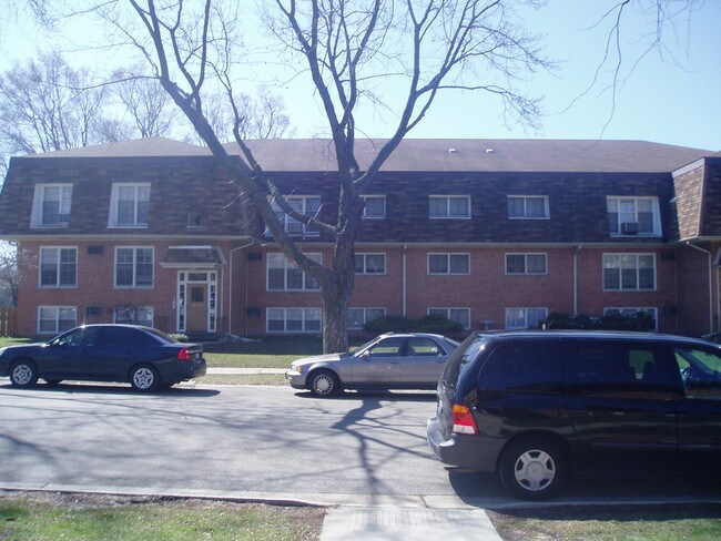
439 W Stevens Dr
03-29-202-005
CHATEAU MILL CONDO BLDG NO 1 UNIT P-28 .0002 PERCENT COMM INT
Commercialnec
DUPAGE
M
Illinois
B and X Area of moderate flood hazard, usually the area between the limits of the 100-year and 500-year floods.
0.93 AC
2024
Northeast DuPage County
2024
Chicago
840303
Chicago-Naperville-Elgin, IL-IN
16,192 SF
NEARBY LISTINGS FOR SALE OR LEASE
DEMOGRAPHICS near 439 W Stevens Dr
1 mile
3 mile
5 mile
2025 Total Population
18,209
84,072
252,229
2030 Population
18,398
84,594
254,289
Pop Growth 2025-2030
+ 1.04%
+ 0.62%
+ 0.82%
Average Age
39
41
41
2025 Total Households
6,131
29,541
91,369
HH Growth 2025-2030
+ 1.01%
+ 0.56%
+ 0.77%
Median Household Inc
$78,456
$91,783
$98,746
Avg Household Size
2.90
2.80
2.70
2025 Avg HH Vehicles
2.00
2.00
2.00
Median Home Value
$302,364
$330,617
$348,664
Median Year Built
1967
1968
1969
Nearby Places
Map Layers
Map Styles
 Street
 Aerial
Layers
 Traffic
 Biking
Places
Listings with unknown addresses are not visible on the map
- Restaurants
- Banks
- Shops
- Fitness
- Groceries
PUBLIC TRANSPORTATION
COMMUTER RAIL
Itasca Station (Milwaukee District West Line - Northeast Illinois Regional Commuter Railroad (Metra))
Drive
Walk
Distance
Itasca Station (Milwaukee District West Line - Northeast Illinois Regional Commuter Railroad (Metra))
8 min
3.2 mi
Wood Dale Station (Milwaukee District West Line - Northeast Illinois Regional Commuter Railroad (Metra))
Drive
Walk
Distance
Wood Dale Station (Milwaukee District West Line - Northeast Illinois Regional Commuter Railroad (Metra))
8 min
4.2 mi
AIRPORT
Chicago O'Hare International
Drive
Walk
Distance
Chicago O'Hare International
22 min
13.1 mi
Chicago Midway International
Drive
Walk
Distance
Chicago Midway International
32 min
19.9 mi
Freight Ports
Port Milwaukee
Drive
Walk
Distance
Port Milwaukee
106 min
87.0 mi
Nearby Properties
Address
Land Use
TOTAL SIZE
Lot Size
Zoning
Address
Land Use
TOTAL SIZE
Lot Size
Zoning
780,693 SF
42.30 AC
I
Address
Land Use
TOTAL SIZE
Lot Size
Zoning
459,796 SF
18.15 AC
I
Address
Land Use
TOTAL SIZE
Lot Size
Zoning
14.37 AC
I
Address
Land Use
TOTAL SIZE
Lot Size
Zoning
309,864 SF
37.33 AC
I
Address
Land Use
TOTAL SIZE
Lot Size
Zoning
453,152 SF
20.35 AC
I
Address
Land Use
TOTAL SIZE
Lot Size
Zoning
139,923 SF
11.98 AC
I
Address
Land Use
TOTAL SIZE
Lot Size
Zoning
136,975 SF
1.90 AC
Address
Land Use
TOTAL SIZE
Lot Size
Zoning
15.33 AC
M
Address
Land Use
TOTAL SIZE
Lot Size
Zoning
10.60 AC
Address
Land Use
TOTAL SIZE
Lot Size
Zoning
205,000 SF
16.78 AC
I
Address
Land Use
TOTAL SIZE
Lot Size
Zoning
139,672 SF
15.41 AC
I
Address
Land Use
TOTAL SIZE
Lot Size
Zoning
79,628 SF
9.31 AC
I
Address
Land Use
TOTAL SIZE
Lot Size
Zoning
4.08 AC
Address
Land Use
TOTAL SIZE
Lot Size
Zoning
179,220 SF
9.29 AC
I
Address
Land Use
TOTAL SIZE
Lot Size
Zoning
286,305 SF
12.29 AC
I
Address
Land Use
TOTAL SIZE
Lot Size
Zoning
265,058 SF
15.05 AC
I
Address
Land Use
TOTAL SIZE
Lot Size
Zoning
354,115 SF
24.95 AC
C
Address
Land Use
TOTAL SIZE
Lot Size
Zoning
60,372 SF
8.99 AC
I
Address
Land Use
TOTAL SIZE
Lot Size
Zoning
2.79 AC
R-3
Address
Land Use
TOTAL SIZE
Lot Size
Zoning
237,520 SF
9.98 AC
I
Address
Land Use
TOTAL SIZE
Lot Size
Zoning
202,468 SF
9.39 AC
I
Address
Land Use
TOTAL SIZE
Lot Size
Zoning
257,335 SF
16.97 AC
I
Address
Land Use
TOTAL SIZE
Lot Size
Zoning
7.16 AC
I
Address
Land Use
TOTAL SIZE
Lot Size
Zoning
121,107 SF
3.19 AC
I
Address
Land Use
TOTAL SIZE
Lot Size
Zoning
258,333 SF
14.30 AC
I
Address
Land Use
TOTAL SIZE
Lot Size
Zoning
20,312 SF
3.53 AC
C
Address
Land Use
TOTAL SIZE
Lot Size
Zoning
110,164 SF
3.83 AC
I
Address
Land Use
TOTAL SIZE
Lot Size
Zoning
226,543 SF
9.62 AC
I
Address
Land Use
TOTAL SIZE
Lot Size
Zoning
225,637 SF
13.93 AC
C
Address
Land Use
TOTAL SIZE
Lot Size
Zoning
205,926 SF
8.06 AC
I
The World's #1 Commercial Real Estate Marketplace
Connect with us
© 2026 CoStar Group
The information above has been obtained from sources believed reliable. While we do not doubt its accuracy we have not verified it and make no guarantee, warranty or representation about it. It is your responsibility to independently confirm its accuracy and completeness. Any projections, opinions, assumptions, or estimates used are for example only and do not represent the current or future performance of the property. The value of this transaction to you depends on tax and other factors which should be evaluated by your tax, financial, and legal advisors. You and your advisors should conduct a careful, independent investigation of the property to determine to your satisfaction the suitability of the property for your needs.