Property Record
4390 Highway 47, Washington, MO 63090


NEARBY LISTINGS FOR SALE OR LEASE
Property Detail
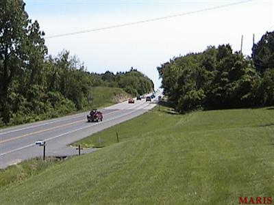
4390 Highway 47
10-7-350-0-000-013000
PT W 1/2 NW
Agriculturalland
Franklin
X
Missouri
29071C0145D
7.20 AC
2025
Franklin County
2025
St. Louis
800202
St. Louis, MO-IL
1,467 SF
DEMOGRAPHICS near 4390 Highway 47
1 mile
3 mile
5 mile
2024 Total Population
2,040
18,049
26,127
2029 Population
2,102
18,561
26,815
Pop Growth 2024-2029
+ 3.04%
+ 2.84%
+ 2.63%
Average Age
44
42
42
2024 Total Households
807
7,490
10,545
HH Growth 2024-2029
+ 2.97%
+ 2.78%
+ 2.57%
Median Household Inc
$110,692
$74,192
$75,470
Avg Household Size
2.50
2.30
2.40
2024 Avg HH Vehicles
2.00
2.00
2.00
Median Home Value
$314,147
$208,067
$217,506
Median Year Built
1996
1979
1982
Nearby Places
Map Layers
Map Styles
 Street
 Aerial
Transit
 Traffic
 Biking
Places
Listings with unknown addresses are not visible on the map
- Restaurants
- Banks
- Shops
- Fitness
- Groceries
PUBLIC TRANSPORTATION
COMMUTER RAIL
Washington Amtrak Station (Lincoln Service Missouri River Runner - Amtrak, Missouri River Runner - Amtrak)
Drive
Walk
Distance
Washington Amtrak Station (Lincoln Service Missouri River Runner - Amtrak, Missouri River Runner - Amtrak)
7 min
3.1 mi
Freight Ports
Tulsa Port of Inola
Drive
Walk
Distance
Tulsa Port of Inola
381 min
345.0 mi
Nearby Properties
Address
Land Use
TOTAL SIZE
Lot Size
Zoning
Address
Land Use
TOTAL SIZE
Lot Size
Zoning
213,953 SF
5.40 AC
Address
Land Use
TOTAL SIZE
Lot Size
Zoning
2,119 SF
40.90 AC
Address
Land Use
TOTAL SIZE
Lot Size
Zoning
25,352 SF
37.70 AC
Address
Land Use
TOTAL SIZE
Lot Size
Zoning
2,900 SF
12.30 AC
Address
Land Use
TOTAL SIZE
Lot Size
Zoning
110,113 SF
29.70 AC
Address
Land Use
TOTAL SIZE
Lot Size
Zoning
10,508 SF
107.30 AC
Address
Land Use
TOTAL SIZE
Lot Size
Zoning
49,142 SF
3.10 AC
Address
Land Use
TOTAL SIZE
Lot Size
Zoning
23,271 SF
1.20 AC
Address
Land Use
TOTAL SIZE
Lot Size
Zoning
239,205 SF
3.60 AC
Address
Land Use
TOTAL SIZE
Lot Size
Zoning
217,772 SF
26.90 AC
Address
Land Use
TOTAL SIZE
Lot Size
Zoning
3,300 SF
28.10 AC
CD
Address
Land Use
TOTAL SIZE
Lot Size
Zoning
53,164 SF
12.50 AC
Address
Land Use
TOTAL SIZE
Lot Size
Zoning
51,250 SF
1.60 AC
Address
Land Use
TOTAL SIZE
Lot Size
Zoning
38,591 SF
4.60 AC
Address
Land Use
TOTAL SIZE
Lot Size
Zoning
25,147 SF
1.60 AC
Address
Land Use
TOTAL SIZE
Lot Size
Zoning
10,773 SF
1.60 AC
Address
Land Use
TOTAL SIZE
Lot Size
Zoning
21,726 SF
6 AC
Address
Land Use
TOTAL SIZE
Lot Size
Zoning
15,585 SF
0.80 AC
Address
Land Use
TOTAL SIZE
Lot Size
Zoning
960 SF
24 AC
Address
Land Use
TOTAL SIZE
Lot Size
Zoning
127,227 SF
9.90 AC
Address
Land Use
TOTAL SIZE
Lot Size
Zoning
23,430 SF
4.50 AC
Address
Land Use
TOTAL SIZE
Lot Size
Zoning
167.10 AC
Address
Land Use
TOTAL SIZE
Lot Size
Zoning
16,882 SF
2.90 AC
Address
Land Use
TOTAL SIZE
Lot Size
Zoning
11.50 AC
Address
Land Use
TOTAL SIZE
Lot Size
Zoning
137,582 SF
8.50 AC
Address
Land Use
TOTAL SIZE
Lot Size
Zoning
11,074 SF
0.50 AC
Address
Land Use
TOTAL SIZE
Lot Size
Zoning
23,069 SF
1.80 AC
Address
Land Use
TOTAL SIZE
Lot Size
Zoning
23,115 SF
5.70 AC
Address
Land Use
TOTAL SIZE
Lot Size
Zoning
105,388 SF
10.10 AC
Address
Land Use
TOTAL SIZE
Lot Size
Zoning
91,480 SF
0.40 AC
The World's #1 Commercial Real Estate Marketplace
Connect with us
© 2026 CoStar Group
The information above has been obtained from sources believed reliable. While we do not doubt its accuracy we have not verified it and make no guarantee, warranty or representation about it. It is your responsibility to independently confirm its accuracy and completeness. Any projections, opinions, assumptions, or estimates used are for example only and do not represent the current or future performance of the property. The value of this transaction to you depends on tax and other factors which should be evaluated by your tax, financial, and legal advisors. You and your advisors should conduct a careful, independent investigation of the property to determine to your satisfaction the suitability of the property for your needs.