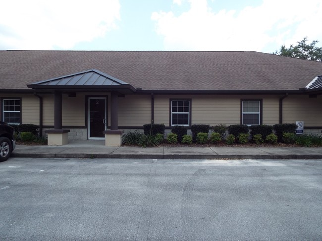
Property Record
4390 Ne 35Th St, Ocala, FL 34479

Current Lease Availabilities
NEARBY LISTINGS FOR SALE OR LEASE
Property Detail
4390 Ne 35Th St
24247-006010
35Th Street Industrial Complex, A Condom
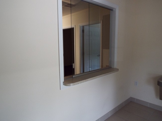
Officebuilding
SEC 02 TWP 15 RGE 22 35TH STREET INDUSTRIAL COMPLEX, A CONDOMINIUM PER DECLARATION RECORDED IN OR 5134 PG 1760 UNIT 7 MORE FULLY DESC AS FOLLOWS: COM AT A POINT ON THE SLY ROW LINE OF NE 35TH ST SAID POINT BEING 1236.04 FT W AND 30 FT S OF THE NW COR
X
Marion
12083C0530E
Florida
2025
0.14 AC
2025
Greater Ocala
001403
Ocala
6,162 SF
Ocala, FL
DEMOGRAPHICS near 4390 Ne 35Th St
1 Mile
3 Mile
5 Mile
2024 Total Population
4,283
30,301
71,163
2029 Population
4,908
34,078
80,034
Pop Growth 2024-2029
+ 14.59%
+ 12.46%
+ 12.47%
Average Age
41
41
41
2024 Total Households
1,975
12,937
29,275
HH Growth 2024-2029
+ 14.68%
+ 12.48%
+ 12.46%
Median Household Inc
$45,722
$52,304
$56,748
Avg Household Size
2.20
2.30
2.40
2024 Avg HH Vehicles
1.00
2.00
2.00
Median Home Value
$123,766
$156,877
$185,273
Median Year Built
1987
1981
1982
Nearby Places
Map Layers
Map Styles
 Street
 Aerial
- Restaurants
- Banks
- Shops
- Fitness
- Groceries
Nearby Properties
Address
Land Use
TOTAL SIZE
Lot Size
Zoning
Address
Land Use
TOTAL SIZE
Lot Size
Zoning
205,664 SF
22.56 AC
B5
Address
Land Use
TOTAL SIZE
Lot Size
Zoning
116,035 SF
38.20 AC
GU
Address
Land Use
TOTAL SIZE
Lot Size
Zoning
111,395 SF
13 AC
B2
Address
Land Use
TOTAL SIZE
Lot Size
Zoning
30,334 SF
34.53 AC
GU
Address
Land Use
TOTAL SIZE
Lot Size
Zoning
78,280 SF
12.54 AC
R3
Address
Land Use
TOTAL SIZE
Lot Size
Zoning
203,940 SF
29.65 AC
SC
Address
Land Use
TOTAL SIZE
Lot Size
Zoning
134,827 SF
14.83 AC
SC
Address
Land Use
TOTAL SIZE
Lot Size
Zoning
2,541.29 AC
A1
Address
Land Use
TOTAL SIZE
Lot Size
Zoning
192,553 SF
21.18 AC
SC
Address
Land Use
TOTAL SIZE
Lot Size
Zoning
10,552 SF
51.60 AC
PRV
Address
Land Use
TOTAL SIZE
Lot Size
Zoning
134,890 SF
18.90 AC
B4
Address
Land Use
TOTAL SIZE
Lot Size
Zoning
35,356 SF
6.14 AC
R3
Address
Land Use
TOTAL SIZE
Lot Size
Zoning
81,689 SF
11.05 AC
B2
Address
Land Use
TOTAL SIZE
Lot Size
Zoning
81,174 SF
18.50 AC
B2
Address
Land Use
TOTAL SIZE
Lot Size
Zoning
22,083 SF
216.46 AC
B2
Address
Land Use
TOTAL SIZE
Lot Size
Zoning
47,567 SF
12 AC
INST
Address
Land Use
TOTAL SIZE
Lot Size
Zoning
27,949 SF
6.03 AC
R3
Address
Land Use
TOTAL SIZE
Lot Size
Zoning
14,344 SF
3.12 AC
B2
Address
Land Use
TOTAL SIZE
Lot Size
Zoning
39,552 SF
5.97 AC
R3
Address
Land Use
TOTAL SIZE
Lot Size
Zoning
36,064 SF
5.31 AC
R3
Address
Land Use
TOTAL SIZE
Lot Size
Zoning
91,003 SF
6.31 AC
B1
Address
Land Use
TOTAL SIZE
Lot Size
Zoning
60,099 SF
52.96 AC
B2
Address
Land Use
TOTAL SIZE
Lot Size
Zoning
98,080 SF
6.69 AC
M1
Address
Land Use
TOTAL SIZE
Lot Size
Zoning
125,469 SF
6.96 AC
M1
Address
Land Use
TOTAL SIZE
Lot Size
Zoning
78,751 SF
20 AC
GU
Address
Land Use
TOTAL SIZE
Lot Size
Zoning
76,132 SF
9.40 AC
R3
Address
Land Use
TOTAL SIZE
Lot Size
Zoning
67,409 SF
7.13 AC
B4
Address
Land Use
TOTAL SIZE
Lot Size
Zoning
18,564 SF
3.25 AC
INST
Address
Land Use
TOTAL SIZE
Lot Size
Zoning
10,800 SF
2.82 AC
B2A
Address
Land Use
TOTAL SIZE
Lot Size
Zoning
60,576 SF
20.47 AC
INST
The World's #1 Commercial Real Estate Marketplace
Connect with us
© 2025 CoStar Group
The information above has been obtained from sources believed reliable. While we do not doubt its accuracy we have not verified it and make no guarantee, warranty or representation about it. It is your responsibility to independently confirm its accuracy and completeness. Any projections, opinions, assumptions, or estimates used are for example only and do not represent the current or future performance of the property. The value of this transaction to you depends on tax and other factors which should be evaluated by your tax, financial, and legal advisors. You and your advisors should conduct a careful, independent investigation of the property to determine to your satisfaction the suitability of the property for your needs.