Property Record
4395 N Wilson Ave, Loveland, CO 80538
NEARBY LISTINGS FOR SALE OR LEASE
Property Detail
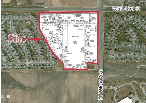
4395 N Wilson Ave
Fort Collins, CO
Giuliano Third Sub Lov (20040119616)
96334-25-001
OUTLOT B, GIULIANO THIRD SUB LOV (20040119616)
Farms
Larimer
X
Colorado
08069C1200F
b
2024
6.62 AC
2025
Outlying Larimer County
001807
Denver
DEMOGRAPHICS near 4395 N Wilson Ave
1 Mile
3 Mile
5 Mile
2024 Total Population
8,120
41,198
87,673
2029 Population
8,553
43,319
92,131
Pop Growth 2024-2029
+ 5.33%
+ 5.15%
+ 5.08%
Average Age
43
44
43
2024 Total Households
3,245
17,060
36,317
HH Growth 2024-2029
+ 5.67%
+ 5.43%
+ 5.34%
Median Household Inc
$88,659
$72,948
$75,426
Avg Household Size
2.50
2.40
2.40
2024 Avg HH Vehicles
2.00
2.00
2.00
Median Home Value
$439,781
$423,354
$430,876
Median Year Built
2001
1988
1990
Nearby Places
Map Layers
Map Styles
 Street
 Aerial
- Restaurants
- Banks
- Shops
- Fitness
- Groceries
SALE & LEASE HISTORY
LISTING DATE
SALE/LEASE

May 12, 2017
For Sale
Nearby Properties
Address
Land Use
TOTAL SIZE
Lot Size
Zoning
Address
Land Use
TOTAL SIZE
Lot Size
Zoning
201,500 SF
28.43 AC
R1E
Address
Land Use
TOTAL SIZE
Lot Size
Zoning
573.74 AC
FA1
Address
Land Use
TOTAL SIZE
Lot Size
Zoning
117,434 SF
29.34 AC
R1
Address
Land Use
TOTAL SIZE
Lot Size
Zoning
137,225 SF
25.76 AC
R1
Address
Land Use
TOTAL SIZE
Lot Size
Zoning
222,636 SF
26.89 AC
P65
Address
Land Use
TOTAL SIZE
Lot Size
Zoning
82,749 SF
25.54 AC
R2
Address
Land Use
TOTAL SIZE
Lot Size
Zoning
117,157 SF
117.61 AC
Address
Land Use
TOTAL SIZE
Lot Size
Zoning
75,000 SF
2.96 AC
B
Address
Land Use
TOTAL SIZE
Lot Size
Zoning
123,130 SF
4.17 AC
Address
Land Use
TOTAL SIZE
Lot Size
Zoning
332,645 SF
14.16 AC
BUD
Address
Land Use
TOTAL SIZE
Lot Size
Zoning
162,703 SF
14.92 AC
B
Address
Land Use
TOTAL SIZE
Lot Size
Zoning
117,496 SF
6.24 AC
Address
Land Use
TOTAL SIZE
Lot Size
Zoning
125,250 SF
9.55 AC
P93
Address
Land Use
TOTAL SIZE
Lot Size
Zoning
41,580 SF
1.83 AC
B
Address
Land Use
TOTAL SIZE
Lot Size
Zoning
48,000 SF
10 AC
P58
Address
Land Use
TOTAL SIZE
Lot Size
Zoning
164,619 SF
11.54 AC
Address
Land Use
TOTAL SIZE
Lot Size
Zoning
59.21 AC
FA
Address
Land Use
TOTAL SIZE
Lot Size
Zoning
50,715 SF
10.23 AC
R1
Address
Land Use
TOTAL SIZE
Lot Size
Zoning
58,901 SF
3.64 AC
B
Address
Land Use
TOTAL SIZE
Lot Size
Zoning
54,950 SF
12.37 AC
P73
Address
Land Use
TOTAL SIZE
Lot Size
Zoning
387,075 SF
17.61 AC
Address
Land Use
TOTAL SIZE
Lot Size
Zoning
50,098 SF
4.49 AC
B
Address
Land Use
TOTAL SIZE
Lot Size
Zoning
51,000 SF
4.21 AC
I
Address
Land Use
TOTAL SIZE
Lot Size
Zoning
60,896 SF
8.72 AC
I
Address
Land Use
TOTAL SIZE
Lot Size
Zoning
33,500 SF
7.18 AC
R1
Address
Land Use
TOTAL SIZE
Lot Size
Zoning
31,800 SF
2.99 AC
B
Address
Land Use
TOTAL SIZE
Lot Size
Zoning
89,748 SF
8.02 AC
B
Address
Land Use
TOTAL SIZE
Lot Size
Zoning
97,225 SF
4.60 AC
P55
Address
Land Use
TOTAL SIZE
Lot Size
Zoning
50,175 SF
7.54 AC
I
Address
Land Use
TOTAL SIZE
Lot Size
Zoning
87,518 SF
8.02 AC
The World's #1 Commercial Real Estate Marketplace
Connect with us
© 2025 CoStar Group
The information above has been obtained from sources believed reliable. While we do not doubt its accuracy we have not verified it and make no guarantee, warranty or representation about it. It is your responsibility to independently confirm its accuracy and completeness. Any projections, opinions, assumptions, or estimates used are for example only and do not represent the current or future performance of the property. The value of this transaction to you depends on tax and other factors which should be evaluated by your tax, financial, and legal advisors. You and your advisors should conduct a careful, independent investigation of the property to determine to your satisfaction the suitability of the property for your needs.