Property Record
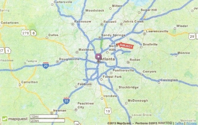
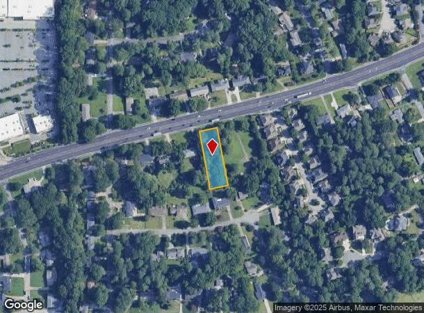
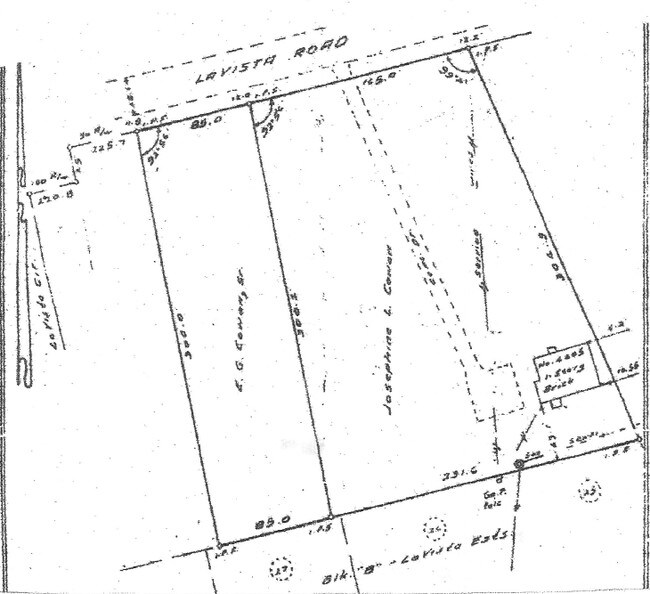
4397 Lavista Rd, Tucker, GA 30084
NEARBY LISTINGS FOR SALE OR LEASE
-
-
-
-
-
-
-
No Photo
-
View all Tucker listings for sale on LoopNet.com
Property Detail
4397 Lavista Rd
Atlanta-Sandy Springs-Roswell, GA
85 X 285 X 85 X 285 . 55 AC
18-211-02-007
DeKalb
Vacantlandnec
Georgia
X
7
13089C0076K
0.53 AC
2025
Northlake/Lavista
2025
Atlanta
021819
DEMOGRAPHICS near 4397 Lavista Rd
1 Mile
3 Mile
5 Mile
2024 Total Population
7,887
85,420
280,299
2029 Population
7,914
85,092
281,657
Pop Growth 2024-2029
+ 0.34%
(0.38%)
+ 0.48%
Average Age
41
39
37
2024 Total Households
3,549
33,547
108,474
HH Growth 2024-2029
+ 0.37%
(0.36%)
+ 0.45%
Median Household Inc
$79,340
$78,621
$64,608
Avg Household Size
2.20
2.50
2.50
2024 Avg HH Vehicles
2.00
2.00
2.00
Median Home Value
$332,559
$346,735
$332,883
Median Year Built
1979
1974
1979
Nearby Places
Map Layers
Map Styles
 Street
 Aerial
- Restaurants
- Banks
- Shops
- Fitness
- Groceries
PUBLIC TRANSPORTATION
AIRPORT
Hartsfield - Jackson Atlanta International
DRIVE
WALK
Distance
Hartsfield - Jackson Atlanta International
32 min
23.6 mi
Freight Ports
Georgia Ports - Savannah
DRIVE
WALK
Distance
Georgia Ports - Savannah
286 min
255.5 mi
SALE & LEASE HISTORY
LISTING DATE
SALE/LEASE

Jul 10, 2017
For Sale
Nearby Properties
Address
Land Use
TOTAL SIZE
Lot Size
Zoning
Address
Land Use
TOTAL SIZE
Lot Size
Zoning
377,506 SF
8.70 AC
X
Address
Land Use
TOTAL SIZE
Lot Size
Zoning
267,983 SF
13 AC
X
Address
Land Use
TOTAL SIZE
Lot Size
Zoning
208,608 SF
20.89 AC
OI: OFFICE
Address
Land Use
TOTAL SIZE
Lot Size
Zoning
179,762 SF
4.96 AC
C1
Address
Land Use
TOTAL SIZE
Lot Size
Zoning
819,703 SF
55.80 AC
M
Address
Land Use
TOTAL SIZE
Lot Size
Zoning
503,480 SF
50.04 AC
RM150
Address
Land Use
TOTAL SIZE
Lot Size
Zoning
228,504 SF
15.57 AC
M
Address
Land Use
TOTAL SIZE
Lot Size
Zoning
70,929 SF
6.64 AC
C1: LOCAL
Address
Land Use
TOTAL SIZE
Lot Size
Zoning
355,421 SF
7.03 AC
X
Address
Land Use
TOTAL SIZE
Lot Size
Zoning
185,066 SF
25.53 AC
O-1
Address
Land Use
TOTAL SIZE
Lot Size
Zoning
313,420 SF
12.74 AC
X
Address
Land Use
TOTAL SIZE
Lot Size
Zoning
587,493 SF
29.79 AC
X
Address
Land Use
TOTAL SIZE
Lot Size
Zoning
222,799 SF
11.59 AC
X
Address
Land Use
TOTAL SIZE
Lot Size
Zoning
213,410 SF
20.68 AC
O-1
Address
Land Use
TOTAL SIZE
Lot Size
Zoning
169,005 SF
11.81 AC
O-1
Address
Land Use
TOTAL SIZE
Lot Size
Zoning
180,586 SF
8.70 AC
X
Address
Land Use
TOTAL SIZE
Lot Size
Zoning
385,221 SF
27.41 AC
RM85
Address
Land Use
TOTAL SIZE
Lot Size
Zoning
135,350 SF
9.01 AC
RM-HD
Address
Land Use
TOTAL SIZE
Lot Size
Zoning
89,362 SF
13.99 AC
M
Address
Land Use
TOTAL SIZE
Lot Size
Zoning
337,746 SF
29.94 AC
RM100
Address
Land Use
TOTAL SIZE
Lot Size
Zoning
170,933 SF
15.39 AC
X
Address
Land Use
TOTAL SIZE
Lot Size
Zoning
158,068 SF
9.21 AC
X
Address
Land Use
TOTAL SIZE
Lot Size
Zoning
480,302 SF
34.46 AC
RM85
Address
Land Use
TOTAL SIZE
Lot Size
Zoning
299,798 SF
17.20 AC
X
Address
Land Use
TOTAL SIZE
Lot Size
Zoning
240,276 SF
19.53 AC
RM85
Address
Land Use
TOTAL SIZE
Lot Size
Zoning
188,550 SF
15.40 AC
C1
Address
Land Use
TOTAL SIZE
Lot Size
Zoning
121,320 SF
13.77 AC
OI
Address
Land Use
TOTAL SIZE
Lot Size
Zoning
170,734 SF
14.90 AC
RM75
Address
Land Use
TOTAL SIZE
Lot Size
Zoning
297,750 SF
24 AC
RM150
Address
Land Use
TOTAL SIZE
Lot Size
Zoning
124,868 SF
14.82 AC
The World's #1 Commercial Real Estate Marketplace
Connect with us
© 2025 CoStar Group
The information above has been obtained from sources believed reliable. While we do not doubt its accuracy we have not verified it and make no guarantee, warranty or representation about it. It is your responsibility to independently confirm its accuracy and completeness. Any projections, opinions, assumptions, or estimates used are for example only and do not represent the current or future performance of the property. The value of this transaction to you depends on tax and other factors which should be evaluated by your tax, financial, and legal advisors. You and your advisors should conduct a careful, independent investigation of the property to determine to your satisfaction the suitability of the property for your needs.