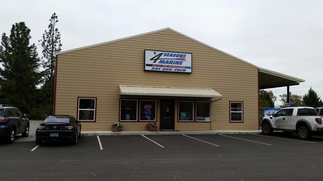
Property Record
4399 Table Rock Rd, Central Point, OR 97502


Property Detail
4399 Table Rock Rd
10926224
Jackson
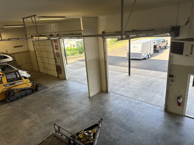
Industrialgeneral
Oregon
CN
179
B and X Area of moderate flood hazard, usually the area between the limits of the 100-year and 500-year floods.
1.52 AC
2025
Medford/Grants Pass
2026
Other Market Areas
001100
Medford, OR
4,000 SF
NEARBY LISTINGS FOR SALE OR LEASE
DEMOGRAPHICS near 4399 Table Rock Rd
1 mile
3 mile
5 mile
2025 Total Population
3,791
43,778
98,414
2030 Population
3,695
42,954
96,467
Pop Growth 2025-2030
(2.53%)
(1.88%)
(1.98%)
Average Age
43
40
40
2025 Total Households
1,443
16,696
37,420
HH Growth 2025-2030
(2.91%)
(2.01%)
(2.14%)
Median Household Inc
$71,901
$74,568
$70,743
Avg Household Size
2.50
2.50
2.50
2025 Avg HH Vehicles
2.00
2.00
2.00
Median Home Value
$419,164
$369,479
$377,806
Median Year Built
1999
1989
1981
Nearby Places
Map Layers
Map Styles
 Street
 Aerial
Layers
 Traffic
 Biking
Places
Listings with unknown addresses are not visible on the map
- Restaurants
- Banks
- Shops
- Fitness
- Groceries
PUBLIC TRANSPORTATION
AIRPORT
Rogue Valley International - Medford
Drive
Walk
Distance
Rogue Valley International - Medford
3 min
1.3 mi
SALE & LEASE HISTORY
LISTING DATE
SALE/LEASE

May 21, 2025
For Lease
Apr 10, 2019
For Sale
Nearby Properties
Address
Land Use
TOTAL SIZE
Lot Size
Zoning
Address
Land Use
TOTAL SIZE
Lot Size
Zoning
290.83 AC
I-L
Address
Land Use
TOTAL SIZE
Lot Size
Zoning
249,867 SF
61.31 AC
SFR-4
Address
Land Use
TOTAL SIZE
Lot Size
Zoning
22.07 AC
GI
Address
Land Use
TOTAL SIZE
Lot Size
Zoning
600,000 SF
18.27 AC
M-1
Address
Land Use
TOTAL SIZE
Lot Size
Zoning
531,599 SF
26.34 AC
C-R
Address
Land Use
TOTAL SIZE
Lot Size
Zoning
31.96 AC
GI
Address
Land Use
TOTAL SIZE
Lot Size
Zoning
177,106 SF
16.28 AC
C-C
Address
Land Use
TOTAL SIZE
Lot Size
Zoning
176,910 SF
17.78 AC
C-R
Address
Land Use
TOTAL SIZE
Lot Size
Zoning
43.71 AC
GI
Address
Land Use
TOTAL SIZE
Lot Size
Zoning
11,180 SF
1.58 AC
MFR-20
Address
Land Use
TOTAL SIZE
Lot Size
Zoning
88,434 SF
12.10 AC
I-L
Address
Land Use
TOTAL SIZE
Lot Size
Zoning
125,910 SF
14.29 AC
C-R
Address
Land Use
TOTAL SIZE
Lot Size
Zoning
30.87 AC
CIVIC
Address
Land Use
TOTAL SIZE
Lot Size
Zoning
88.67 AC
I-L
Address
Land Use
TOTAL SIZE
Lot Size
Zoning
136,756 SF
12.50 AC
C-R
Address
Land Use
TOTAL SIZE
Lot Size
Zoning
177.42 AC
GI
Address
Land Use
TOTAL SIZE
Lot Size
Zoning
1,680 SF
43.61 AC
GI
Address
Land Use
TOTAL SIZE
Lot Size
Zoning
109,042 SF
7.06 AC
C-R
Address
Land Use
TOTAL SIZE
Lot Size
Zoning
15.97 AC
GI
Address
Land Use
TOTAL SIZE
Lot Size
Zoning
6,039 SF
5.26 AC
MMR
Address
Land Use
TOTAL SIZE
Lot Size
Zoning
77,232 SF
1.46 AC
MFR-20
Address
Land Use
TOTAL SIZE
Lot Size
Zoning
13.49 AC
M-1
Address
Land Use
TOTAL SIZE
Lot Size
Zoning
31,283 SF
2.95 AC
I-L
Address
Land Use
TOTAL SIZE
Lot Size
Zoning
116,000 SF
5.17 AC
MFR-30
Address
Land Use
TOTAL SIZE
Lot Size
Zoning
164,324 SF
7.40 AC
C-R
Address
Land Use
TOTAL SIZE
Lot Size
Zoning
144,396 SF
10.67 AC
C-R
Address
Land Use
TOTAL SIZE
Lot Size
Zoning
102,184 SF
5.82 AC
I-L
Address
Land Use
TOTAL SIZE
Lot Size
Zoning
164,324 SF
6.42 AC
C-R
Address
Land Use
TOTAL SIZE
Lot Size
Zoning
80,753 SF
7.68 AC
C-R
Address
Land Use
TOTAL SIZE
Lot Size
Zoning
98,547 SF
4.36 AC
I-L
The World's #1 Commercial Real Estate Marketplace
Connect with us
© 2026 CoStar Group
The information above has been obtained from sources believed reliable. While we do not doubt its accuracy we have not verified it and make no guarantee, warranty or representation about it. It is your responsibility to independently confirm its accuracy and completeness. Any projections, opinions, assumptions, or estimates used are for example only and do not represent the current or future performance of the property. The value of this transaction to you depends on tax and other factors which should be evaluated by your tax, financial, and legal advisors. You and your advisors should conduct a careful, independent investigation of the property to determine to your satisfaction the suitability of the property for your needs.