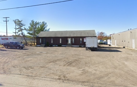
Property Record
44 A St, Johnston, RI 02919

Property Detail
44 A St
JOHN-000032-000000-000037
Providence
Industrialgeneral
Rhode Island
I
37
B and X Area of moderate flood hazard, usually the area between the limits of the 100-year and 500-year floods.
2.82 AC
2025
Johnston
2025
Providence
012200
Providence-Warwick, RI-MA
NEARBY LISTINGS FOR SALE OR LEASE
DEMOGRAPHICS near 44 A St
1 mile
3 mile
5 mile
2025 Total Population
788
18,402
99,080
2030 Population
831
19,276
102,643
Pop Growth 2025-2030
+ 5.46%
+ 4.75%
+ 3.60%
Average Age
45
44
42
2025 Total Households
269
7,204
38,605
HH Growth 2025-2030
+ 5.58%
+ 4.73%
+ 3.69%
Median Household Inc
$123,863
$115,041
$88,540
Avg Household Size
2.60
2.50
2.50
2025 Avg HH Vehicles
2.00
2.00
2.00
Median Home Value
$617,834
$473,210
$397,173
Median Year Built
1990
1983
1969
Nearby Places
Map Layers
Map Styles
 Street
 Aerial
Layers
 Traffic
 Biking
Places
Listings with unknown addresses are not visible on the map
- Restaurants
- Banks
- Shops
- Fitness
- Groceries
PUBLIC TRANSPORTATION
COMMUTER RAIL
Providence (Providence/Stoughton Line - Massachusetts Bay Transportation Authority Commuter Rail (Purple Line))
Drive
Walk
Distance
Providence (Providence/Stoughton Line - Massachusetts Bay Transportation Authority Commuter Rail (Purple Line))
16 min
8.9 mi
AIRPORT
Rhode Island Tf Green International
Drive
Walk
Distance
Rhode Island Tf Green International
22 min
11.3 mi
Worcester Regional
Drive
Walk
Distance
Worcester Regional
68 min
49.0 mi
Freight Ports
Port of Davisville, RI
Drive
Walk
Distance
Port of Davisville, RI
33 min
20.5 mi
Nearby Properties
Address
Land Use
TOTAL SIZE
Lot Size
Zoning
Address
Land Use
TOTAL SIZE
Lot Size
Zoning
32.30 AC
I
Address
Land Use
TOTAL SIZE
Lot Size
Zoning
13,542 SF
95.26 AC
R10
Address
Land Use
TOTAL SIZE
Lot Size
Zoning
15.35 AC
MPD
Address
Land Use
TOTAL SIZE
Lot Size
Zoning
0.97 AC
A12
Address
Land Use
TOTAL SIZE
Lot Size
Zoning
7.06 AC
R20
Address
Land Use
TOTAL SIZE
Lot Size
Zoning
96.12 AC
I
Address
Land Use
TOTAL SIZE
Lot Size
Zoning
122,836 SF
15.10 AC
R40
Address
Land Use
TOTAL SIZE
Lot Size
Zoning
8.33 AC
R10
Address
Land Use
TOTAL SIZE
Lot Size
Zoning
60,039 SF
18.41 AC
A80
Address
Land Use
TOTAL SIZE
Lot Size
Zoning
8,742 SF
16.26 AC
R40
Address
Land Use
TOTAL SIZE
Lot Size
Zoning
21.86 AC
I
Address
Land Use
TOTAL SIZE
Lot Size
Zoning
133.14 AC
R10
Address
Land Use
TOTAL SIZE
Lot Size
Zoning
93,878 SF
14.15 AC
B2
Address
Land Use
TOTAL SIZE
Lot Size
Zoning
153,214 SF
14.37 AC
C4
Address
Land Use
TOTAL SIZE
Lot Size
Zoning
10.50 AC
B2
Address
Land Use
TOTAL SIZE
Lot Size
Zoning
13.89 AC
B2
Address
Land Use
TOTAL SIZE
Lot Size
Zoning
11.40 AC
R10
Address
Land Use
TOTAL SIZE
Lot Size
Zoning
22,445 SF
5 AC
A80
Address
Land Use
TOTAL SIZE
Lot Size
Zoning
133,908 SF
13.26 AC
B2
Address
Land Use
TOTAL SIZE
Lot Size
Zoning
86,428 SF
7.37 AC
B2
Address
Land Use
TOTAL SIZE
Lot Size
Zoning
32.59 AC
M2
Address
Land Use
TOTAL SIZE
Lot Size
Zoning
80,000 SF
10 AC
M1
Address
Land Use
TOTAL SIZE
Lot Size
Zoning
4.78 AC
A80
Address
Land Use
TOTAL SIZE
Lot Size
Zoning
4.57 AC
B2
Address
Land Use
TOTAL SIZE
Lot Size
Zoning
46,071 SF
3.98 AC
R20
Address
Land Use
TOTAL SIZE
Lot Size
Zoning
236,551 SF
19.49 AC
M2
Address
Land Use
TOTAL SIZE
Lot Size
Zoning
55.25 AC
A80
Address
Land Use
TOTAL SIZE
Lot Size
Zoning
77,132 SF
4.50 AC
M2
Address
Land Use
TOTAL SIZE
Lot Size
Zoning
48,750 SF
2.26 AC
M2
Address
Land Use
TOTAL SIZE
Lot Size
Zoning
103,530 SF
5.20 AC
B2
The World's #1 Commercial Real Estate Marketplace
Connect with us
© 2026 CoStar Group
The information above has been obtained from sources believed reliable. While we do not doubt its accuracy we have not verified it and make no guarantee, warranty or representation about it. It is your responsibility to independently confirm its accuracy and completeness. Any projections, opinions, assumptions, or estimates used are for example only and do not represent the current or future performance of the property. The value of this transaction to you depends on tax and other factors which should be evaluated by your tax, financial, and legal advisors. You and your advisors should conduct a careful, independent investigation of the property to determine to your satisfaction the suitability of the property for your needs.