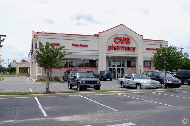
Property Record
44 Gulf Beach Hwy, Pensacola, FL 32507


NEARBY LISTINGS FOR SALE OR LEASE
Property Detail
44 Gulf Beach Hwy
Pensacola-Ferry Pass-Brent, FL
Subdivision Number: 4000
50-2S-30-4000-000-000
BEG AT SE COR LT 1 BLK 6 1ST ADDN TO DURCHSLAGS S/D PB 2 P 18 SAID POINT ALSO BEING INTER WLY R/W LI NAVY BLVD (200 FT R/W) AND NLY R/W LI GULF BEACH HWY (SR# 292 95 FT R/W) N 90 DEG W ALG NLY R/W GULF BEACH HWY 122 64/100 FT TO SW COR LT 1 N 0 DEG 1
Storemultistory
Escambia
X
Florida
12033C0369G
1
2024
0.89 AC
2025
Warrington
002607
Pensacola
11,120 SF
DEMOGRAPHICS near 44 Gulf Beach Hwy
1 Mile
3 Mile
5 Mile
2024 Total Population
6,553
44,671
100,483
2029 Population
6,767
45,905
103,329
Pop Growth 2024-2029
+ 3.27%
+ 2.76%
+ 2.83%
Average Age
40
37
37
2024 Total Households
2,919
16,419
38,332
HH Growth 2024-2029
+ 3.32%
+ 2.74%
+ 2.83%
Median Household Inc
$37,949
$39,734
$41,310
Avg Household Size
2.10
2.30
2.30
2024 Avg HH Vehicles
1.00
2.00
2.00
Median Home Value
$165,144
$134,583
$141,533
Median Year Built
1955
1970
1974
Nearby Places
Map Layers
Map Styles
 Street
 Aerial
- Restaurants
- Banks
- Shops
- Fitness
- Groceries
PUBLIC TRANSPORTATION
AIRPORT
Pensacola International
DRIVE
WALK
Distance
Pensacola International
21 min
9.5 mi
Freight Ports
Port of Mobile
DRIVE
WALK
Distance
Port of Mobile
74 min
58.0 mi
Nearby Properties
Address
Land Use
TOTAL SIZE
Lot Size
Zoning
Address
Land Use
TOTAL SIZE
Lot Size
Zoning
22,400 SF
5,633.91 AC
PUB
Address
Land Use
TOTAL SIZE
Lot Size
Zoning
6,950 SF
584.36 AC
PUB
Address
Land Use
TOTAL SIZE
Lot Size
Zoning
288,114 SF
17.89 AC
HC/LI
Address
Land Use
TOTAL SIZE
Lot Size
Zoning
378,320 SF
44.10 AC
PUB
Address
Land Use
TOTAL SIZE
Lot Size
Zoning
207,331 SF
24.09 AC
HDR
Address
Land Use
TOTAL SIZE
Lot Size
Zoning
219,481 SF
161.44 AC
NONE
Address
Land Use
TOTAL SIZE
Lot Size
Zoning
334,324 SF
55.06 AC
PUB
Address
Land Use
TOTAL SIZE
Lot Size
Zoning
188,512 SF
11.44 AC
COM
Address
Land Use
TOTAL SIZE
Lot Size
Zoning
127,684 SF
8.24 AC
HDR
Address
Land Use
TOTAL SIZE
Lot Size
Zoning
169,346 SF
15.21 AC
HDR
Address
Land Use
TOTAL SIZE
Lot Size
Zoning
133,096 SF
10.32 AC
HDR
Address
Land Use
TOTAL SIZE
Lot Size
Zoning
151,996 SF
30.44 AC
HDR
Address
Land Use
TOTAL SIZE
Lot Size
Zoning
130,830 SF
26.30 AC
M-2
Address
Land Use
TOTAL SIZE
Lot Size
Zoning
99,147 SF
5.89 AC
HDMU
Address
Land Use
TOTAL SIZE
Lot Size
Zoning
116,020 SF
4.71 AC
MDR
Address
Land Use
TOTAL SIZE
Lot Size
Zoning
184,232 SF
11.32 AC
HC/LI
Address
Land Use
TOTAL SIZE
Lot Size
Zoning
137,411 SF
15.02 AC
COM
Address
Land Use
TOTAL SIZE
Lot Size
Zoning
146,790 SF
8.83 AC
C-1,C-3
Address
Land Use
TOTAL SIZE
Lot Size
Zoning
151,208 SF
7.19 AC
C-3,M-2
Address
Land Use
TOTAL SIZE
Lot Size
Zoning
371,425 SF
24.78 AC
HC/LI
Address
Land Use
TOTAL SIZE
Lot Size
Zoning
223,987 SF
36.60 AC
MDR
Address
Land Use
TOTAL SIZE
Lot Size
Zoning
557,783 SF
39.80 AC
M-2
Address
Land Use
TOTAL SIZE
Lot Size
Zoning
61,788 SF
8.60 AC
HDR
Address
Land Use
TOTAL SIZE
Lot Size
Zoning
121,075 SF
9.39 AC
COM
Address
Land Use
TOTAL SIZE
Lot Size
Zoning
53,228 SF
0.69 AC
COM
Address
Land Use
TOTAL SIZE
Lot Size
Zoning
100,476 SF
3.74 AC
COM,HC/LI
Address
Land Use
TOTAL SIZE
Lot Size
Zoning
78,174 SF
4.52 AC
HDMU
Address
Land Use
TOTAL SIZE
Lot Size
Zoning
69,224 SF
9.89 AC
C-2,C-3
Address
Land Use
TOTAL SIZE
Lot Size
Zoning
90,932 SF
7.37 AC
HDMU,MDR
Address
Land Use
TOTAL SIZE
Lot Size
Zoning
51,484 SF
4.60 AC
R-2
The World's #1 Commercial Real Estate Marketplace
Connect with us
© 2026 CoStar Group
The information above has been obtained from sources believed reliable. While we do not doubt its accuracy we have not verified it and make no guarantee, warranty or representation about it. It is your responsibility to independently confirm its accuracy and completeness. Any projections, opinions, assumptions, or estimates used are for example only and do not represent the current or future performance of the property. The value of this transaction to you depends on tax and other factors which should be evaluated by your tax, financial, and legal advisors. You and your advisors should conduct a careful, independent investigation of the property to determine to your satisfaction the suitability of the property for your needs.