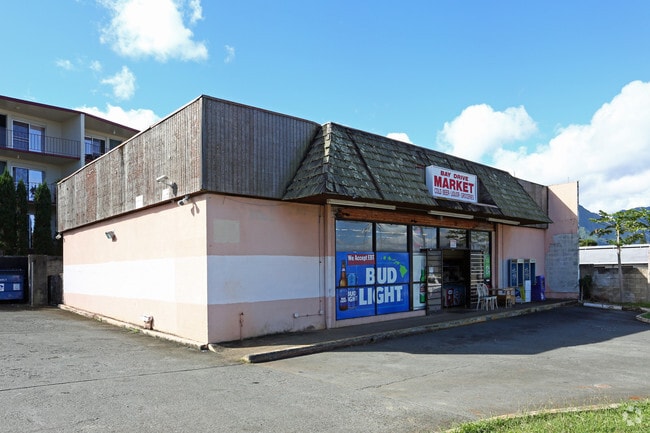
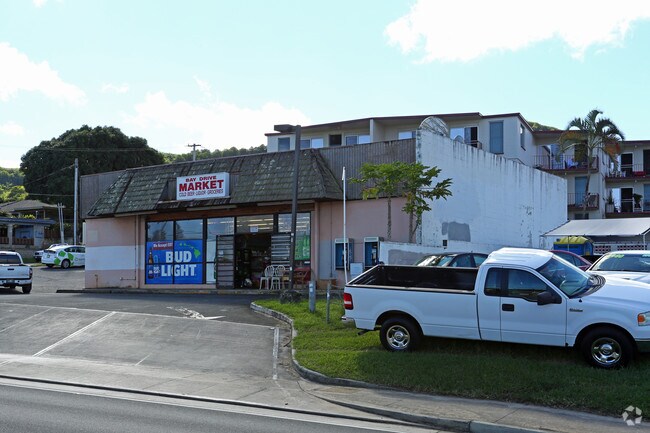
Property Record
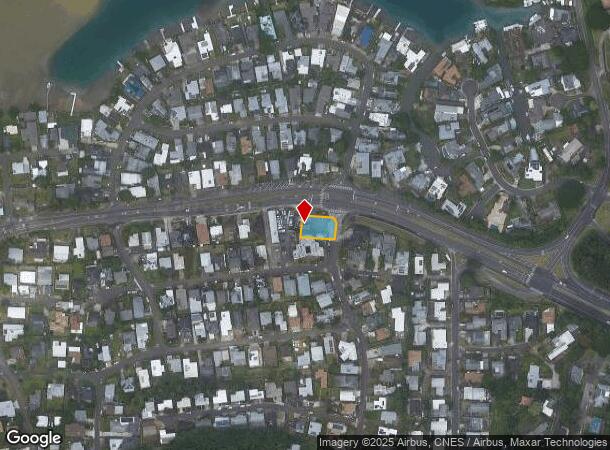
44 Kaneohe Bay Dr, Kaneohe, HI 96744
NEARBY LISTINGS FOR SALE OR LEASE
Property Detail
44 Kaneohe Bay Dr
1-4-4-019-085-0000
LOT 125-A-1-A 10,001 SF MAP 61 LC CONSOL NO 31 TOG/E FOR ROAD & UTILITY PURPOSES
Commercialnec
Honolulu
D
Hawaii
15003C0290H
125-a
2024
0.23 AC
2025
Windward
010701
Hawaii
1,475 SF
Urban Honolulu, HI
DEMOGRAPHICS near 44 Kaneohe Bay Dr
1 Mile
3 Mile
5 Mile
2024 Total Population
5,428
65,802
99,471
2029 Population
5,074
63,409
95,901
Pop Growth 2024-2029
(6.52%)
(3.64%)
(3.59%)
Average Age
46
42
41
2024 Total Households
1,704
20,828
30,775
HH Growth 2024-2029
(8.04%)
(4.55%)
(4.58%)
Median Household Inc
$145,013
$119,247
$122,137
Avg Household Size
2.90
2.90
2.90
2024 Avg HH Vehicles
2.00
2.00
2.00
Median Home Value
$951,034
$916,605
$949,292
Median Year Built
1970
1969
1971
Nearby Places
Map Layers
Map Styles
 Street
 Aerial
- Restaurants
- Banks
- Shops
- Fitness
- Groceries
PUBLIC TRANSPORTATION
AIRPORT
Daniel K Inouye International
DRIVE
WALK
Distance
Daniel K Inouye International
26 min
13.2 mi
Freight Ports
Honolulu Harbor, Oahu
DRIVE
WALK
Distance
Honolulu Harbor, Oahu
29 min
14.0 mi
SALE & LEASE HISTORY
LISTING DATE
SALE/LEASE

Nov 30, 2018
For Sale
Nearby Properties
Address
Land Use
TOTAL SIZE
Lot Size
Zoning
Address
Land Use
TOTAL SIZE
Lot Size
Zoning
130,311 SF
7.05 AC
B-2
Address
Land Use
TOTAL SIZE
Lot Size
Zoning
206,907 SF
15.02 AC
B-2
Address
Land Use
TOTAL SIZE
Lot Size
Zoning
370,415 SF
9.03 AC
B-2
Address
Land Use
TOTAL SIZE
Lot Size
Zoning
325,894 SF
22.26 AC
I-2
Address
Land Use
TOTAL SIZE
Lot Size
Zoning
226,160 SF
9.90 AC
R-5
Address
Land Use
TOTAL SIZE
Lot Size
Zoning
137,288 SF
16.12 AC
A-2
Address
Land Use
TOTAL SIZE
Lot Size
Zoning
118,302 SF
9.55 AC
B-2
Address
Land Use
TOTAL SIZE
Lot Size
Zoning
56.87 AC
P-2
Address
Land Use
TOTAL SIZE
Lot Size
Zoning
75,635 SF
7.21 AC
B-1
Address
Land Use
TOTAL SIZE
Lot Size
Zoning
86.85 AC
AG-2
Address
Land Use
TOTAL SIZE
Lot Size
Zoning
128,707 SF
4.57 AC
B-2
Address
Land Use
TOTAL SIZE
Lot Size
Zoning
54,244 SF
3.38 AC
B-2
Address
Land Use
TOTAL SIZE
Lot Size
Zoning
120,970 SF
2.43 AC
B-2
Address
Land Use
TOTAL SIZE
Lot Size
Zoning
88,447 SF
4.41 AC
B-2
Address
Land Use
TOTAL SIZE
Lot Size
Zoning
85,618 SF
4.82 AC
B-2
Address
Land Use
TOTAL SIZE
Lot Size
Zoning
55,645 SF
3.10 AC
B-2
Address
Land Use
TOTAL SIZE
Lot Size
Zoning
397,566 SF
3.09 AC
B-1
Address
Land Use
TOTAL SIZE
Lot Size
Zoning
31,955 SF
215.52 AC
P-1
Address
Land Use
TOTAL SIZE
Lot Size
Zoning
70,952 SF
2.31 AC
B-2
Address
Land Use
TOTAL SIZE
Lot Size
Zoning
116,574 SF
245.64 AC
P-1
Address
Land Use
TOTAL SIZE
Lot Size
Zoning
15.90 AC
P-2
Address
Land Use
TOTAL SIZE
Lot Size
Zoning
48,556 SF
2.18 AC
B-2
Address
Land Use
TOTAL SIZE
Lot Size
Zoning
59,491 SF
1.55 AC
B-2
Address
Land Use
TOTAL SIZE
Lot Size
Zoning
52,880 SF
3.47 AC
B-2
Address
Land Use
TOTAL SIZE
Lot Size
Zoning
5,952 SF
1.73 AC
B-2
Address
Land Use
TOTAL SIZE
Lot Size
Zoning
1.76 AC
BMX-3
Address
Land Use
TOTAL SIZE
Lot Size
Zoning
69,142 SF
132.46 AC
P-1
Address
Land Use
TOTAL SIZE
Lot Size
Zoning
24,971 SF
1.67 AC
B-2
Address
Land Use
TOTAL SIZE
Lot Size
Zoning
64.05 AC
AG-2
Address
Land Use
TOTAL SIZE
Lot Size
Zoning
1.74 AC
BMX-3
The World's #1 Commercial Real Estate Marketplace
Connect with us
© 2025 CoStar Group
The information above has been obtained from sources believed reliable. While we do not doubt its accuracy we have not verified it and make no guarantee, warranty or representation about it. It is your responsibility to independently confirm its accuracy and completeness. Any projections, opinions, assumptions, or estimates used are for example only and do not represent the current or future performance of the property. The value of this transaction to you depends on tax and other factors which should be evaluated by your tax, financial, and legal advisors. You and your advisors should conduct a careful, independent investigation of the property to determine to your satisfaction the suitability of the property for your needs.