Property Record
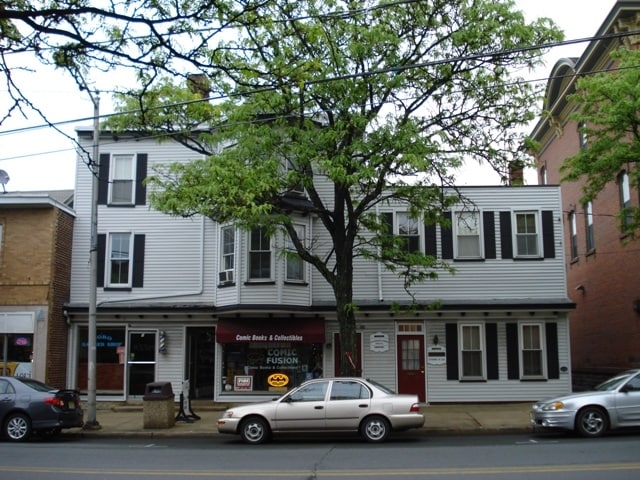
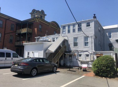
40 Main St, Flemington, NJ 08822


Current Lease Availabilities
Property Detail
40 Main St
09-00018-0000-00010
ADDITIONAL LOTS: 11
Vacantlandnec
HUNTERDON
DB
New Jersey
B and X Area of moderate flood hazard, usually the area between the limits of the 100-year and 500-year floods.
10
2024
0.28 AC
2025
Hunterdon
011400
Northern New Jersey
6,983 SF
Newark, NJ
NEARBY LISTINGS FOR SALE OR LEASE
DEMOGRAPHICS near 40 Main St
1 mile
3 mile
5 mile
2025 Total Population
8,480
25,656
37,836
2030 Population
8,802
26,435
38,776
Pop Growth 2025-2030
+ 3.80%
+ 3.04%
+ 2.48%
Average Age
40
42
43
2025 Total Households
3,275
9,742
14,167
HH Growth 2025-2030
+ 3.76%
+ 3.06%
+ 2.51%
Median Household Inc
$92,092
$124,663
$141,380
Avg Household Size
2.50
2.60
2.60
2025 Avg HH Vehicles
2.00
2.00
2.00
Median Home Value
$432,064
$492,295
$559,149
Median Year Built
1975
1983
1983
Nearby Places
Map Layers
Map Styles
 Street
 Aerial
Layers
 Traffic
 Biking
Places
Listings with unknown addresses are not visible on the map
- Restaurants
- Banks
- Shops
- Fitness
- Groceries
PUBLIC TRANSPORTATION
COMMUTER RAIL
White House (Raritan Valley Line - NJ Transit Commuter Rail (NJ Transit))
Drive
Walk
Distance
White House (Raritan Valley Line - NJ Transit Commuter Rail (NJ Transit))
23 min
9.8 mi
AIRPORT
Trenton Mercer
Drive
Walk
Distance
Trenton Mercer
36 min
19.2 mi
Lehigh Valley International
Drive
Walk
Distance
Lehigh Valley International
61 min
42.7 mi
Freight Ports
Port of Philadelphia
Drive
Walk
Distance
Port of Philadelphia
72 min
46.7 mi
Nearby Properties
Address
Land Use
TOTAL SIZE
Lot Size
Zoning
Address
Land Use
TOTAL SIZE
Lot Size
Zoning
34.80 AC
H
Address
Land Use
TOTAL SIZE
Lot Size
Zoning
68.38 AC
P
Address
Land Use
TOTAL SIZE
Lot Size
Zoning
7.88 AC
CR
Address
Land Use
TOTAL SIZE
Lot Size
Zoning
39.32 AC
P
Address
Land Use
TOTAL SIZE
Lot Size
Zoning
65.10 AC
I-1
Address
Land Use
TOTAL SIZE
Lot Size
Zoning
19.85 AC
B-2
Address
Land Use
TOTAL SIZE
Lot Size
Zoning
10,546 SF
12.75 AC
GA
Address
Land Use
TOTAL SIZE
Lot Size
Zoning
12,208 SF
11 AC
GA
Address
Land Use
TOTAL SIZE
Lot Size
Zoning
11.90 AC
CR
Address
Land Use
TOTAL SIZE
Lot Size
Zoning
11.59 AC
B-2
Address
Land Use
TOTAL SIZE
Lot Size
Zoning
23.84 AC
I-2
Address
Land Use
TOTAL SIZE
Lot Size
Zoning
20.89 AC
O/SS
Address
Land Use
TOTAL SIZE
Lot Size
Zoning
26.03 AC
I-2
Address
Land Use
TOTAL SIZE
Lot Size
Zoning
108.22 AC
I-2
Address
Land Use
TOTAL SIZE
Lot Size
Zoning
54.74 AC
P
Address
Land Use
TOTAL SIZE
Lot Size
Zoning
1,418 SF
19.67 AC
P
Address
Land Use
TOTAL SIZE
Lot Size
Zoning
4.34 AC
PO
Address
Land Use
TOTAL SIZE
Lot Size
Zoning
12.75 AC
B-2
Address
Land Use
TOTAL SIZE
Lot Size
Zoning
11.58 AC
P
Address
Land Use
TOTAL SIZE
Lot Size
Zoning
0.75 AC
H
Address
Land Use
TOTAL SIZE
Lot Size
Zoning
31.46 AC
R-3
Address
Land Use
TOTAL SIZE
Lot Size
Zoning
4.51 AC
R-3
Address
Land Use
TOTAL SIZE
Lot Size
Zoning
16.01 AC
I-2
Address
Land Use
TOTAL SIZE
Lot Size
Zoning
7.99 AC
CR
Address
Land Use
TOTAL SIZE
Lot Size
Zoning
5.47 AC
B-2
Address
Land Use
TOTAL SIZE
Lot Size
Zoning
13.56 AC
CR
Address
Land Use
TOTAL SIZE
Lot Size
Zoning
2,826 SF
6.28 AC
B-2
Address
Land Use
TOTAL SIZE
Lot Size
Zoning
7.75 AC
HR
Address
Land Use
TOTAL SIZE
Lot Size
Zoning
38.30 AC
O-2
Address
Land Use
TOTAL SIZE
Lot Size
Zoning
7.09 AC
I-2
The World's #1 Commercial Real Estate Marketplace
Connect with us
© 2026 CoStar Group
The information above has been obtained from sources believed reliable. While we do not doubt its accuracy we have not verified it and make no guarantee, warranty or representation about it. It is your responsibility to independently confirm its accuracy and completeness. Any projections, opinions, assumptions, or estimates used are for example only and do not represent the current or future performance of the property. The value of this transaction to you depends on tax and other factors which should be evaluated by your tax, financial, and legal advisors. You and your advisors should conduct a careful, independent investigation of the property to determine to your satisfaction the suitability of the property for your needs.