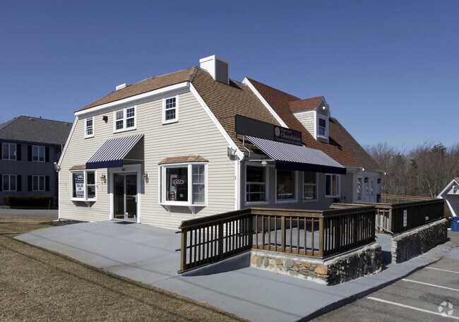
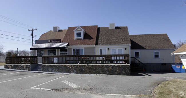
Property Record
44 Route 28, West Harwich, MA 02671
NEARBY LISTINGS FOR SALE OR LEASE
Property Detail
44 Route 28
HARW-000010-000000-D000002-000001
Barnstable
Commercialnec
Massachusetts
X
0.72 AC
25001C0611J
Cape Cod
2025
Other Market Areas
2025
Barnstable Town, MA
011002
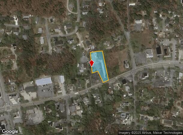
DEMOGRAPHICS near 44 Route 28
1 Mile
3 Mile
5 Mile
2024 Total Population
4,644
30,212
53,267
2029 Population
4,771
31,188
54,856
Pop Growth 2024-2029
+ 2.73%
+ 3.23%
+ 2.98%
Average Age
45
45
47
2024 Total Households
2,078
12,998
23,307
HH Growth 2024-2029
+ 2.60%
+ 3.33%
+ 2.97%
Median Household Inc
$55,189
$63,383
$72,042
Avg Household Size
2.00
2.20
2.20
2024 Avg HH Vehicles
1.00
2.00
2.00
Median Home Value
$427,451
$417,266
$449,796
Median Year Built
1973
1973
1973
Nearby Places
Map Layers
Map Styles
 Street
 Aerial
- Restaurants
- Banks
- Shops
- Fitness
- Groceries
PUBLIC TRANSPORTATION
COMMUTER RAIL
Hyannis (CapeFLYER - Cape Cod Regional Transit Authority)
DRIVE
WALK
Distance
Hyannis (CapeFLYER - Cape Cod Regional Transit Authority)
17 min
9.1 mi
AIRPORT
Nantucket Memorial
DRIVE
WALK
Distance
Nantucket Memorial
167 min
42.6 mi
Freight Ports
Port of New Bedford Harbor
DRIVE
WALK
Distance
Port of New Bedford Harbor
81 min
57.7 mi
Nearby Properties
Address
Land Use
TOTAL SIZE
Lot Size
Zoning
Address
Land Use
TOTAL SIZE
Lot Size
Zoning
13.34 AC
E
Address
Land Use
TOTAL SIZE
Lot Size
Zoning
138,804 SF
15.94 AC
Address
Land Use
TOTAL SIZE
Lot Size
Zoning
2,117 SF
Address
Land Use
TOTAL SIZE
Lot Size
Zoning
12.93 AC
R
Address
Land Use
TOTAL SIZE
Lot Size
Zoning
Address
Land Use
TOTAL SIZE
Lot Size
Zoning
3.42 AC
Address
Land Use
TOTAL SIZE
Lot Size
Zoning
10.34 AC
Address
Land Use
TOTAL SIZE
Lot Size
Zoning
Address
Land Use
TOTAL SIZE
Lot Size
Zoning
3.58 AC
R
Address
Land Use
TOTAL SIZE
Lot Size
Zoning
3,480 SF
22.78 AC
E
Address
Land Use
TOTAL SIZE
Lot Size
Zoning
Address
Land Use
TOTAL SIZE
Lot Size
Zoning
14,844 SF
0.50 AC
Address
Land Use
TOTAL SIZE
Lot Size
Zoning
Address
Land Use
TOTAL SIZE
Lot Size
Zoning
Address
Land Use
TOTAL SIZE
Lot Size
Zoning
4.88 AC
E
Address
Land Use
TOTAL SIZE
Lot Size
Zoning
59,054 SF
9.53 AC
R
Address
Land Use
TOTAL SIZE
Lot Size
Zoning
1.52 AC
R
Address
Land Use
TOTAL SIZE
Lot Size
Zoning
2,003 SF
1.57 AC
R
Address
Land Use
TOTAL SIZE
Lot Size
Zoning
0.78 AC
R
Address
Land Use
TOTAL SIZE
Lot Size
Zoning
1.32 AC
R
Address
Land Use
TOTAL SIZE
Lot Size
Zoning
Address
Land Use
TOTAL SIZE
Lot Size
Zoning
6,276 SF
0.80 AC
R
Address
Land Use
TOTAL SIZE
Lot Size
Zoning
Address
Land Use
TOTAL SIZE
Lot Size
Zoning
0.80 AC
R
Address
Land Use
TOTAL SIZE
Lot Size
Zoning
9.77 AC
Address
Land Use
TOTAL SIZE
Lot Size
Zoning
14.54 AC
Address
Land Use
TOTAL SIZE
Lot Size
Zoning
45.75 AC
R
Address
Land Use
TOTAL SIZE
Lot Size
Zoning
0.41 AC
R
Address
Land Use
TOTAL SIZE
Lot Size
Zoning
1.55 AC
R
Address
Land Use
TOTAL SIZE
Lot Size
Zoning
26,948 SF
The World's #1 Commercial Real Estate Marketplace
Connect with us
© 2025 CoStar Group
The information above has been obtained from sources believed reliable. While we do not doubt its accuracy we have not verified it and make no guarantee, warranty or representation about it. It is your responsibility to independently confirm its accuracy and completeness. Any projections, opinions, assumptions, or estimates used are for example only and do not represent the current or future performance of the property. The value of this transaction to you depends on tax and other factors which should be evaluated by your tax, financial, and legal advisors. You and your advisors should conduct a careful, independent investigation of the property to determine to your satisfaction the suitability of the property for your needs.