Property Record
44 Vixen Cir, Pinedale, WY 82941

NEARBY LISTINGS FOR SALE OR LEASE
Property Detail
44 Vixen Cir
570-258696
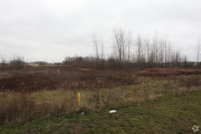
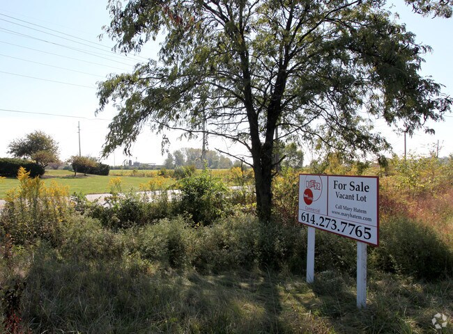
NORTON RD ENTRY 1473 1.000 ACRE
Commercialacreage
Franklin
X
Ohio
39097C0200E
1 AC
2024
Southwest
2024
Columbus
030500
Columbus, OH
DEMOGRAPHICS near 44 Vixen Cir
1 Mile
3 Mile
5 Mile
2024 Total Population
5,911
64,609
157,896
2029 Population
5,875
64,316
157,953
Pop Growth 2024-2029
(0.61%)
(0.45%)
+ 0.04%
Average Age
35
36
37
2024 Total Households
2,131
24,293
60,990
HH Growth 2024-2029
(0.66%)
(0.56%)
(0.05%)
Median Household Inc
$58,375
$59,820
$62,420
Avg Household Size
2.70
2.60
2.50
2024 Avg HH Vehicles
2.00
2.00
2.00
Median Home Value
$215,392
$192,644
$190,052
Median Year Built
1989
1986
1978
Nearby Places
Map Layers
Map Styles
 Street
 Aerial
- Restaurants
- Banks
- Shops
- Fitness
- Groceries
PUBLIC TRANSPORTATION
AIRPORT
Rickenbacker International
DRIVE
WALK
Distance
Rickenbacker International
23 min
16.3 mi
John Glenn Columbus International
DRIVE
WALK
Distance
John Glenn Columbus International
27 min
19.0 mi
Freight Ports
Port of Toledo
DRIVE
WALK
Distance
Port of Toledo
187 min
139.4 mi
Nearby Properties
Address
Land Use
TOTAL SIZE
Lot Size
Zoning
Address
Land Use
TOTAL SIZE
Lot Size
Zoning
470,659 SF
101.09 AC
Address
Land Use
TOTAL SIZE
Lot Size
Zoning
269,165 SF
7 AC
Address
Land Use
TOTAL SIZE
Lot Size
Zoning
210,724 SF
43.38 AC
Address
Land Use
TOTAL SIZE
Lot Size
Zoning
1,178,014 SF
152.63 AC
Address
Land Use
TOTAL SIZE
Lot Size
Zoning
472,671 SF
70.36 AC
Address
Land Use
TOTAL SIZE
Lot Size
Zoning
1,011,597 SF
49.94 AC
Address
Land Use
TOTAL SIZE
Lot Size
Zoning
749,152 SF
41.23 AC
Address
Land Use
TOTAL SIZE
Lot Size
Zoning
247,354 SF
30.38 AC
Address
Land Use
TOTAL SIZE
Lot Size
Zoning
110,590 SF
13.44 AC
Address
Land Use
TOTAL SIZE
Lot Size
Zoning
62,400 SF
9.02 AC
Address
Land Use
TOTAL SIZE
Lot Size
Zoning
332,176 SF
24.52 AC
Address
Land Use
TOTAL SIZE
Lot Size
Zoning
122,159 SF
2.77 AC
Address
Land Use
TOTAL SIZE
Lot Size
Zoning
131,116 SF
15.30 AC
Address
Land Use
TOTAL SIZE
Lot Size
Zoning
202,330 SF
18.89 AC
Address
Land Use
TOTAL SIZE
Lot Size
Zoning
117,389 SF
177.98 AC
Address
Land Use
TOTAL SIZE
Lot Size
Zoning
178,452 SF
34.84 AC
Address
Land Use
TOTAL SIZE
Lot Size
Zoning
542,043 SF
30.41 AC
Address
Land Use
TOTAL SIZE
Lot Size
Zoning
18,823 SF
14.73 AC
Address
Land Use
TOTAL SIZE
Lot Size
Zoning
377,124 SF
19.58 AC
Address
Land Use
TOTAL SIZE
Lot Size
Zoning
72,320 SF
2.52 AC
Address
Land Use
TOTAL SIZE
Lot Size
Zoning
52,283 SF
19.41 AC
Address
Land Use
TOTAL SIZE
Lot Size
Zoning
94,593 SF
7.97 AC
Address
Land Use
TOTAL SIZE
Lot Size
Zoning
204,787 SF
11.88 AC
Address
Land Use
TOTAL SIZE
Lot Size
Zoning
108,574 SF
17.04 AC
Address
Land Use
TOTAL SIZE
Lot Size
Zoning
35,828 SF
15.81 AC
Address
Land Use
TOTAL SIZE
Lot Size
Zoning
98,674 SF
4.95 AC
Address
Land Use
TOTAL SIZE
Lot Size
Zoning
128,617 SF
14.79 AC
Address
Land Use
TOTAL SIZE
Lot Size
Zoning
80,520 SF
15.16 AC
Address
Land Use
TOTAL SIZE
Lot Size
Zoning
35,201 SF
281.60 AC
Address
Land Use
TOTAL SIZE
Lot Size
Zoning
115,550 SF
13.72 AC
The World's #1 Commercial Real Estate Marketplace
Connect with us
© 2025 CoStar Group
The information above has been obtained from sources believed reliable. While we do not doubt its accuracy we have not verified it and make no guarantee, warranty or representation about it. It is your responsibility to independently confirm its accuracy and completeness. Any projections, opinions, assumptions, or estimates used are for example only and do not represent the current or future performance of the property. The value of this transaction to you depends on tax and other factors which should be evaluated by your tax, financial, and legal advisors. You and your advisors should conduct a careful, independent investigation of the property to determine to your satisfaction the suitability of the property for your needs.