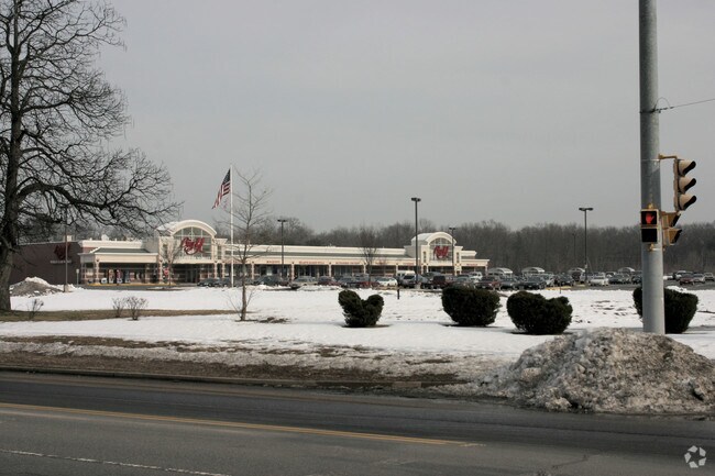
Property Record
44 Willimansett St, South Hadley, MA 01075


NEARBY LISTINGS FOR SALE OR LEASE
Property Detail
44 Willimansett St
SHAD-000014-000018
Hampshire
Supermarket
Massachusetts
2025
6.32 AC
2025
Hampshire County
821000
Hartford
55,936 SF
Springfield, MA
DEMOGRAPHICS near 44 Willimansett St
1 Mile
3 Mile
5 Mile
2024 Total Population
6,097
52,068
102,932
2029 Population
5,225
48,239
97,374
Pop Growth 2024-2029
(14.30%)
(7.35%)
(5.40%)
Average Age
44
40
41
2024 Total Households
2,704
21,251
42,279
HH Growth 2024-2029
(14.39%)
(8.03%)
(5.79%)
Median Household Inc
$67,500
$54,329
$58,593
Avg Household Size
2.20
2.30
2.30
2024 Avg HH Vehicles
2.00
1.00
2.00
Median Home Value
$302,636
$264,518
$256,596
Median Year Built
1966
1956
1956
Nearby Places
Map Layers
Map Styles
 Street
 Aerial
- Restaurants
- Banks
- Shops
- Fitness
- Groceries
PUBLIC TRANSPORTATION
COMMUTER RAIL
DRIVE
WALK
Distance
8 min
3.3 mi
DRIVE
WALK
Distance
18 min
8.8 mi
AIRPORT
Bradley International
DRIVE
WALK
Distance
Bradley International
46 min
24.1 mi
Nearby Properties
Address
Land Use
TOTAL SIZE
Lot Size
Zoning
Address
Land Use
TOTAL SIZE
Lot Size
Zoning
16.30 AC
RA2
Address
Land Use
TOTAL SIZE
Lot Size
Zoning
4.50 AC
RA2
Address
Land Use
TOTAL SIZE
Lot Size
Zoning
171,241 SF
18.94 AC
106
Address
Land Use
TOTAL SIZE
Lot Size
Zoning
52 AC
RA1
Address
Land Use
TOTAL SIZE
Lot Size
Zoning
26.68 AC
110
Address
Land Use
TOTAL SIZE
Lot Size
Zoning
9 AC
RA2
Address
Land Use
TOTAL SIZE
Lot Size
Zoning
2.41 AC
DR
Address
Land Use
TOTAL SIZE
Lot Size
Zoning
4.04 AC
107
Address
Land Use
TOTAL SIZE
Lot Size
Zoning
257,179 SF
22.84 AC
110
Address
Land Use
TOTAL SIZE
Lot Size
Zoning
81.65 AC
110
Address
Land Use
TOTAL SIZE
Lot Size
Zoning
320,639 SF
14.16 AC
110
Address
Land Use
TOTAL SIZE
Lot Size
Zoning
23,111 SF
1.43 AC
IA
Address
Land Use
TOTAL SIZE
Lot Size
Zoning
62,808 SF
7.60 AC
R-1
Address
Land Use
TOTAL SIZE
Lot Size
Zoning
26.35 AC
RA2
Address
Land Use
TOTAL SIZE
Lot Size
Zoning
194,875 SF
2.75 AC
IG
Address
Land Use
TOTAL SIZE
Lot Size
Zoning
64,638 SF
9.26 AC
RA2
Address
Land Use
TOTAL SIZE
Lot Size
Zoning
14.47 AC
110
Address
Land Use
TOTAL SIZE
Lot Size
Zoning
43,289 SF
2.63 AC
DR
Address
Land Use
TOTAL SIZE
Lot Size
Zoning
80,393 SF
1.71 AC
111
Address
Land Use
TOTAL SIZE
Lot Size
Zoning
10.62 AC
111A
Address
Land Use
TOTAL SIZE
Lot Size
Zoning
217,640 SF
12.21 AC
110
Address
Land Use
TOTAL SIZE
Lot Size
Zoning
3.30 AC
RA2
Address
Land Use
TOTAL SIZE
Lot Size
Zoning
152,380 SF
11.36 AC
110
Address
Land Use
TOTAL SIZE
Lot Size
Zoning
61,808 SF
8.53 AC
RA2
Address
Land Use
TOTAL SIZE
Lot Size
Zoning
291,714 SF
35.75 AC
110
Address
Land Use
TOTAL SIZE
Lot Size
Zoning
144,384 SF
35.87 AC
RA2
Address
Land Use
TOTAL SIZE
Lot Size
Zoning
2.44 AC
RA2
Address
Land Use
TOTAL SIZE
Lot Size
Zoning
2.61 AC
107
Address
Land Use
TOTAL SIZE
Lot Size
Zoning
2.77 AC
106
Address
Land Use
TOTAL SIZE
Lot Size
Zoning
16.36 AC
RA1
The World's #1 Commercial Real Estate Marketplace
Connect with us
© 2025 CoStar Group
The information above has been obtained from sources believed reliable. While we do not doubt its accuracy we have not verified it and make no guarantee, warranty or representation about it. It is your responsibility to independently confirm its accuracy and completeness. Any projections, opinions, assumptions, or estimates used are for example only and do not represent the current or future performance of the property. The value of this transaction to you depends on tax and other factors which should be evaluated by your tax, financial, and legal advisors. You and your advisors should conduct a careful, independent investigation of the property to determine to your satisfaction the suitability of the property for your needs.