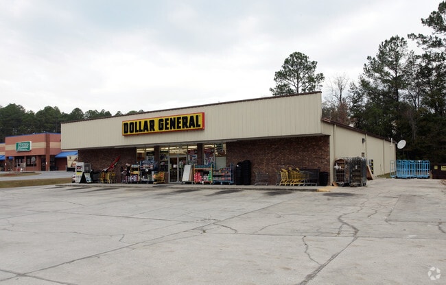
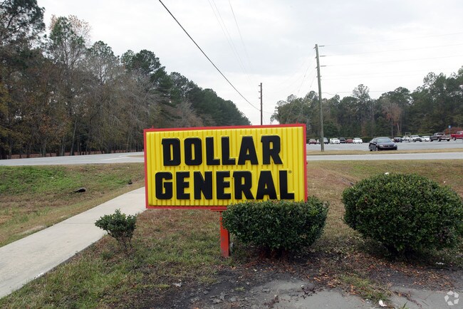
Property Record
534 W Bacon St, Pembroke, GA 31321

Property Detail
534 W Bacon St
P01-03-006
19GMD 4-0-267 10/06/77 DOLLAR GENERAL STORE
Wholesaleoutletdiscountstore
Bryan
B-3
Georgia
AE The base floodplain where base flood elevations are provided. AE Zones are now used on new format FIRMs instead of A1-A30 Zones.
0.67 AC
2025
Bryan County
2025
Savannah
920103
Savannah, GA
8,000 SF
NEARBY LISTINGS FOR SALE OR LEASE
-
-
View all Pembroke listings for sale on LoopNet.com
DEMOGRAPHICS near 534 W Bacon St
1 mile
3 mile
5 mile
2025 Total Population
1,986
3,527
4,779
2030 Population
2,182
3,900
5,271
Pop Growth 2025-2030
+ 9.87%
+ 10.58%
+ 10.30%
Average Age
39
39
39
2025 Total Households
759
1,323
1,789
HH Growth 2025-2030
+ 9.75%
+ 10.51%
+ 10.23%
Median Household Inc
$63,019
$65,451
$65,865
Avg Household Size
2.60
2.70
2.70
2025 Avg HH Vehicles
2.00
2.00
2.00
Median Home Value
$211,538
$219,784
$225,116
Median Year Built
1992
1993
1994
Nearby Places
Map Layers
Map Styles
 Street
 Aerial
Transit
 Traffic
 Biking
Places
Listings with unknown addresses are not visible on the map
- Restaurants
- Banks
- Shops
- Fitness
- Groceries
PUBLIC TRANSPORTATION
AIRPORT
Savannah/Hilton Head International
Drive
Walk
Distance
Savannah/Hilton Head International
48 min
33.4 mi
Freight Ports
Georgia Ports - Savannah
Drive
Walk
Distance
Georgia Ports - Savannah
54 min
37.5 mi
SALE & LEASE HISTORY
LISTING DATE
SALE/LEASE

Jul 08, 2019
For Sale
Nearby Properties
Address
Land Use
TOTAL SIZE
Lot Size
Zoning
Address
Land Use
TOTAL SIZE
Lot Size
Zoning
81,504 SF
46.29 AC
B-2
Address
Land Use
TOTAL SIZE
Lot Size
Zoning
123,462 SF
36.82 AC
B-2
Address
Land Use
TOTAL SIZE
Lot Size
Zoning
69,775 SF
3.62 AC
R-3
Address
Land Use
TOTAL SIZE
Lot Size
Zoning
149.91 AC
PUD
Address
Land Use
TOTAL SIZE
Lot Size
Zoning
75 AC
PUD
Address
Land Use
TOTAL SIZE
Lot Size
Zoning
227.37 AC
R-1
Address
Land Use
TOTAL SIZE
Lot Size
Zoning
20,674 SF
3.73 AC
R-1
Address
Land Use
TOTAL SIZE
Lot Size
Zoning
17,664 SF
5.76 AC
R-3
Address
Land Use
TOTAL SIZE
Lot Size
Zoning
15,262 SF
1.69 AC
B-2
Address
Land Use
TOTAL SIZE
Lot Size
Zoning
600 SF
239.42 AC
R-1
Address
Land Use
TOTAL SIZE
Lot Size
Zoning
10,680 SF
2.66 AC
R-1
Address
Land Use
TOTAL SIZE
Lot Size
Zoning
7,003 SF
1.63 AC
B-2
Address
Land Use
TOTAL SIZE
Lot Size
Zoning
98.05 AC
PUD
Address
Land Use
TOTAL SIZE
Lot Size
Zoning
21,838 SF
3.85 AC
R-3
Address
Land Use
TOTAL SIZE
Lot Size
Zoning
4,790 SF
1.93 AC
B-3
Address
Land Use
TOTAL SIZE
Lot Size
Zoning
31,627 SF
3.90 AC
B-2
Address
Land Use
TOTAL SIZE
Lot Size
Zoning
8,820 SF
0.97 AC
B-2
Address
Land Use
TOTAL SIZE
Lot Size
Zoning
535 SF
4.87 AC
R-3
Address
Land Use
TOTAL SIZE
Lot Size
Zoning
25,104 SF
1.73 AC
R-3
Address
Land Use
TOTAL SIZE
Lot Size
Zoning
1,280 SF
4.51 AC
I-1
Address
Land Use
TOTAL SIZE
Lot Size
Zoning
11,826 SF
4.10 AC
A-5
Address
Land Use
TOTAL SIZE
Lot Size
Zoning
642.44 AC
AG-5
Address
Land Use
TOTAL SIZE
Lot Size
Zoning
154.03 AC
A-5
Address
Land Use
TOTAL SIZE
Lot Size
Zoning
15,768 SF
2.23 AC
R-3
Address
Land Use
TOTAL SIZE
Lot Size
Zoning
18,000 SF
7.29 AC
I-1
Address
Land Use
TOTAL SIZE
Lot Size
Zoning
6,114 SF
2.65 AC
R-1
Address
Land Use
TOTAL SIZE
Lot Size
Zoning
30.89 AC
R-3
Address
Land Use
TOTAL SIZE
Lot Size
Zoning
4,644 SF
0.72 AC
B-3
Address
Land Use
TOTAL SIZE
Lot Size
Zoning
5,455 SF
0.56 AC
B-3
The World's #1 Commercial Real Estate Marketplace
Connect with us
© 2026 CoStar Group
The information above has been obtained from sources believed reliable. While we do not doubt its accuracy we have not verified it and make no guarantee, warranty or representation about it. It is your responsibility to independently confirm its accuracy and completeness. Any projections, opinions, assumptions, or estimates used are for example only and do not represent the current or future performance of the property. The value of this transaction to you depends on tax and other factors which should be evaluated by your tax, financial, and legal advisors. You and your advisors should conduct a careful, independent investigation of the property to determine to your satisfaction the suitability of the property for your needs.