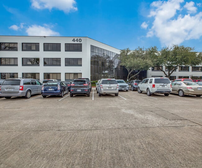
Property Record
440 Benmar Dr, Houston, TX 77060


Current Lease Availabilities
Property Detail
440 Benmar Dr
1144680020002
RES D BLK 2 (009 RES B BREENBRIAR NO. 7) GREENBRIAR PLAZA
Officebuilding
HARRIS
AE The base floodplain where base flood elevations are provided. AE Zones are now used on new format FIRMs instead of A1-A30 Zones.
Texas
2024
5.16 AC
2025
Greenspoint/N Belt West
240101
Houston
124,315 SF
Houston-Pasadena-The Woodlands, TX
NEARBY LISTINGS FOR SALE OR LEASE
DEMOGRAPHICS near 440 Benmar Dr
1 mile
3 mile
5 mile
2025 Total Population
22,921
90,414
250,655
2030 Population
24,479
96,058
265,757
Pop Growth 2025-2030
+ 6.80%
+ 6.24%
+ 6.03%
Average Age
31
32
34
2025 Total Households
9,172
29,754
77,175
HH Growth 2025-2030
+ 6.97%
+ 6.54%
+ 6.35%
Median Household Inc
$32,899
$41,736
$49,157
Avg Household Size
2.50
3.00
3.20
2025 Avg HH Vehicles
1.00
2.00
2.00
Median Home Value
$176,666
$193,723
$191,770
Median Year Built
1983
1984
1986
Nearby Places
Map Layers
Map Styles
 Street
 Aerial
Layers
 Traffic
 Biking
Places
Listings with unknown addresses are not visible on the map
- Restaurants
- Banks
- Shops
- Fitness
- Groceries
PUBLIC TRANSPORTATION
AIRPORT
George Bush Intcntl/Houston
Drive
Walk
Distance
George Bush Intcntl/Houston
11 min
7.2 mi
William P Hobby
Drive
Walk
Distance
William P Hobby
42 min
26.9 mi
Freight Ports
Port of Houston
Drive
Walk
Distance
Port of Houston
31 min
20.6 mi
Nearby Properties
Address
Land Use
TOTAL SIZE
Lot Size
Zoning
Address
Land Use
TOTAL SIZE
Lot Size
Zoning
858,420 SF
60.71 AC
Address
Land Use
TOTAL SIZE
Lot Size
Zoning
145.62 AC
Address
Land Use
TOTAL SIZE
Lot Size
Zoning
739,141 SF
54 AC
Address
Land Use
TOTAL SIZE
Lot Size
Zoning
413,178 SF
21.45 AC
Address
Land Use
TOTAL SIZE
Lot Size
Zoning
704,105 SF
40.72 AC
Address
Land Use
TOTAL SIZE
Lot Size
Zoning
657,500 SF
36.24 AC
Address
Land Use
TOTAL SIZE
Lot Size
Zoning
614,256 SF
31.25 AC
Address
Land Use
TOTAL SIZE
Lot Size
Zoning
500,000 SF
24.58 AC
Address
Land Use
TOTAL SIZE
Lot Size
Zoning
608,784 SF
29.08 AC
Address
Land Use
TOTAL SIZE
Lot Size
Zoning
502,325 SF
25.13 AC
Address
Land Use
TOTAL SIZE
Lot Size
Zoning
485,125 SF
28.55 AC
Address
Land Use
TOTAL SIZE
Lot Size
Zoning
718,600 SF
42.09 AC
Address
Land Use
TOTAL SIZE
Lot Size
Zoning
276,324 SF
33.79 AC
Address
Land Use
TOTAL SIZE
Lot Size
Zoning
504,000 SF
32.25 AC
Address
Land Use
TOTAL SIZE
Lot Size
Zoning
368,632 SF
20.06 AC
Address
Land Use
TOTAL SIZE
Lot Size
Zoning
241,625 SF
11.10 AC
Address
Land Use
TOTAL SIZE
Lot Size
Zoning
356,900 SF
19.38 AC
Address
Land Use
TOTAL SIZE
Lot Size
Zoning
394,784 SF
22.47 AC
Address
Land Use
TOTAL SIZE
Lot Size
Zoning
350,500 SF
17.71 AC
Address
Land Use
TOTAL SIZE
Lot Size
Zoning
353,600 SF
23.45 AC
Address
Land Use
TOTAL SIZE
Lot Size
Zoning
356,622 SF
18.26 AC
Address
Land Use
TOTAL SIZE
Lot Size
Zoning
125,512 SF
18.26 AC
Address
Land Use
TOTAL SIZE
Lot Size
Zoning
423,730 SF
5.91 AC
Address
Land Use
TOTAL SIZE
Lot Size
Zoning
284,476 SF
20 AC
Address
Land Use
TOTAL SIZE
Lot Size
Zoning
291,656 SF
18.94 AC
Address
Land Use
TOTAL SIZE
Lot Size
Zoning
284,687 SF
19.66 AC
Address
Land Use
TOTAL SIZE
Lot Size
Zoning
329,643 SF
19.99 AC
Address
Land Use
TOTAL SIZE
Lot Size
Zoning
57,551 SF
49.71 AC
Address
Land Use
TOTAL SIZE
Lot Size
Zoning
257,000 SF
13.34 AC
Address
Land Use
TOTAL SIZE
Lot Size
Zoning
288,525 SF
17.66 AC
The World's #1 Commercial Real Estate Marketplace
Connect with us
© 2026 CoStar Group
The information above has been obtained from sources believed reliable. While we do not doubt its accuracy we have not verified it and make no guarantee, warranty or representation about it. It is your responsibility to independently confirm its accuracy and completeness. Any projections, opinions, assumptions, or estimates used are for example only and do not represent the current or future performance of the property. The value of this transaction to you depends on tax and other factors which should be evaluated by your tax, financial, and legal advisors. You and your advisors should conduct a careful, independent investigation of the property to determine to your satisfaction the suitability of the property for your needs.