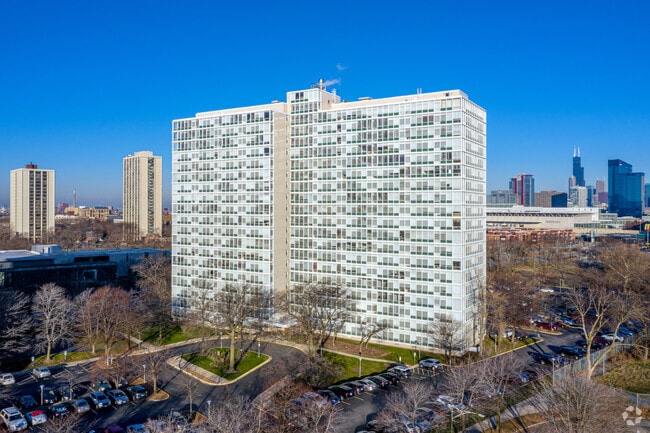
Property Record
440 E 31St St, Chicago, IL 60616

Property Detail
440 E 31St St
17-27-407-062-0000
COOK
Commercialnec
Illinois
PD 1509
14,15
B and X Area of moderate flood hazard, usually the area between the limits of the 100-year and 500-year floods.
1.85 AC
2023
Bronzeville
2025
Chicago
841000
Chicago-Naperville-Elgin, IL-IN
NEARBY LISTINGS FOR SALE OR LEASE
DEMOGRAPHICS near 440 E 31St St
1 mile
3 mile
5 mile
2025 Total Population
30,418
242,971
688,337
2030 Population
30,874
244,427
688,789
Pop Growth 2025-2030
+ 1.50%
+ 0.60%
+ 0.07%
Average Age
40
38
38
2025 Total Households
14,717
115,539
323,235
HH Growth 2025-2030
+ 1.25%
+ 0.75%
+ 0.55%
Median Household Inc
$67,562
$86,461
$88,082
Avg Household Size
1.90
2.00
2.00
2025 Avg HH Vehicles
1.00
1.00
1.00
Median Home Value
$377,945
$401,384
$410,079
Median Year Built
1969
1978
1973
Nearby Places
Map Layers
Map Styles
 Street
 Aerial
Layers
 Traffic
 Biking
Places
Listings with unknown addresses are not visible on the map
- Restaurants
- Banks
- Shops
- Fitness
- Groceries
PUBLIC TRANSPORTATION
COMMUTER RAIL
27Th Street Station (Metra Electric Line - Northeast Illinois Regional Commuter Railroad (Metra))
Drive
Walk
Distance
27Th Street Station (Metra Electric Line - Northeast Illinois Regional Commuter Railroad (Metra))
4 min
10 min
0.6 mi
Mccormick Place Station (Metra Electric Line - Northeast Illinois Regional Commuter Railroad (Metra), South Shore Line - Northeast Illinois Regional Commuter Railroad (Metra))
Drive
Walk
Distance
Mccormick Place Station (Metra Electric Line - Northeast Illinois Regional Commuter Railroad (Metra), South Shore Line - Northeast Illinois Regional Commuter Railroad (Metra))
6 min
2.4 mi
AIRPORT
Chicago Midway International
Drive
Walk
Distance
Chicago Midway International
16 min
10.0 mi
Chicago O'Hare International
Drive
Walk
Distance
Chicago O'Hare International
34 min
21.5 mi
Freight Ports
Port Milwaukee
Drive
Walk
Distance
Port Milwaukee
112 min
89.7 mi
SALE & LEASE HISTORY
LISTING DATE
SALE/LEASE

Mar 06, 2019
For Sale
Nearby Properties
Address
Land Use
TOTAL SIZE
Lot Size
Zoning
Address
Land Use
TOTAL SIZE
Lot Size
Zoning
4,667,723 SF
2.94 AC
DC-16
Address
Land Use
TOTAL SIZE
Lot Size
Zoning
1,496,448 SF
2 AC
PD 376
Address
Land Use
TOTAL SIZE
Lot Size
Zoning
1,810,145 SF
1.03 AC
PD 365
Address
Land Use
TOTAL SIZE
Lot Size
Zoning
1,215,367 SF
3.76 AC
PD 675
Address
Land Use
TOTAL SIZE
Lot Size
Zoning
2,750,656 SF
6.29 AC
PD 1065
Address
Land Use
TOTAL SIZE
Lot Size
Zoning
1,231,710 SF
2.01 AC
PD 27
Address
Land Use
TOTAL SIZE
Lot Size
Zoning
590,844 SF
0.80 AC
PD 26
Address
Land Use
TOTAL SIZE
Lot Size
Zoning
2.06 AC
DX-16
Address
Land Use
TOTAL SIZE
Lot Size
Zoning
1.23 AC
PD 291
Address
Land Use
TOTAL SIZE
Lot Size
Zoning
1.54 AC
PD 743
Address
Land Use
TOTAL SIZE
Lot Size
Zoning
1,571,900 SF
0.59 AC
PD 382
Address
Land Use
TOTAL SIZE
Lot Size
Zoning
1,527,000 SF
1.65 AC
DX-16
Address
Land Use
TOTAL SIZE
Lot Size
Zoning
1,250,000 SF
1.51 AC
PD 27
Address
Land Use
TOTAL SIZE
Lot Size
Zoning
1,335,777 SF
1.15 AC
DX-16
Address
Land Use
TOTAL SIZE
Lot Size
Zoning
843,070 SF
0.53 AC
DC-16
Address
Land Use
TOTAL SIZE
Lot Size
Zoning
1,612,954 SF
1.38 AC
DC-16
Address
Land Use
TOTAL SIZE
Lot Size
Zoning
1,767,367 SF
0.89 AC
PD 219
Address
Land Use
TOTAL SIZE
Lot Size
Zoning
1,087,781 SF
0.90 AC
PD 365
Address
Land Use
TOTAL SIZE
Lot Size
Zoning
1,474,784 SF
0.92 AC
PD 829
Address
Land Use
TOTAL SIZE
Lot Size
Zoning
1,252,885 SF
0.99 AC
PD 499
Address
Land Use
TOTAL SIZE
Lot Size
Zoning
589,535 SF
0.96 AC
DX-12
Address
Land Use
TOTAL SIZE
Lot Size
Zoning
532,933 SF
0.43 AC
DC-16
Address
Land Use
TOTAL SIZE
Lot Size
Zoning
1,081,939 SF
0.68 AC
PD 1323
Address
Land Use
TOTAL SIZE
Lot Size
Zoning
662,088 SF
4.91 AC
PD 504
Address
Land Use
TOTAL SIZE
Lot Size
Zoning
935,500 SF
0.36 AC
PD 70
Address
Land Use
TOTAL SIZE
Lot Size
Zoning
1,073,733 SF
0.35 AC
DC-16
Address
Land Use
TOTAL SIZE
Lot Size
Zoning
243,200 SF
0.80 AC
DX-7
Address
Land Use
TOTAL SIZE
Lot Size
Zoning
760,895 SF
0.80 AC
DC-16
Address
Land Use
TOTAL SIZE
Lot Size
Zoning
965,500 SF
0.30 AC
PD 176
Address
Land Use
TOTAL SIZE
Lot Size
Zoning
474,979 SF
29.67 AC
PD 553
The World's #1 Commercial Real Estate Marketplace
Connect with us
© 2026 CoStar Group
The information above has been obtained from sources believed reliable. While we do not doubt its accuracy we have not verified it and make no guarantee, warranty or representation about it. It is your responsibility to independently confirm its accuracy and completeness. Any projections, opinions, assumptions, or estimates used are for example only and do not represent the current or future performance of the property. The value of this transaction to you depends on tax and other factors which should be evaluated by your tax, financial, and legal advisors. You and your advisors should conduct a careful, independent investigation of the property to determine to your satisfaction the suitability of the property for your needs.