Property Record
440 E Interstate 30, Garland, TX 75043

NEARBY LISTINGS FOR SALE OR LEASE
Property Detail
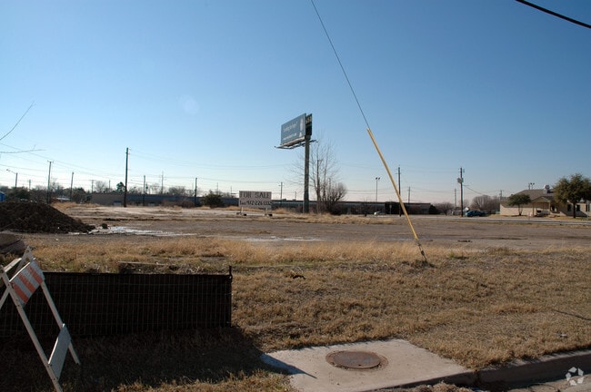
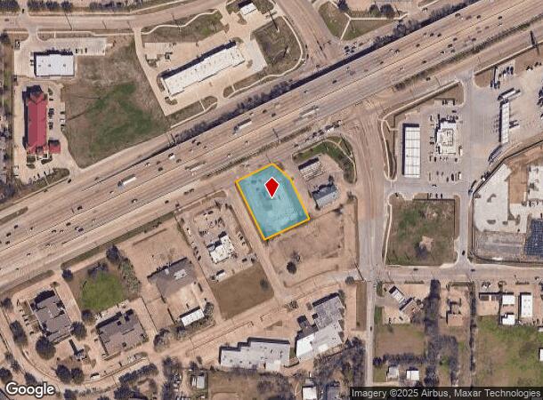
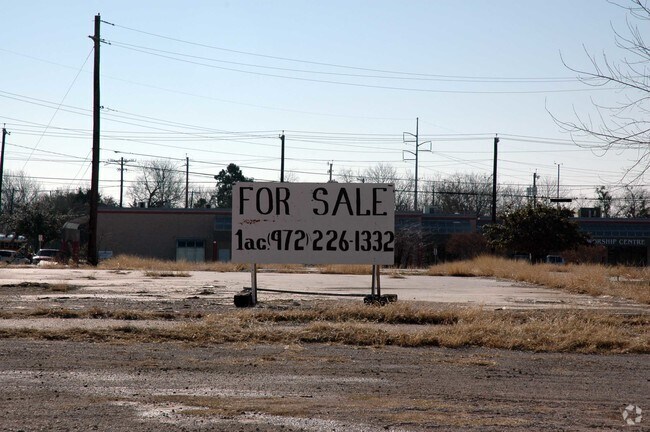
440 E Interstate 30
Dallas-Fort Worth-Arlington, TX
Lazy S
26309700010010000
LAZY S BLK 1 LOT 1 INT201500113038 DD04282015 CO-DC 3097000100100 2CG30970001
Commercialacreage
Dallas
X
Texas
48257C0025E
1
2024
0.98 AC
2025
Mesquite/Forney/Terrell
018132
Dallas/Ft Worth
DEMOGRAPHICS near 440 E Interstate 30
1 Mile
3 Mile
5 Mile
2024 Total Population
13,312
62,588
193,341
2029 Population
13,247
62,070
192,597
Pop Growth 2024-2029
(0.49%)
(0.83%)
(0.38%)
Average Age
38
38
37
2024 Total Households
4,519
22,157
66,605
HH Growth 2024-2029
(0.62%)
(1.02%)
(0.53%)
Median Household Inc
$71,909
$67,889
$67,401
Avg Household Size
2.90
2.80
2.80
2024 Avg HH Vehicles
2.00
2.00
2.00
Median Home Value
$244,810
$251,814
$236,594
Median Year Built
1987
1984
1982
Nearby Places
Map Layers
Map Styles
 Street
 Aerial
- Restaurants
- Banks
- Shops
- Fitness
- Groceries
PUBLIC TRANSPORTATION
AIRPORT
Dallas Love Field
DRIVE
WALK
Distance
Dallas Love Field
32 min
20.4 mi
Dallas-Fort Worth International
DRIVE
WALK
Distance
Dallas-Fort Worth International
43 min
36.1 mi
Nearby Properties
Address
Land Use
TOTAL SIZE
Lot Size
Zoning
Address
Land Use
TOTAL SIZE
Lot Size
Zoning
441,557 SF
20.14 AC
Z239
Address
Land Use
TOTAL SIZE
Lot Size
Zoning
260,782 SF
16.30 AC
Z77
Address
Land Use
TOTAL SIZE
Lot Size
Zoning
336,685 SF
18.51 AC
Z85
Address
Land Use
TOTAL SIZE
Lot Size
Zoning
336,035 SF
21.78 AC
Z160
Address
Land Use
TOTAL SIZE
Lot Size
Zoning
298,038 SF
9.06 AC
Z59
Address
Land Use
TOTAL SIZE
Lot Size
Zoning
224,063 SF
13.51 AC
Z10
Address
Land Use
TOTAL SIZE
Lot Size
Zoning
268,152 SF
13.86 AC
Z52
Address
Land Use
TOTAL SIZE
Lot Size
Zoning
197,284 SF
10.70 AC
Z02
Address
Land Use
TOTAL SIZE
Lot Size
Zoning
178,125 SF
10.50 AC
Z77
Address
Land Use
TOTAL SIZE
Lot Size
Zoning
190,106 SF
12.31 AC
Z160
Address
Land Use
TOTAL SIZE
Lot Size
Zoning
229,054 SF
12.36 AC
Z160
Address
Land Use
TOTAL SIZE
Lot Size
Zoning
231,526 SF
9.61 AC
Z237
Address
Land Use
TOTAL SIZE
Lot Size
Zoning
210,375 SF
7.54 AC
Address
Land Use
TOTAL SIZE
Lot Size
Zoning
173,559 SF
12.66 AC
Z160
Address
Land Use
TOTAL SIZE
Lot Size
Zoning
195,817 SF
9.28 AC
Z160
Address
Land Use
TOTAL SIZE
Lot Size
Zoning
126,465 SF
10.09 AC
Z239
Address
Land Use
TOTAL SIZE
Lot Size
Zoning
223,216 SF
13.79 AC
Z239
Address
Land Use
TOTAL SIZE
Lot Size
Zoning
66,131 SF
1.52 AC
Z85
Address
Land Use
TOTAL SIZE
Lot Size
Zoning
321,170 SF
23.73 AC
Z237
Address
Land Use
TOTAL SIZE
Lot Size
Zoning
104,307 SF
5.97 AC
Z237
Address
Land Use
TOTAL SIZE
Lot Size
Zoning
92,413 SF
4.98 AC
Z85
Address
Land Use
TOTAL SIZE
Lot Size
Zoning
123,400 SF
6.33 AC
Z239
Address
Land Use
TOTAL SIZE
Lot Size
Zoning
124,112 SF
5.38 AC
Z237
Address
Land Use
TOTAL SIZE
Lot Size
Zoning
114,962 SF
7.19 AC
Z239
Address
Land Use
TOTAL SIZE
Lot Size
Zoning
159,595 SF
13.66 AC
Z239
Address
Land Use
TOTAL SIZE
Lot Size
Zoning
83,154 SF
14.39 AC
Z386
Address
Land Use
TOTAL SIZE
Lot Size
Zoning
155,857 SF
4.02 AC
Z239
Address
Land Use
TOTAL SIZE
Lot Size
Zoning
130,696 SF
16.17 AC
Z85
Address
Land Use
TOTAL SIZE
Lot Size
Zoning
106,342 SF
7.39 AC
Z160
Address
Land Use
TOTAL SIZE
Lot Size
Zoning
134,287 SF
8.25 AC
Z160
The World's #1 Commercial Real Estate Marketplace
Connect with us
© 2026 CoStar Group
The information above has been obtained from sources believed reliable. While we do not doubt its accuracy we have not verified it and make no guarantee, warranty or representation about it. It is your responsibility to independently confirm its accuracy and completeness. Any projections, opinions, assumptions, or estimates used are for example only and do not represent the current or future performance of the property. The value of this transaction to you depends on tax and other factors which should be evaluated by your tax, financial, and legal advisors. You and your advisors should conduct a careful, independent investigation of the property to determine to your satisfaction the suitability of the property for your needs.