Property Record
440 Nepperhan Ave, Yonkers, NY 10701
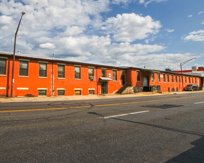
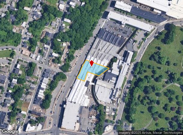
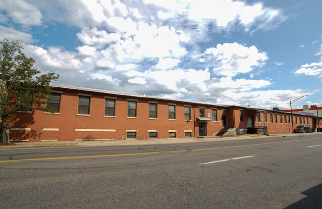
This Property Is For Sale
NEARBY LISTINGS FOR SALE OR LEASE
Property Detail
440 Nepperhan Ave
1800-002-000-02073-000-0030
Westchester
Distributionwarehouseregional
New York
AE
30.000
34003C0210H
0.83 AC
2025
Southwest
2024
Westchester/So Connecticut
000501
New York-Jersey City-White Plains, NY-NJ
30,036 SF
DEMOGRAPHICS near 440 Nepperhan Ave
1 Mile
3 Mile
5 Mile
2024 Total Population
59,856
231,911
685,806
2029 Population
58,894
225,515
653,365
Pop Growth 2024-2029
(1.61%)
(2.76%)
(4.73%)
Average Age
37
41
40
2024 Total Households
21,795
89,299
255,555
HH Growth 2024-2029
(1.75%)
(2.92%)
(5.03%)
Median Household Inc
$51,294
$74,254
$72,107
Avg Household Size
2.60
2.50
2.60
2024 Avg HH Vehicles
1.00
1.00
1.00
Median Home Value
$379,444
$452,161
$572,187
Median Year Built
1960
1954
1952
Nearby Places
- Restaurants
- Banks
- Shops
- Fitness
- Groceries
PUBLIC TRANSPORTATION
COMMUTER RAIL
Yonkers Station (Hudson Line - Metro-North Commuter Railroad Company (Metro-North))
DRIVE
WALK
Distance
Yonkers Station (Hudson Line - Metro-North Commuter Railroad Company (Metro-North))
3 min
1.3 mi
Ludlow Station (Hudson Line - Metro-North Commuter Railroad Company (Metro-North))
DRIVE
WALK
Distance
Ludlow Station (Hudson Line - Metro-North Commuter Railroad Company (Metro-North))
4 min
2.1 mi
AIRPORT
LaGuardia
DRIVE
WALK
Distance
LaGuardia
29 min
16.8 mi
Westchester County
DRIVE
WALK
Distance
Westchester County
29 min
20.3 mi
John F Kennedy International
DRIVE
WALK
Distance
John F Kennedy International
38 min
25.3 mi
Freight Ports
NY - Red Hook Container Terminal
DRIVE
WALK
Distance
NY - Red Hook Container Terminal
41 min
25.0 mi
Nearby Properties
Address
Land Use
TOTAL SIZE
Lot Size
Zoning
Address
Land Use
TOTAL SIZE
Lot Size
Zoning
689 SF
423.72 AC
P
Address
Land Use
TOTAL SIZE
Lot Size
Zoning
289.02 AC
P
Address
Land Use
TOTAL SIZE
Lot Size
Zoning
201,590 SF
4.13 AC
BA
Address
Land Use
TOTAL SIZE
Lot Size
Zoning
301,156 SF
13.94 AC
A
Address
Land Use
TOTAL SIZE
Lot Size
Zoning
185.35 AC
P
Address
Land Use
TOTAL SIZE
Lot Size
Zoning
70,737 SF
1.67 AC
BB
Address
Land Use
TOTAL SIZE
Lot Size
Zoning
166.61 AC
P
Address
Land Use
TOTAL SIZE
Lot Size
Zoning
23.97 AC
Address
Land Use
TOTAL SIZE
Lot Size
Zoning
94.42 AC
P
Address
Land Use
TOTAL SIZE
Lot Size
Zoning
225.36 AC
O
Address
Land Use
TOTAL SIZE
Lot Size
Zoning
450,784 SF
42.36 AC
R4
Address
Land Use
TOTAL SIZE
Lot Size
Zoning
64,165 SF
3.24 AC
B
Address
Land Use
TOTAL SIZE
Lot Size
Zoning
58.78 AC
P
Address
Land Use
TOTAL SIZE
Lot Size
Zoning
193,520 SF
4.32 AC
R4
Address
Land Use
TOTAL SIZE
Lot Size
Zoning
54.65 AC
P
Address
Land Use
TOTAL SIZE
Lot Size
Zoning
Address
Land Use
TOTAL SIZE
Lot Size
Zoning
159,260 SF
12.19 AC
R4
Address
Land Use
TOTAL SIZE
Lot Size
Zoning
192,939 SF
12.57 AC
R4
Address
Land Use
TOTAL SIZE
Lot Size
Zoning
Address
Land Use
TOTAL SIZE
Lot Size
Zoning
7,855 SF
1.10 AC
C
Address
Land Use
TOTAL SIZE
Lot Size
Zoning
109,914 SF
2.09 AC
R4
Address
Land Use
TOTAL SIZE
Lot Size
Zoning
97,000 SF
1.91 AC
R4
Address
Land Use
TOTAL SIZE
Lot Size
Zoning
13,225 SF
136.69 AC
PARK
Address
Land Use
TOTAL SIZE
Lot Size
Zoning
25.58 AC
P
Address
Land Use
TOTAL SIZE
Lot Size
Zoning
54,500 SF
13.96 AC
R1-1
Address
Land Use
TOTAL SIZE
Lot Size
Zoning
115,904 SF
4.87 AC
R1-1
Address
Land Use
TOTAL SIZE
Lot Size
Zoning
47,712 SF
6.27 AC
R1-1
Address
Land Use
TOTAL SIZE
Lot Size
Zoning
83,366 SF
5.92 AC
R4
Address
Land Use
TOTAL SIZE
Lot Size
Zoning
36,413 SF
0.89 AC
A
Address
Land Use
TOTAL SIZE
Lot Size
Zoning
55,584 SF
11.35 AC
R1-2
The World's #1 Commercial Real Estate Marketplace
Connect with us
© 2025 CoStar Group
The information above has been obtained from sources believed reliable. While we do not doubt its accuracy we have not verified it and make no guarantee, warranty or representation about it. It is your responsibility to independently confirm its accuracy and completeness. Any projections, opinions, assumptions, or estimates used are for example only and do not represent the current or future performance of the property. The value of this transaction to you depends on tax and other factors which should be evaluated by your tax, financial, and legal advisors. You and your advisors should conduct a careful, independent investigation of the property to determine to your satisfaction the suitability of the property for your needs.